
- Snæfellsjökull Peninsula
- Budakirkja church
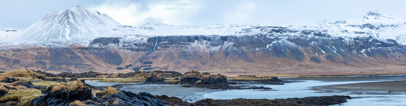
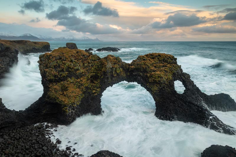
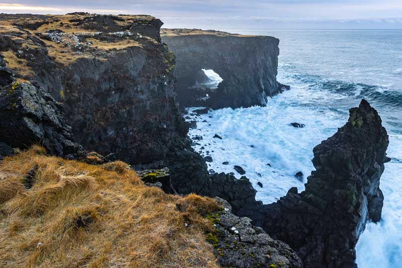
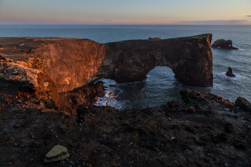
- Arnarstapi & Gatklettur
- Kirkjufellsfoss Waterfall
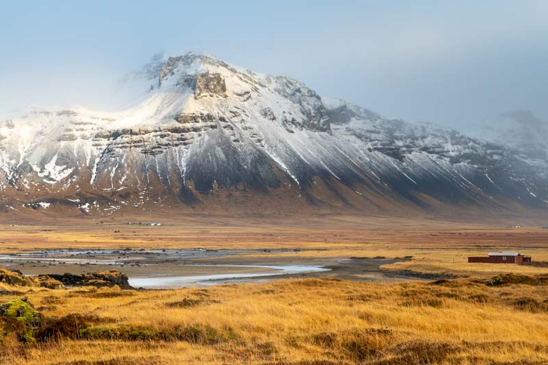
- Svodufoss waterfall
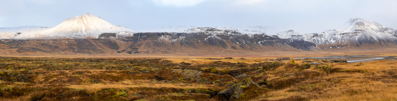
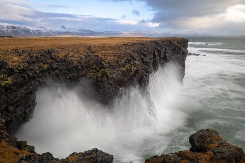
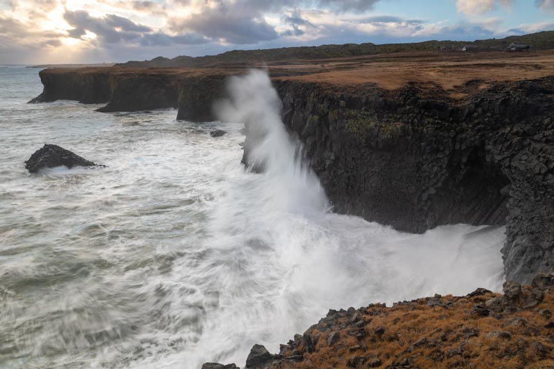
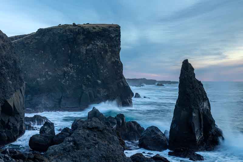
- Rugged coastline of Lóndrangar
- Hraunfossar waterfall
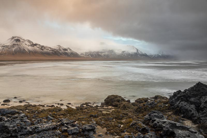
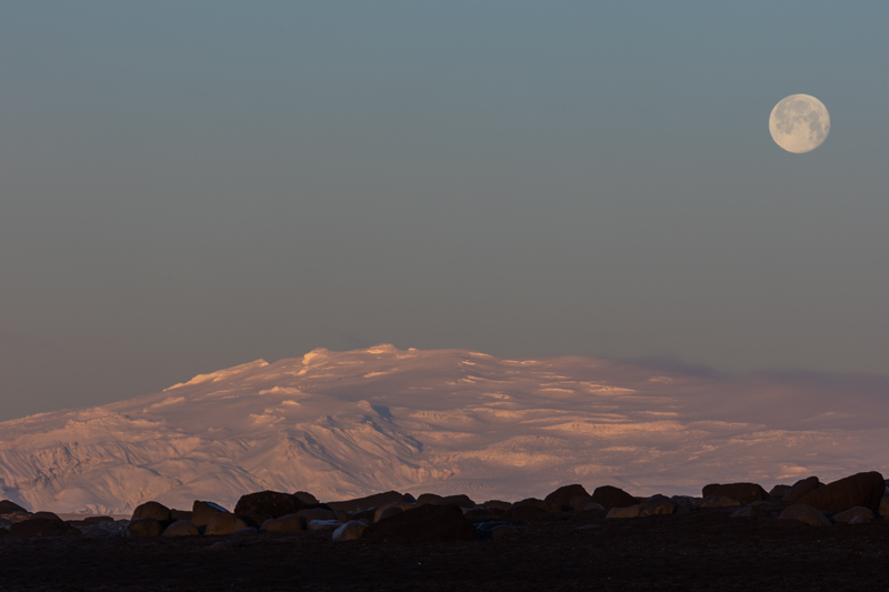
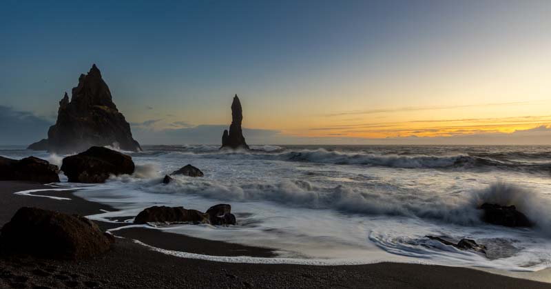
- West of Vik
- Heading east from Vik
- Diamond Beach
- East to Hofn
- Back to Vestrahorn with Extreme Caution
- Heading West back to Vik
- A very wet day – so plans change
- Heading west to the Fagradalsfjall Volcano
We originally travelled from the UK to Iceland in December 2018 to meet up with a photographic tour party from Zion in USA. We first met up the tour leaders in the USA a few years before. This time we extended our time in Iceland and travelled a few weeks earlier in November. Many of the locations were the same, but with more time we added more time to explore as well.
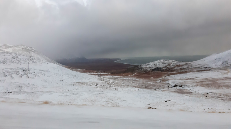
An early start from the UK – hoping to catch the sun before the end of the day.
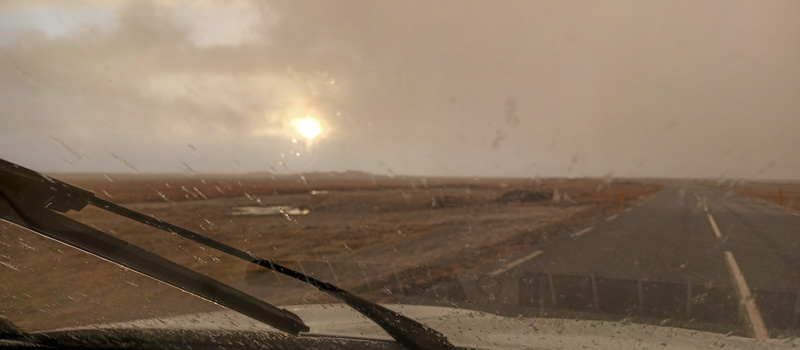
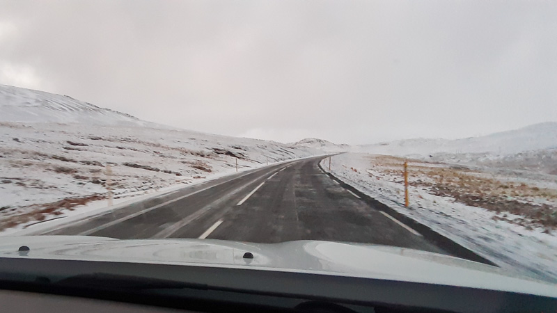
We were on the road from 0415 on Monday 15th November and travelled to Iceland via Heathrow landing just after 11 O’clock in the morning. Hoping to collect the car and travel 3 hours to our first destination in time for the sun setting. The journey was eventful in as far as the different weather conditions we travelled through – Rain, sleet, hailstones, snow, high winds and finally some distant sunshine:
So, did we make it in time at our first destination for a few snaps?
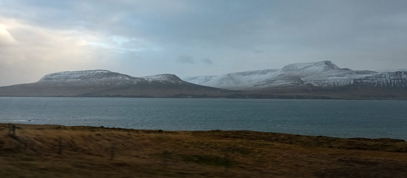
Snæfellsjökull Peninsula
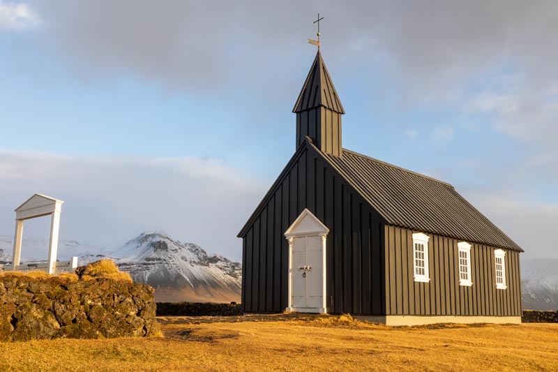
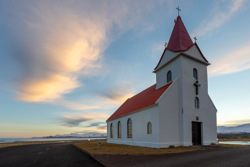
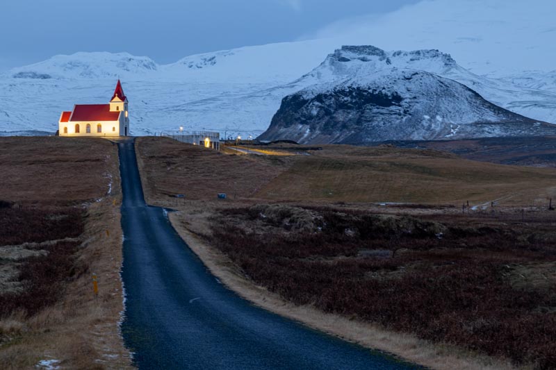
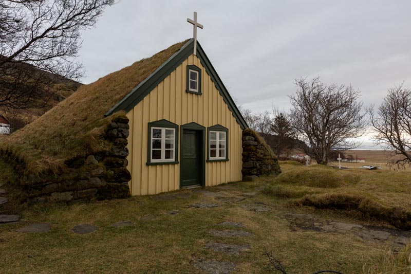
We were staying on the peninsula for a few days, but arrived at our first photo location just before the sunset. We were also staying for one night in the hotel adjacent to this church….
Budakirkja church
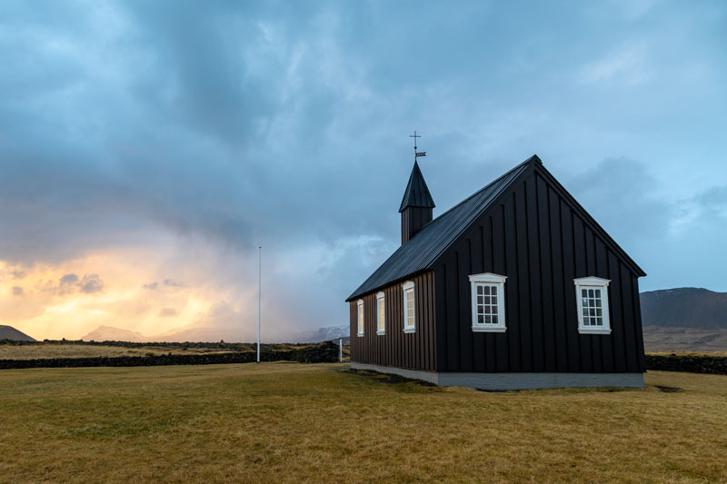
It was dry, but still extremely winding and we only had approx. 20 minutes until we lost the light. Not enough time to unpack our bags for tripods etc, so we opted for hand held and bracketed shots which still produced reasonable HDR images in Lightroom.
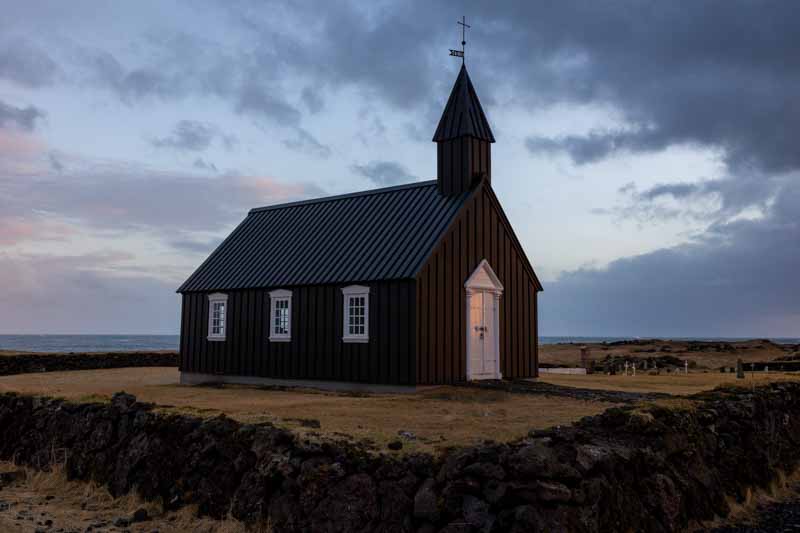
We are staying 200 yards from here in the Badir hotel, so if weather permits we’ll have another crack at it tomorrow at sunrise – not until 10:30!
So a good start to our new adventure – for now, I think it’s time to catch up on those ZZZzzzzzzz.
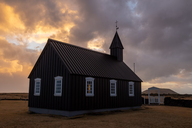
Tuesday 16th November: We stayed overnight in the Hotel Budir which was about 200 metres from the church we photographed yesterday, but the day started with rain and heavy cloud, so no point dashing out at 10:15 for sunrise, so we packed the bags, loaded up the car and sat in the hotel lounge waiting for the weather to change – which in Iceland it will do quite frequently. After 30 minute the rain stopped, but the church had no real light on it, so we aimed our cameras in the other direction:-
Then the sun came out and the scenes changed dramatically
So we moved back to the church again whilst the light was on the subject
It was now lunchtime, but after a great breakfast we headed back to the car for a coffee and then off to Arnarstapi, which ended up being our only other location for the day, but one that has several different viewpoints to photograph.
Arnarstapi & Gatklettur
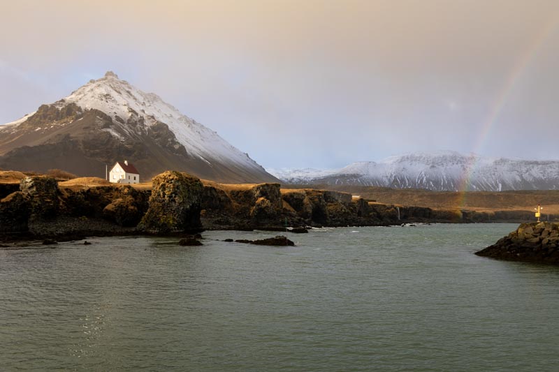
It was difficult shooting into the rain with filters, but if I wanted the rainbow, I had no other choice. The last time we were here in 2018…
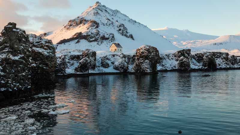
…the whole scene was snow covered, but it was great to have another crack at the location in different conditions.
There was plenty of birdlife around, which wasn’t the point of our trip, but tried a few shots – most have since been deleted as not up to standard
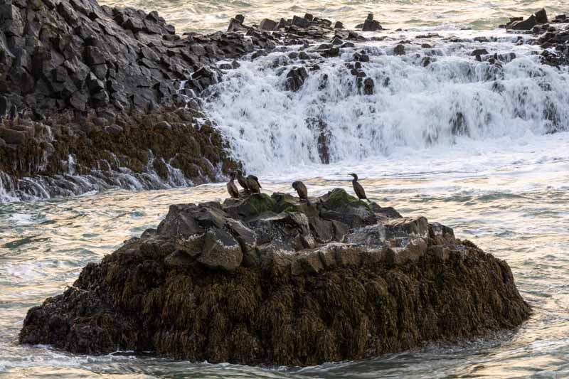
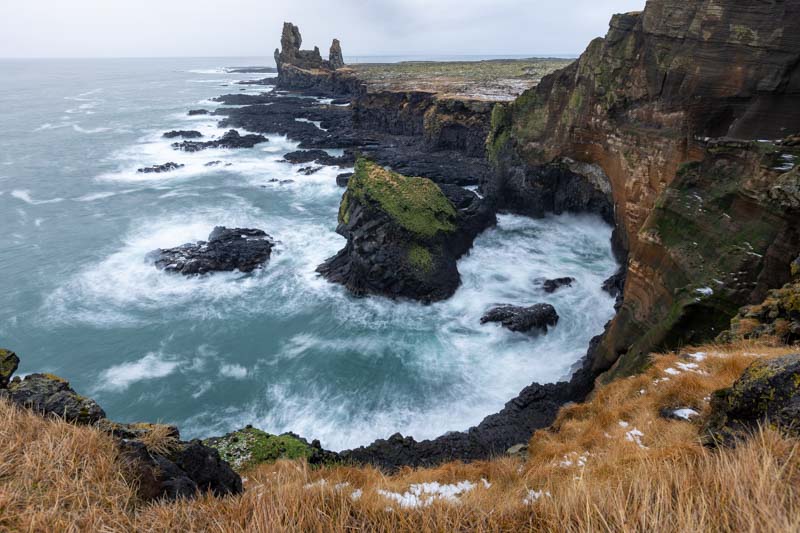
A short distance away there is a viewing platform overlooking the cliffs which we hadn’t visited before, despite being in the vicinity.
Also nearby is a stone arch know as Gatklettur
So today, we’ve had a mixture of sky conditions, some rain and high winds which allowed us to try several different filters and a few lenses. All in all a terrific day; so we headed back to the car for the journey across the mountain range to our next destination of Grundarfjordur where we are stopping for the next 3 nights, so we could return here again during this trip.
Not much in the way of restaurants in Grundarfjordur – in fact a choice of one, the other doesn’t open until Thursday, but we had a good burger before heading back to our accommodation to prepare the photos and this blog. Tonight there is a reasonable ‘Northern Lights’ forecast with clear skies after midnight. It’s now 10:30pm, so I doubt I’ll be getting much sleep – keeping an eye out!
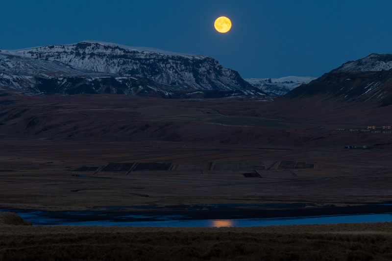
Wednesday 17th November: We had hoped to catch sight of the ‘Northern Lights’ again last night. Our first experience was back in 2018 at the Kirkjufell peak a few miles from the town:-
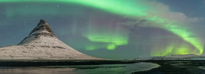
But this time the probability was up and providing we had some clear skies we may have been lucky. I checked outside at 11 pm just after finishing yesterday’s blog, but is was still very cloudy, so I set my alarm for 2 am to check again.
It’s difficult to see the northern lights by eye if your location is polluted by street lighting, which it was as we were staying in the town. The sky over the town had cleared but still 35% cloud cover. So I got the camera out and set is up for night sky photography and then observed a green glow in the sky. So immediately dragged wifey out of bed and we headed off to a nearby location – unfortunately in the 30 minutes to get ready, the sky had clouded over again. We waited a short time, but decided it wasn’t going to be our lucky day, so headed back for more sleep. At least we captured it on our previous visit.
Sunrise on the Snaefellsjokull peninsula
We are staying on the northern shore of the Snaefellsjokull peninsula with mountains between us and the winter sun, so we headed west towards the flatter end of the peninsula. First stop was the Ingjaldsholskirkja Church which didn’t dissappoint.
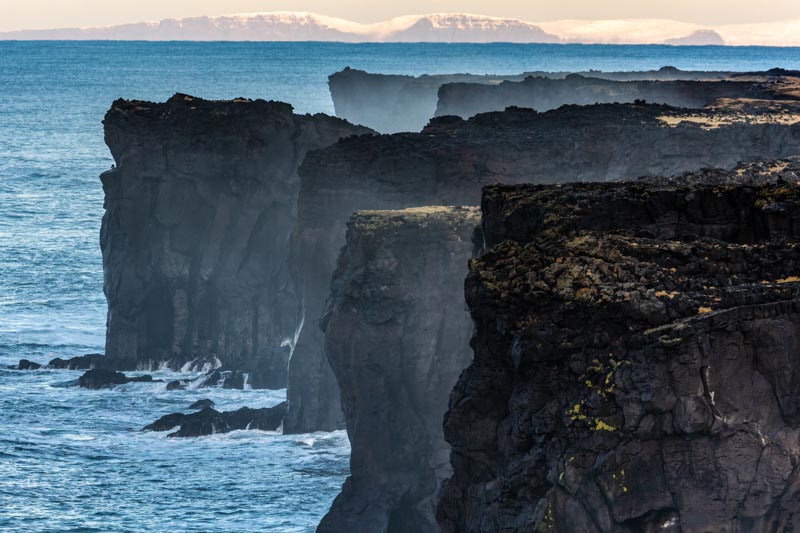
We had plenty of time around this church to capture the sky as the clouds moved across. But the sun was still hidden by clouds at a lower level. So we headed for 2 light houses that were a few miles apart to see if the light would improve.
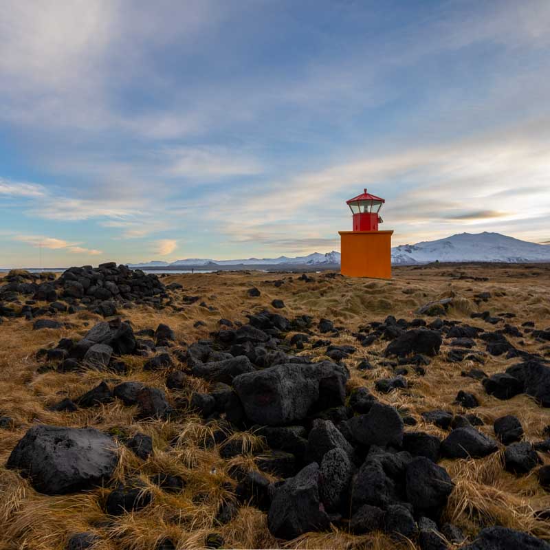
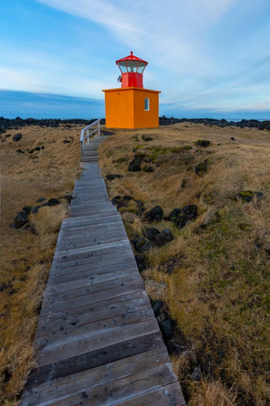
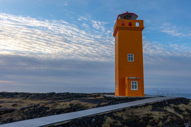
The first lighthouse wasn’t very large, more of a hut, but the orange theme remained consistent with the second lighthouse. The coastline next to the larger Svortuloft lighthouse had some feathered rock dwellers
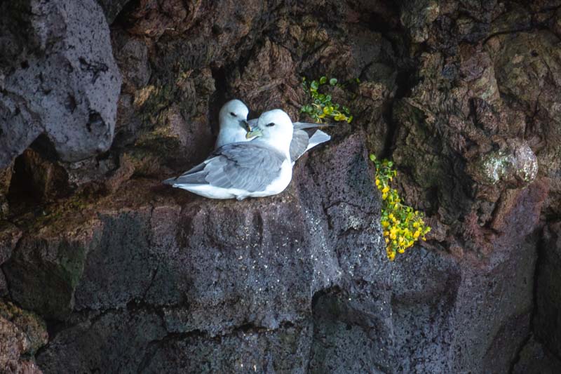
These were nestled in the rock face in the next photo.
Turning around I then noticed this next image which was difficult to capture due to the large amount of mist coming up from the sea.
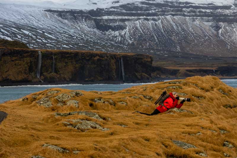
From here we headed further around the peninsula and stopped at the Saxholl Crater which has a metal staircase around the perimeter to gain easy access to the top
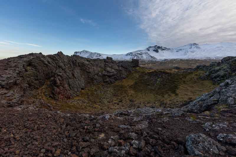
As you can see from this photo, the sky to the south (right) is still covered with cloud which would have spoilt the rest of the day. But as it happened a tyre warning in the car and low fuel meant our priorities had to shift. There were no garages in this area so we made our way back to base to get the issue resolved. In so doing, we missed our opportunity for a last waterfall shot of the day. Maybe tomorrow – if the rain forecast is wrong.
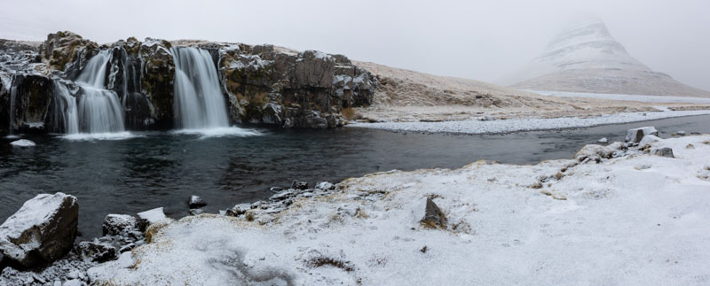
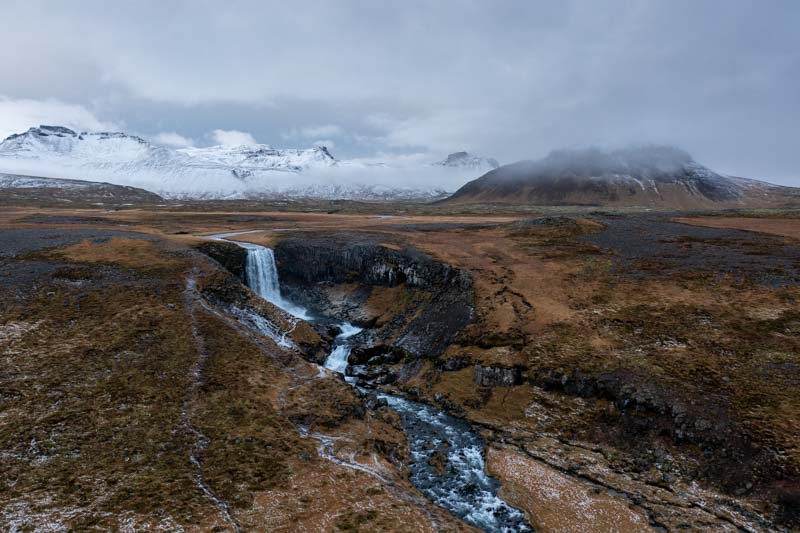
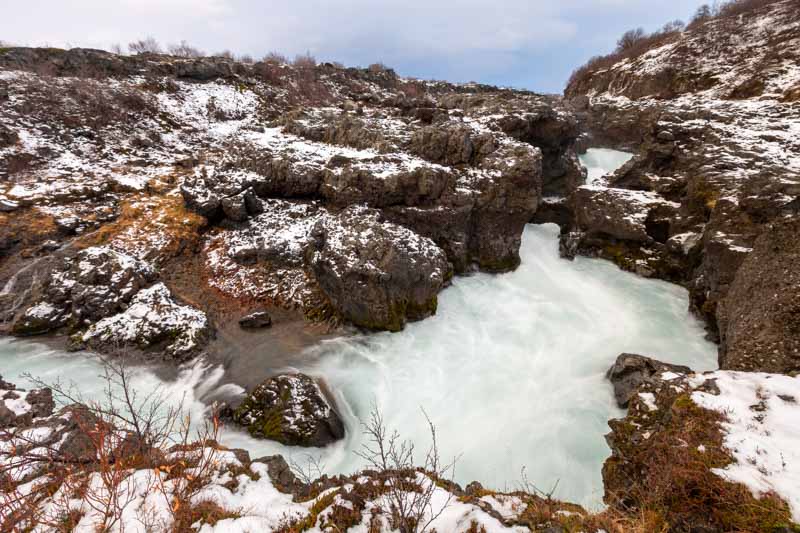
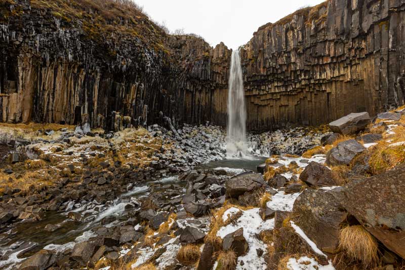
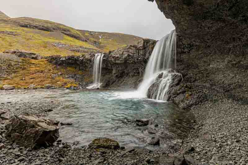
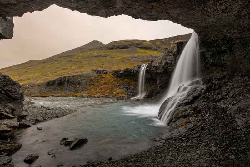
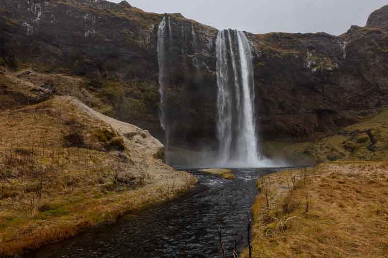
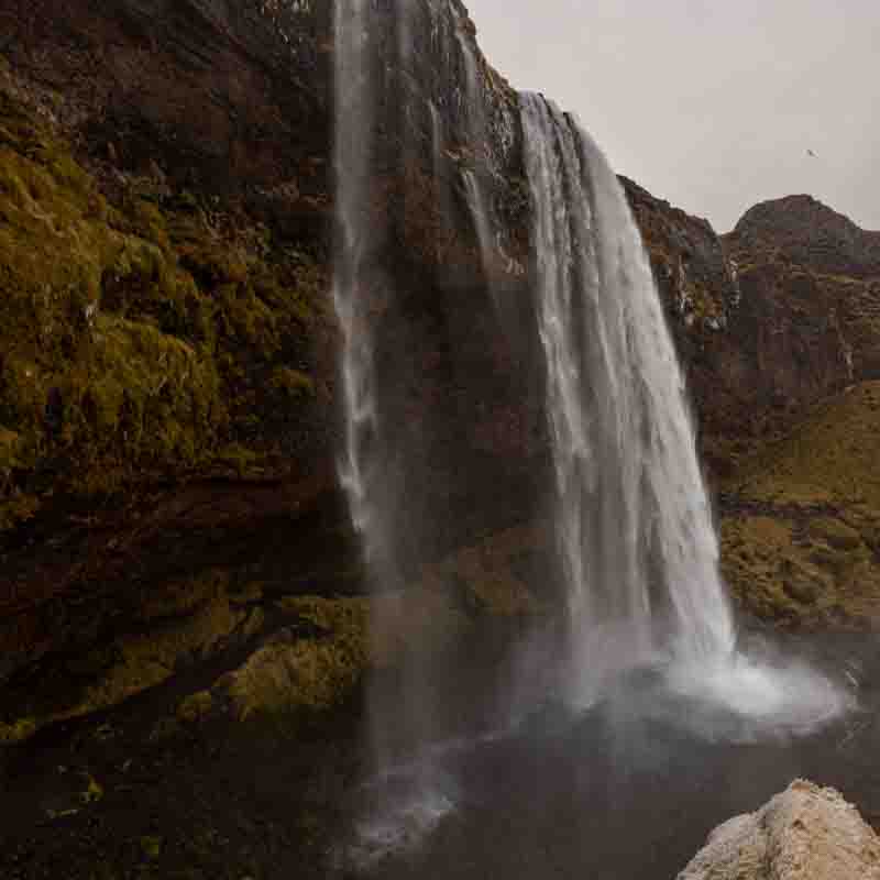
Kirkjufellsfoss Waterfall
Thursday 18th November: After being spoilt in yesterday’s sunshine the forecast today was rain or snow all day so we thought we may be strolling around the towns in the area and drinking coffee. We set off with a positive attitude in the snow to a waterfall nearby which we failed to get a good photo of the last time we were here. Also waterfall photos are best taken on overcast or gloomy days and we were definitely experiencing the latter.
Due to the snow we shared one tripod between us and took turns using my large rim hat as a snow shelter for the lens and trying very hard to keep the cameras dry.
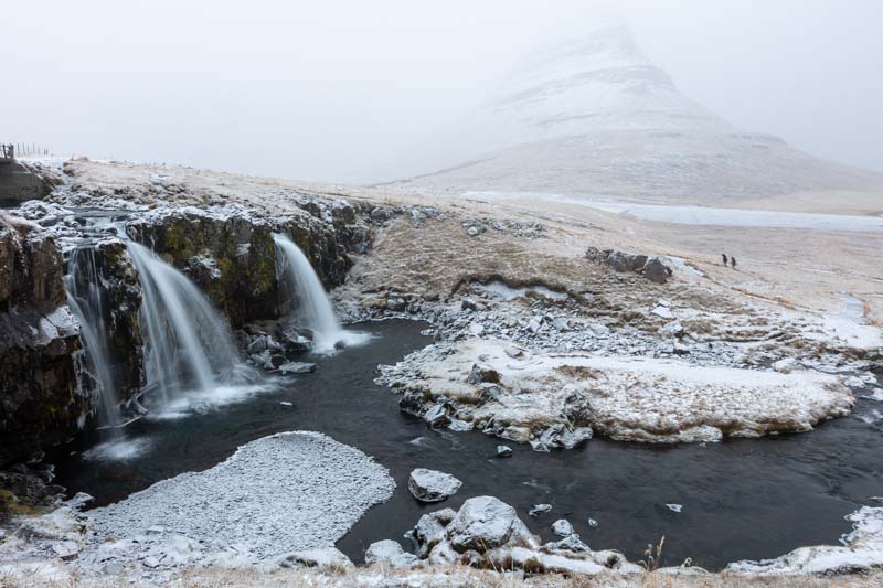
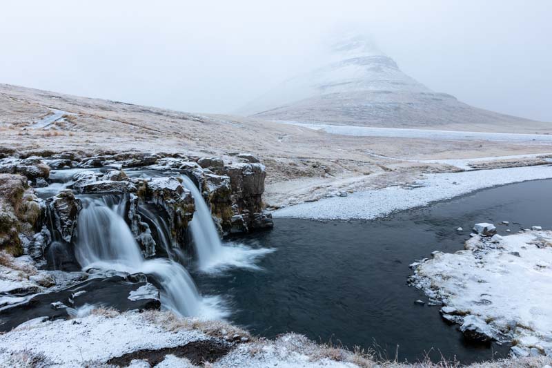
There are two waterfalls, the upper (on the left) and lower (on the right). The lower one we tried a panorama of 3 photos that I stitched together in our Lightroom software
It then started to rain and wind direction changed directly into the lens, so we had to move on, but a positive start to the day.
So we thought waterfalls would be a good theme for the day and headed west to another I had identified on the map.
Svodufoss waterfall
As we approached the waterfall we realised the river cut across us and we would have to detour to get close to the falls – so maybe now was a good time to deploy my new toy – the drone.
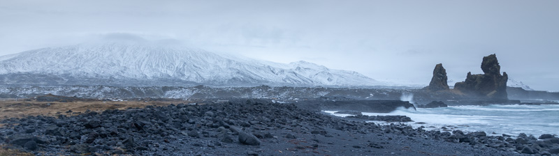
The weather had dried up so we moved on to another coastal location which we couldn’t get a good photo during our previous trip due to the brightness of the sky and bright sunshine – but today was a better day for it.
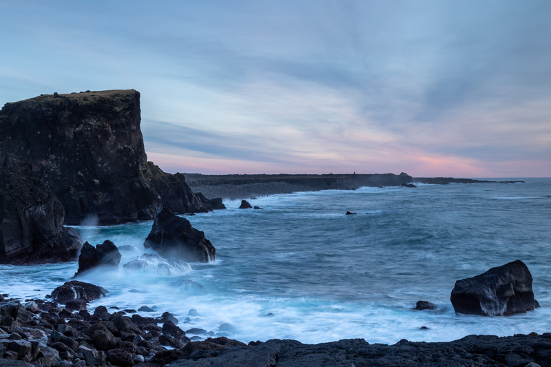
Rugged coastline of Lóndrangar
In 2018, this whole area was covered in snow and the sun behind the rock pinnacles was too bright. This time the overcast conditions actually produced a much better photo.
We were now nearing sunset, but I wanted to see what the rocks looked like from the other side.
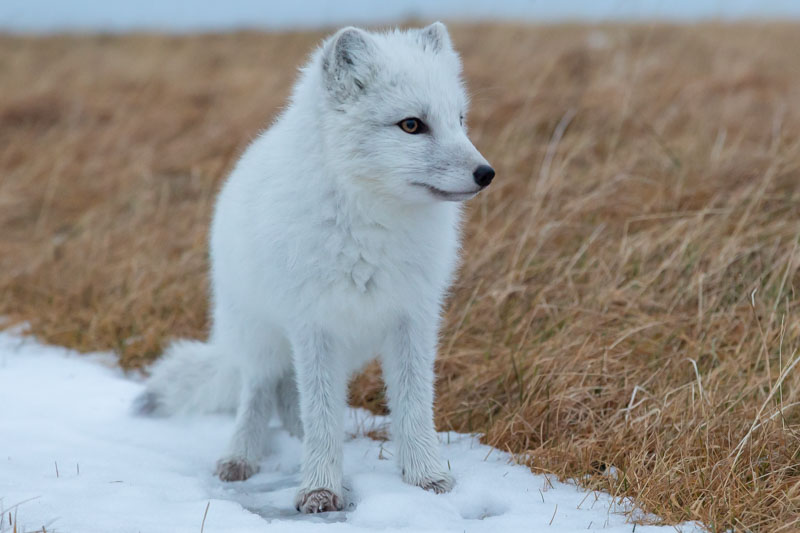
At 20 minutes past sunset, we packed away ready to head home…. Then we disturbed a creature foraging for food. Even better, I’d mistakenly packed my 100-400mm lens instead of the newly purchased 70-200mm lens for this trip, so I decided to make use of it….
Arctic Foxes
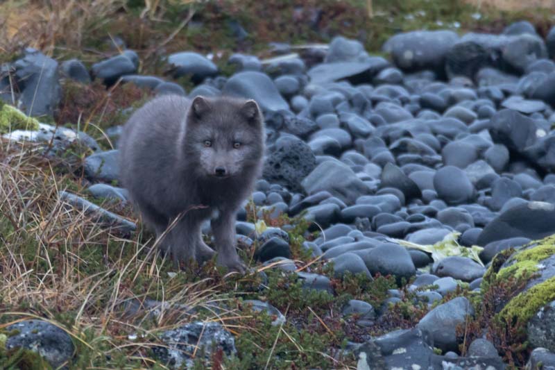
Due to the low light, the camera was set to ISO 4000 and this shot taken at a 1/30th of a sec with the lens on 400mm hand held. So many thanks to a camera club colleague for helping me to decide to purchase the Canon R6 – it is fantastic.
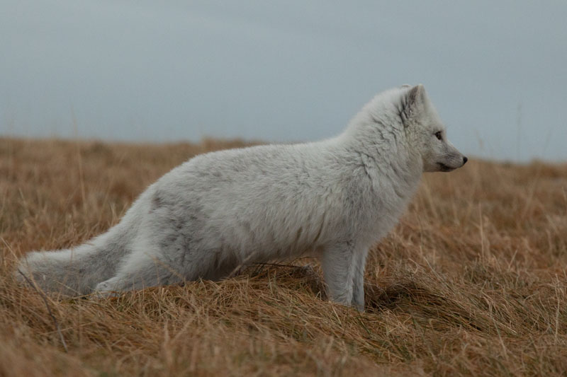
So once again we set off for home and then we could believe our eyes! This time we only needed the 24-105mm lens as the animal came very close to us….
So from a very gloomy outlook for the day, we finished on a high – well, nearly finished as we just had to snap one of our earlier locations on the way home.
Tomorrow we head south for Vik, but providing the weather is OK, we hope to photograph some more locations along the way.
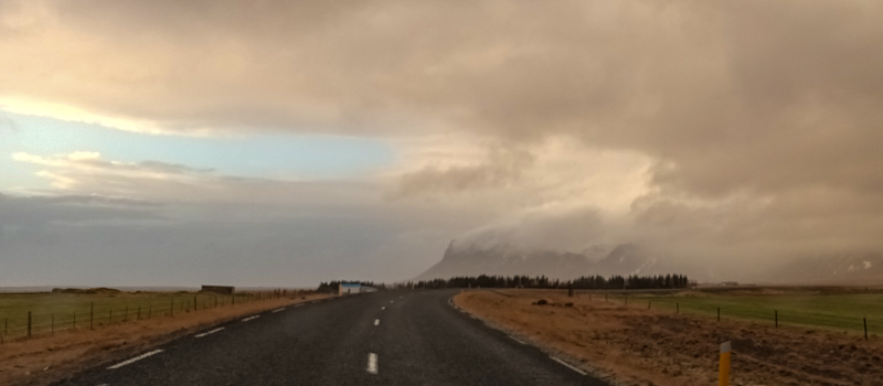
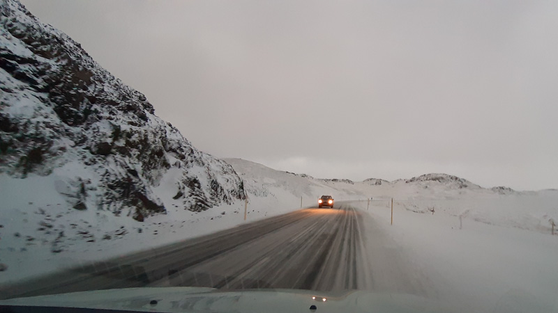
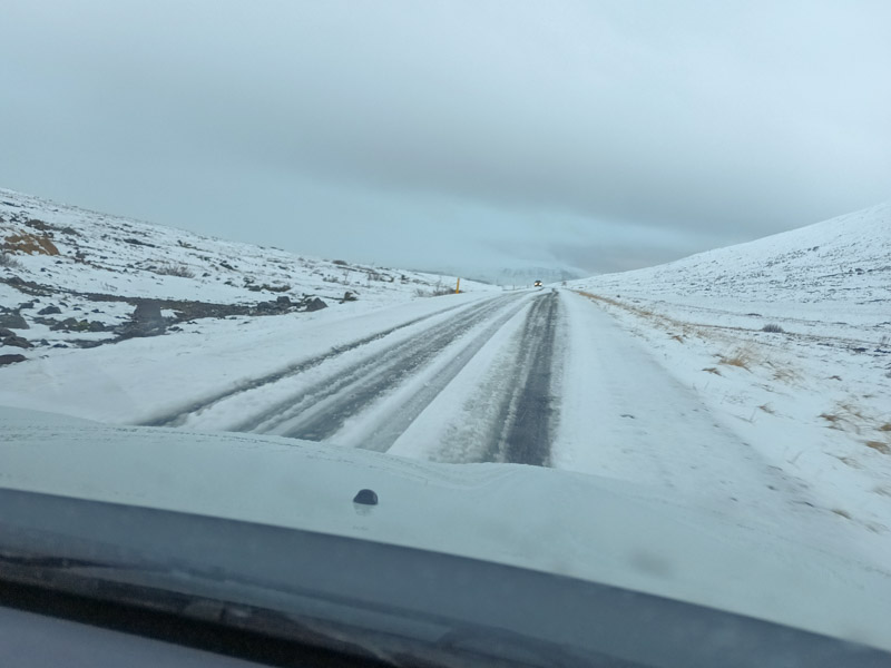
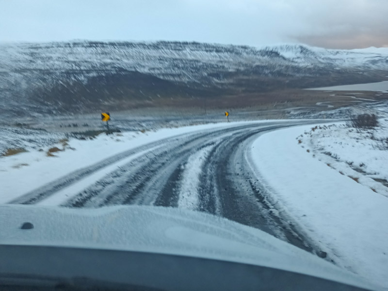
Friday 19th November: Today was a travelling day, heading 290 miles due south, but with a few planned detours. Unfortunately the weather wasn’t good at all as we probably had 30 minutes in the whole day when it didn’t rain. But if we had to endure rain, then travelling was our best outcome.
So we headed westwards initially for another waterfall location.
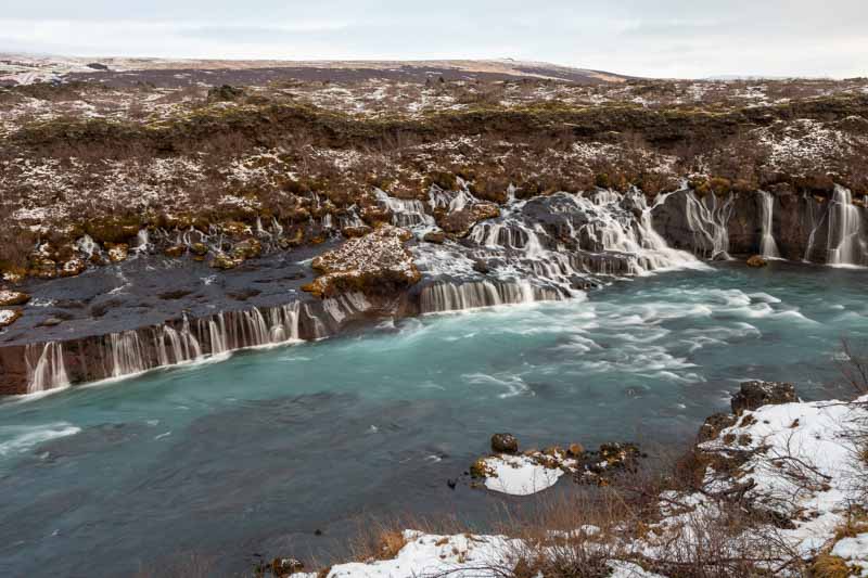
Hraunfossar waterfall
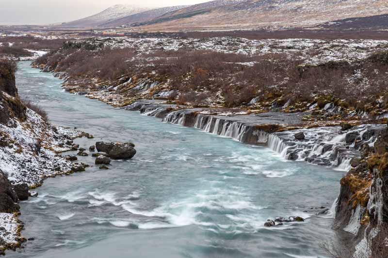
I did get the drone out, but within the minute it started to rain again, so it was packed away. There are several viewing platforms around the area to give us the alternative views
The area was covered in ice, so we were pleased we had our crampons with us whilst everyone else slipped along the uneven ground.
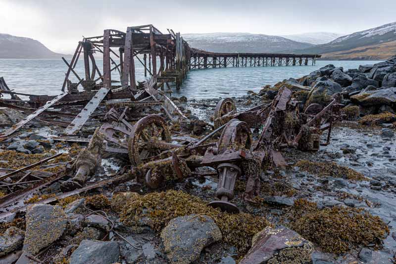
From here we headed south to find a disused Royal Navy jetty last in use in world war 2. We had to travel along gravel roads up over the mountains to avoid a longer detour. Thankfully the 4WD helped to make the journey and uneventful one, although Vanessa refused to drive, so it was down to me.
Anyway we made it, but the rain hadn’t stopped and after travelling all this way we didn’t let it deter us from a least one or two shots in the rain.
Eventually we arrived in Vik just over 9.5 hours after we set off and headed straight to our favourite restaurant for a bacon burger – we’d been tasting it all the way.
Tomorrow is a much better forecast, so we hope to travel less and take more photos.
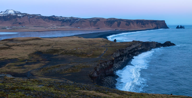
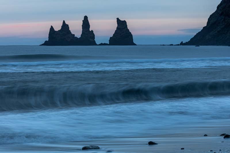
West of Vik
Saturday 20th November: Let’s start the day at midnight. I got out of bed and took the camera outside as I could see stars from the window and we had an Aurora alert. Dragged wifey out of bed and got in the car – the Aurora was clearly visible as the headed off looking for a suitable shooting location. Unfortunately as we parked up, the light show had gone. So back to bed and looking forwards to the day ahead as the weather forecast was good..
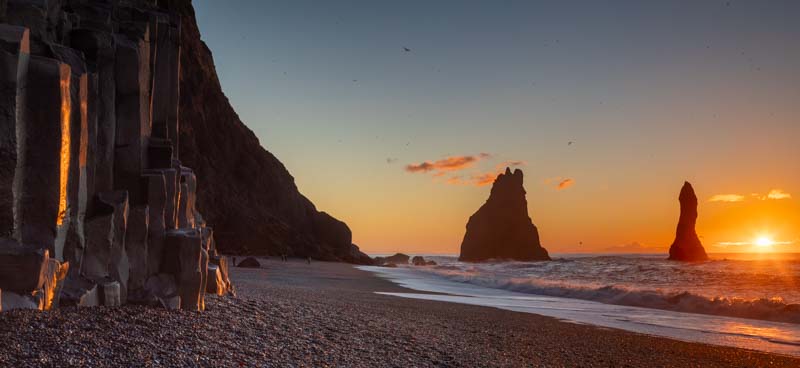
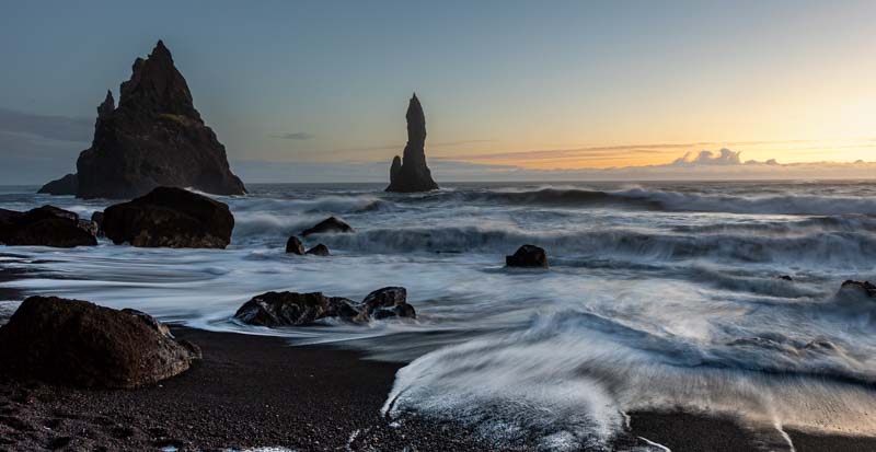
We woke up to completely clear skies and frozen car doors. After defrosting them, we headed off to Vik’s black beach which we didn’t photograph in 2018 due to high winds and poor visibility. But today was different…
The Black Beach
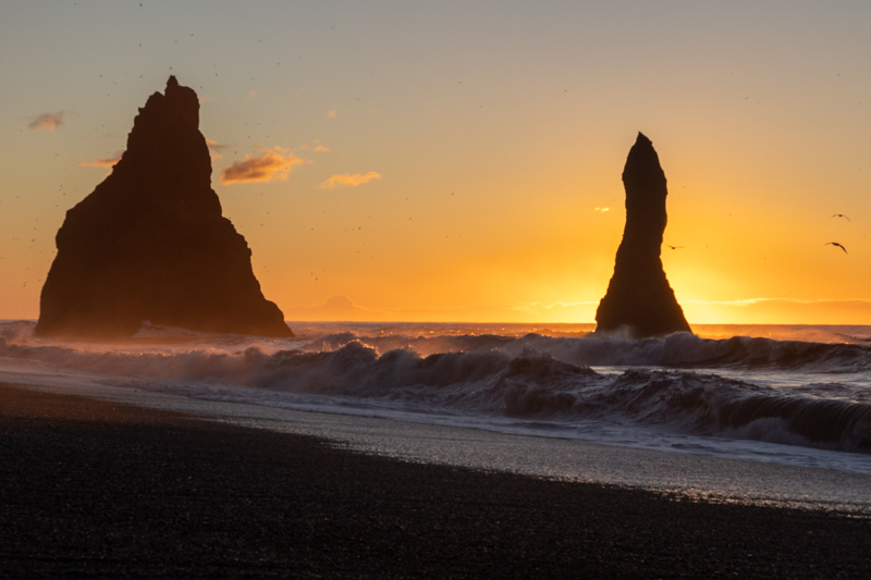
We weren’t finished at the beach just yet, looking behind we captured these:-
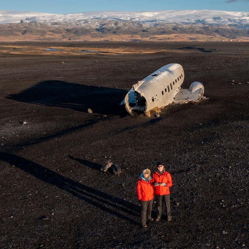
Next stop was just a few miles down the road in the car and then a 3.5 mile walk down to the beach to see the crash site of a DC3
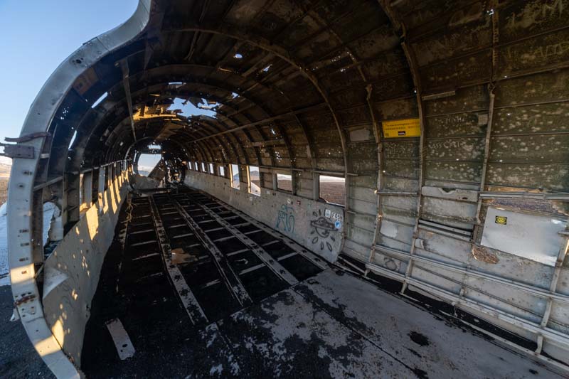
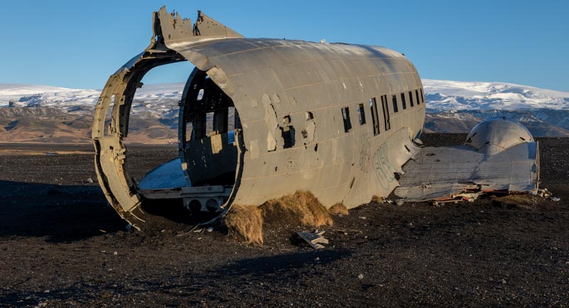
Solheimasandur DC3 Plane Wreck
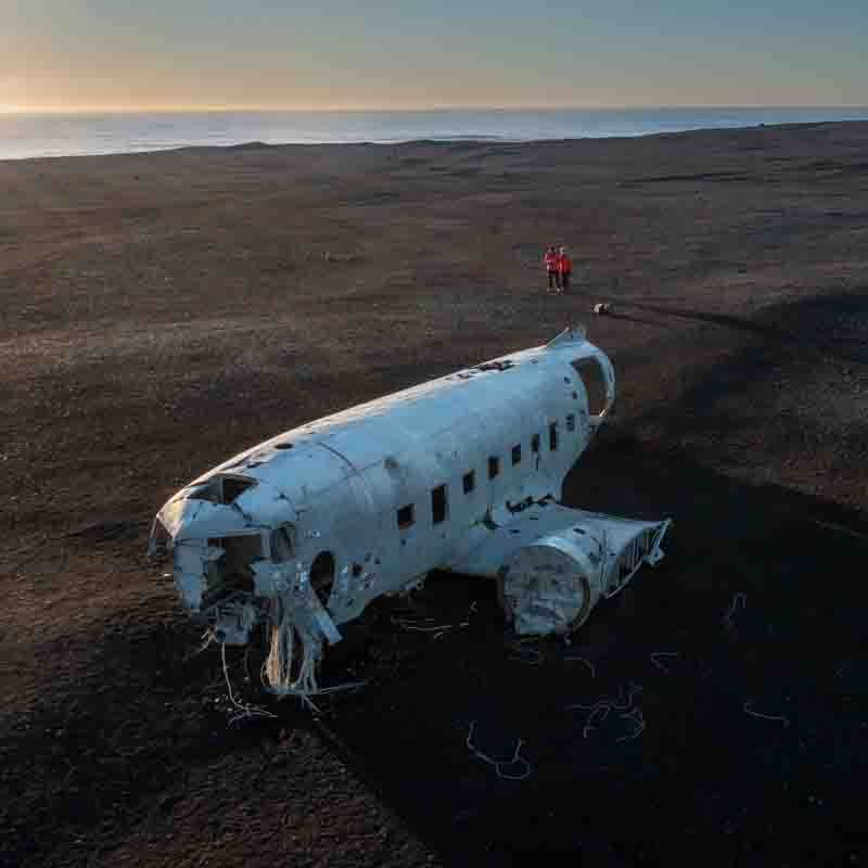
I did deploy the drone here to get a different perspective – mainly trying to get the distant snowy mountains into the back drop.
Just after we packed away, a bus load of people descended on the site, so we paid for the bus back to the car park- only to save us 30 minutes in the day to visit more locations.
Skogafoss waterfall
This was just a few more miles west of the DC3 carpark. The area was busy with people close up to the waterfall – so how do you stay dry; but also get a photo of the waterfall with no people in the shot.
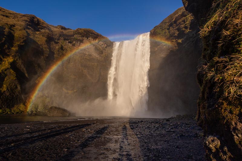
Simple answer, you fit a 12mm super wide angle lens to the wife’s camera and deploy her to get in front to the crowd – she did have a cloth to dry the lens, but I think she did rather well here. You can see the shadows from the people behind her but you had to get close to see the full rainbow. P.S. I remained dry!
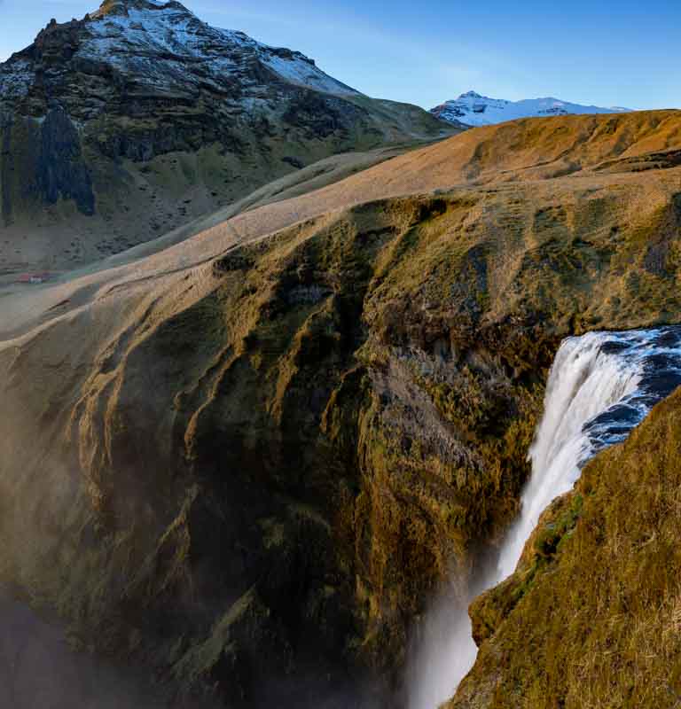
This wasn’t taken with the drone – they’re not allowed at the waterfall. So we had to climb the steps up the hillside which was a challenge. This was a stitched upper and lower image to get the full drop.
After this we had one hour to sunset, so we headed back towards Vik
Thinking we had finished we headed back….. but maybe just one more image caught Vanessa’s eye and we couldn’t resist it…
So we had a really good day today – also advised that the Aurora alert tonight was ‘level 4’ which was reasonably high. So now we are staying up and hoping for clear skies.
Tomorrow we head east to our next destination which takes us past the Diamond Beach. Hopefully we’ll get a little sunshine in a rainy day to make them pop out.
Heading east from Vik
Sunday 21st November: Last night clouded over again, so no Aurora, but at least we had a good night’s sleep. The morning was low visibility and heavy drizzle, so no sunrise either. So we simply had breakfast and headed off into the rain for our first location 2 hours away.
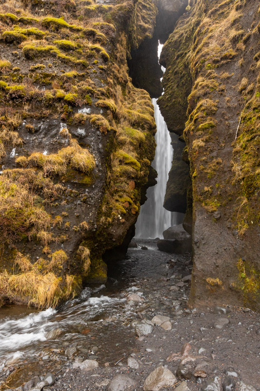
Svartifoss waterfall
We arrived at the Vatnajokull National Park under clearer skies and set off on a 1.1 mile trek into the hills to find the Svartifoss waterfall.
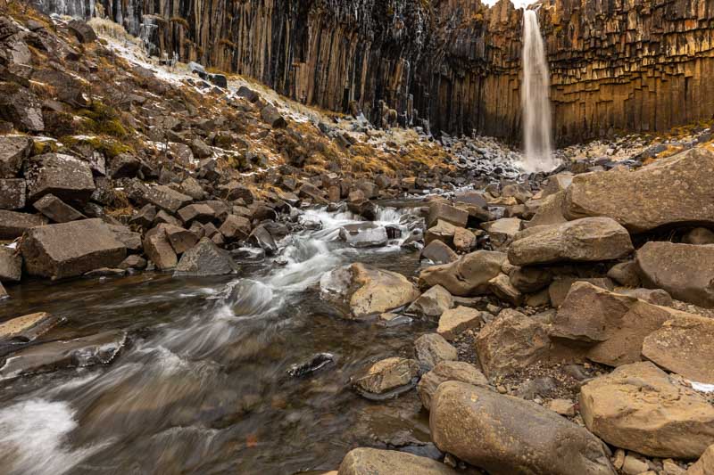
We definitely needed the crampons again as the path was very icy down into this bowl. But most people we passed didn’t have them and it was interesting watching them clamber all over the rocks avoiding the ice. So if you do think about travelling here – get some crampons.
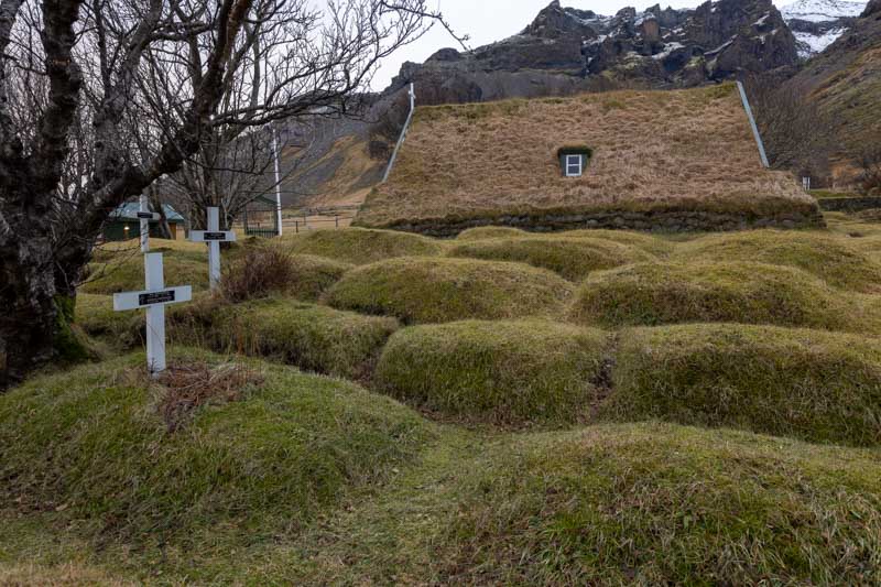
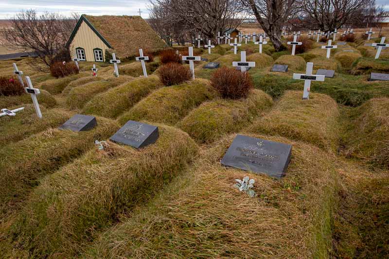
We then travelled another 10 minutes to a little church Vanessa wanted to see on the last visit, but could never find its location.
Hofs Church (Hofskirkja) near Fagurhólsmýri
Vanessa took the best photo of this area that I missed completely:-
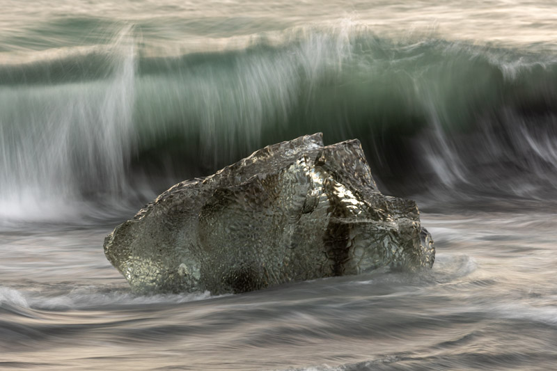
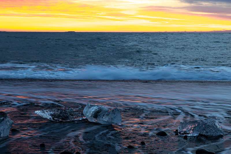
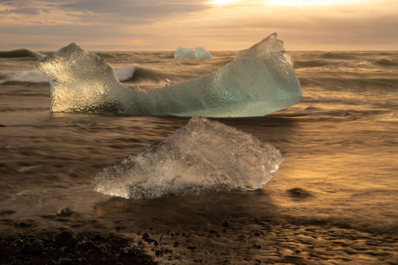
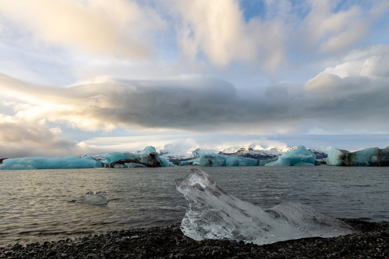
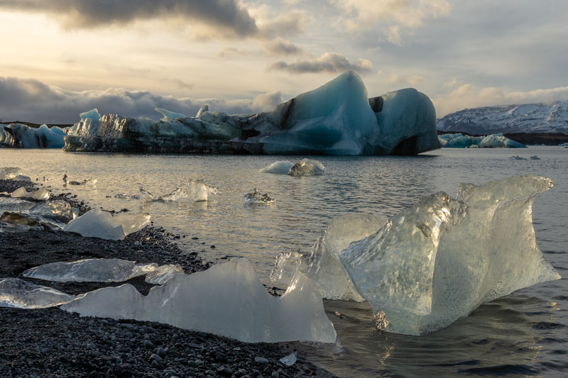
We then headed off to the Diamond Beach which was one of our favourite locations in 2018. Unfortunately there weren’t anywhere near the number of icebergs on the beach that we had seen before and the sea was quite rough making it difficult to get close to the remaining ice without getting very wet feet
Diamond Beach
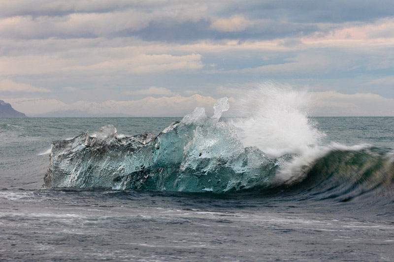
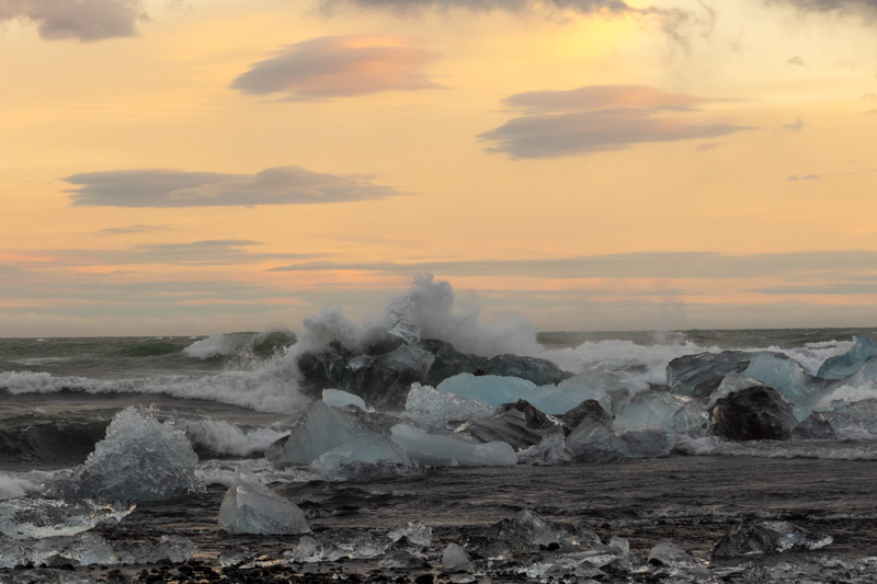
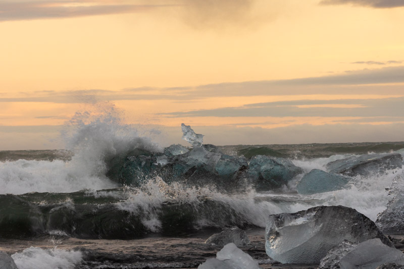
For all these shots I used my 100-400mm lens to stay dry and capture from a distance.
This was my favourite image of the day, but we plan to return tomorrow morning for another go.
Monday 22nd November: Last night we did venture out again to look for the Aurora as the skies cleared and headed for the Iceberg Lagoon to give some foreground interest. But the wind was so strong we couldn’t actually open the car door against the force. So we returned back to the hotel for some kip.
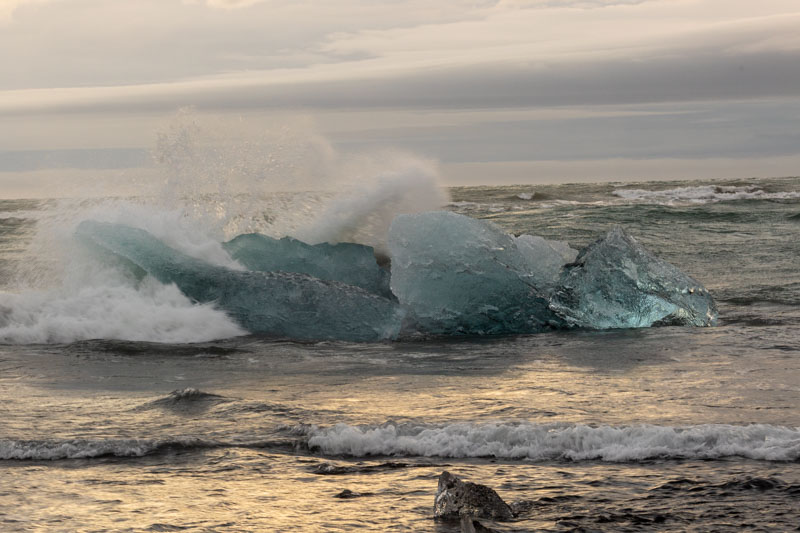
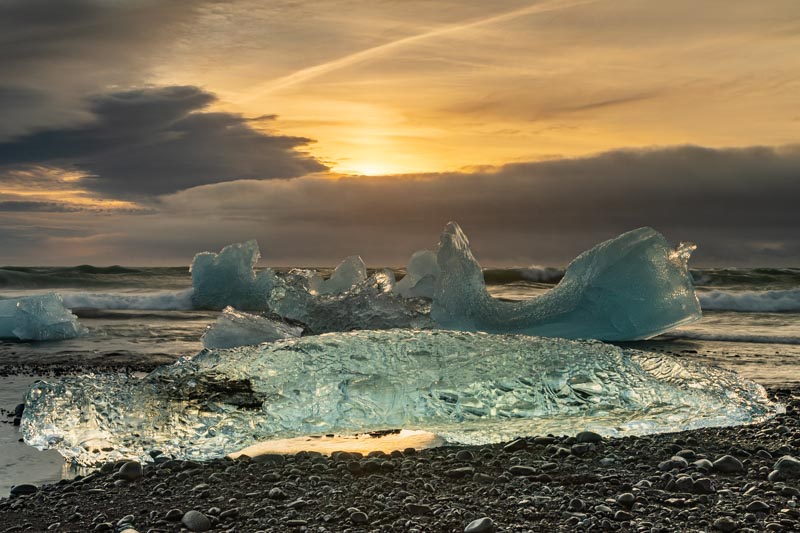
After breakfast we headed back to the Diamond Beach and with a glimmer of red in the sky so we hoped for better light and photos. We took several hundred and selected just a few for this blog.
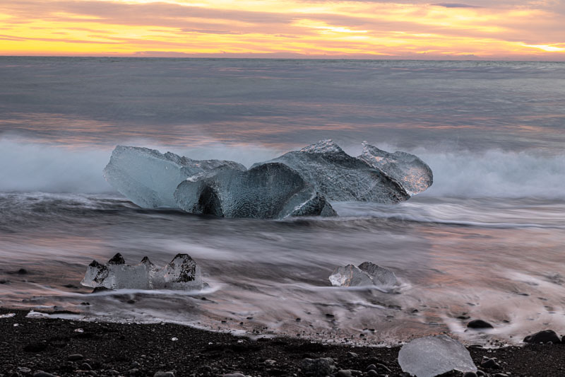
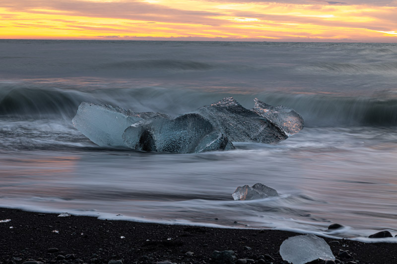
The sky was really bright, but no direct sunlight which we were hoping for. This was the closest we came to.
The on-shore wind was getting stronger, so we headed over the road to the lagoon which is where the icebergs collect before being swept out to sea on a high tide when they break into small pieces.
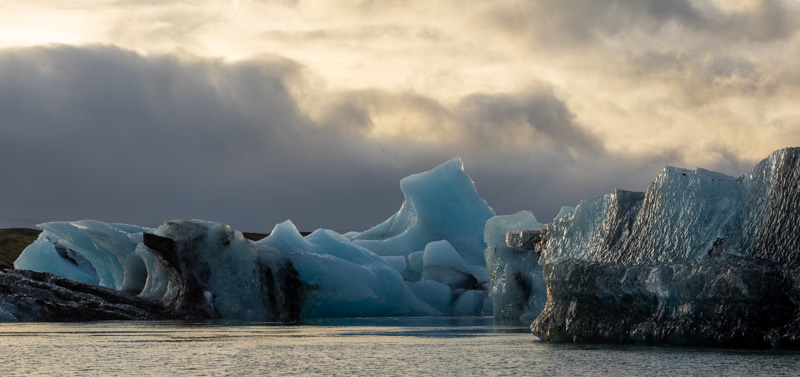
Jökulsárlón Glacier Lagoon
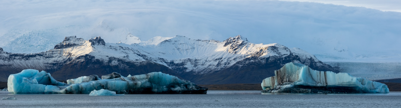
There were a few seals in the lagoon – here’s two of them….
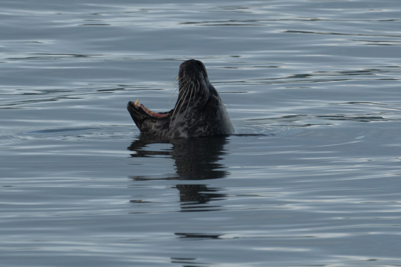
The seal ‘ice formation’ was a great catch thanks to Vanessa’s eagle eye. Just before we finished here the sun made a short appearance and later the seal was no more.
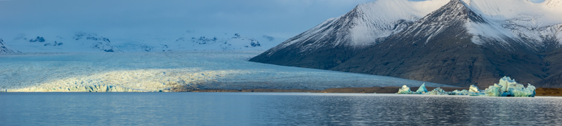
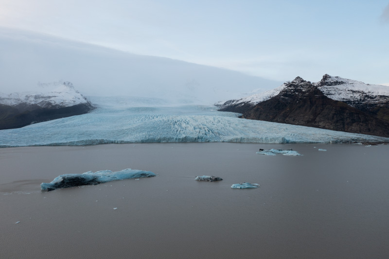
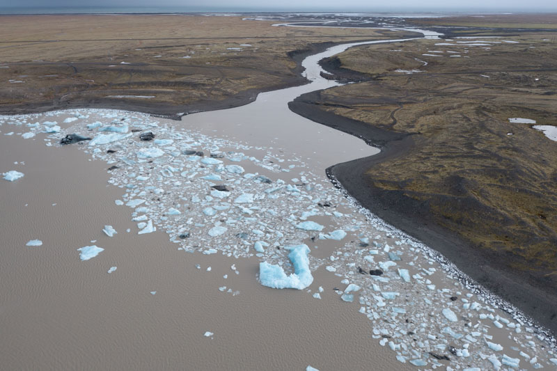
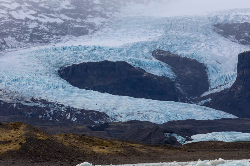
We then drove a few miles west to the Glacier – and a 10 minutes walk from the carpark. The images below from the drone shows the glacier wall and all the small icebergs gathering at the lagoon outlet ready to float the sea.
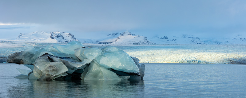
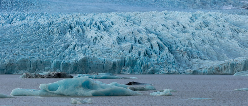
Fjallsárlón Glacier
A close up image of the glacier
And another glacier winding its way down the mountain
Much less rushing around today, but a very rewarding day with plenty of images between us. Tomorrow we will leave early after a quick breakfast to head further east to Hofn where we hope to photograph the Vestrahorn mountain range.
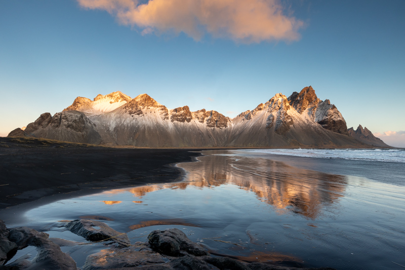
East to Hofn
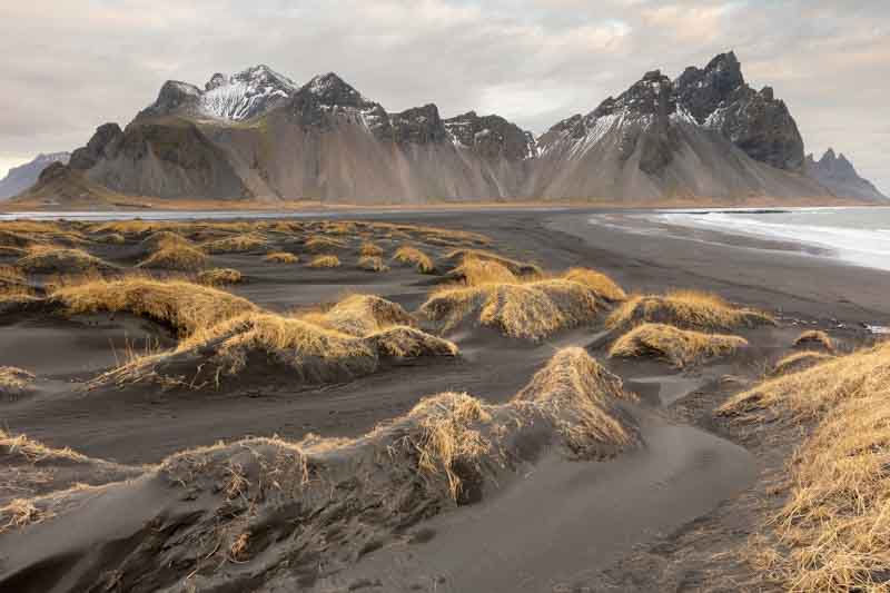
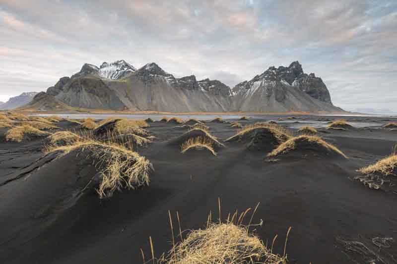
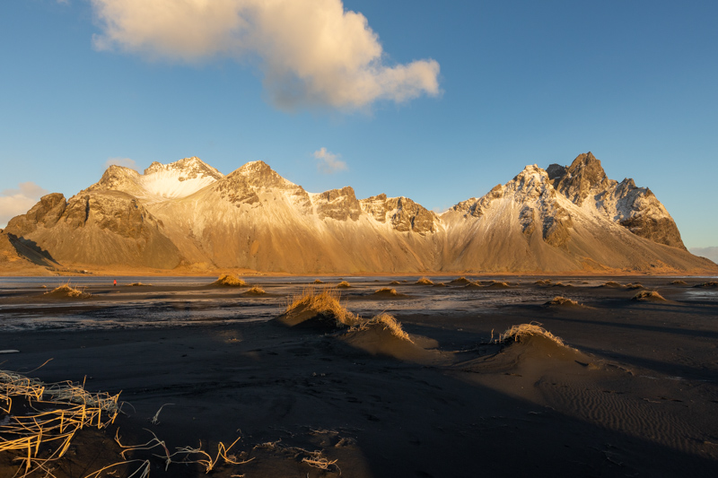
Tuesday 23rd November: We had 1 hour to travel to get to the Vestrahorn mountain range before sunrise. As it turned out, we didn’t see the sun at all today and the afternoon was mostly rain. But we made the best of the time available to us. The mountain is accessible via a private gravel road approximately 7km east of Höfn. There is a charge of a 1000ISK (subject to change) which can be paid at the Viking Cafe & Guesthouse at the end of the gravel road. A barrier controls access to the dunes in front of the mountain.
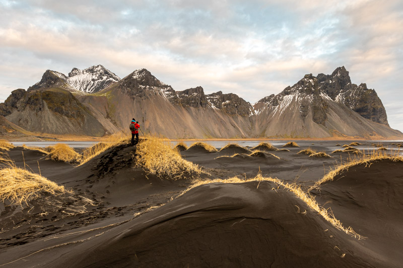
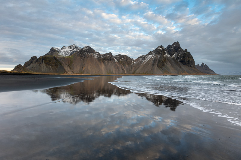
Vestrahorn Mountain (Stokksnes)
Vestrahorn has a black sandy beach which is very flat, but tidal, so the water does move at a reasonable pace once the tide rises. This does provide opportunities for sand and reflection shots.
Here’s a nice one of wifey – in the red!
Vanessa had been having some issues with her tripod with the head clamp working loose. It was now almost unusable without repair, so we needed a star-drive screw driver to fix it – what’s the chances of finding one out here!
We joined 3 other photographers down at the beach and we were chatting with their guide from the UK – Mark Bauer who is a well known Dorset photographer who has written many books. Amazingly he carried a small bag of star spanners and Allen keys – one of them fitted and fixed Vanessa’s tridod.
He was running a tour as part of his company ‘Dawn to Dusk’ which he started with another photographer – Ross Hoddinott who has also written many articles that I have read.
As we walked back to the Viking Cafe, we met Ross and had a good chat – amazing just who you can meet away from home. Anyway, the best of the weather was behind us, so after a coffee and muffin we headed off to Skutafoss waterfall nearby.
Skutafoss waterfall
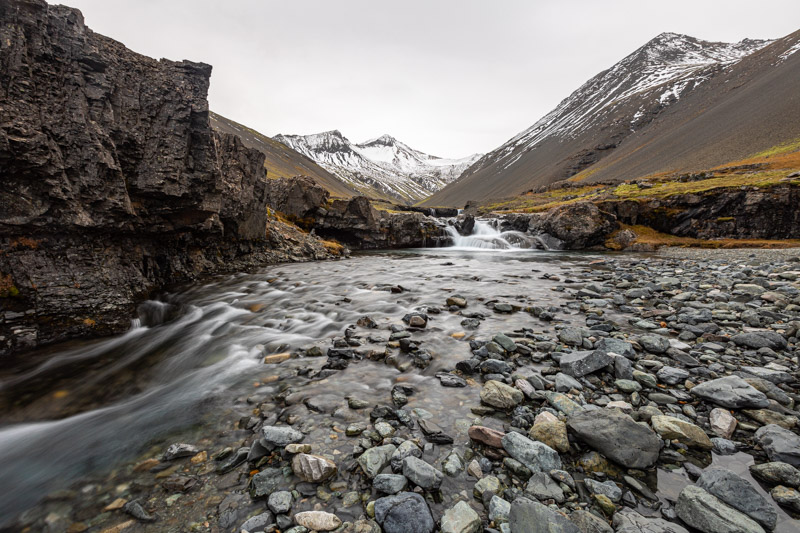
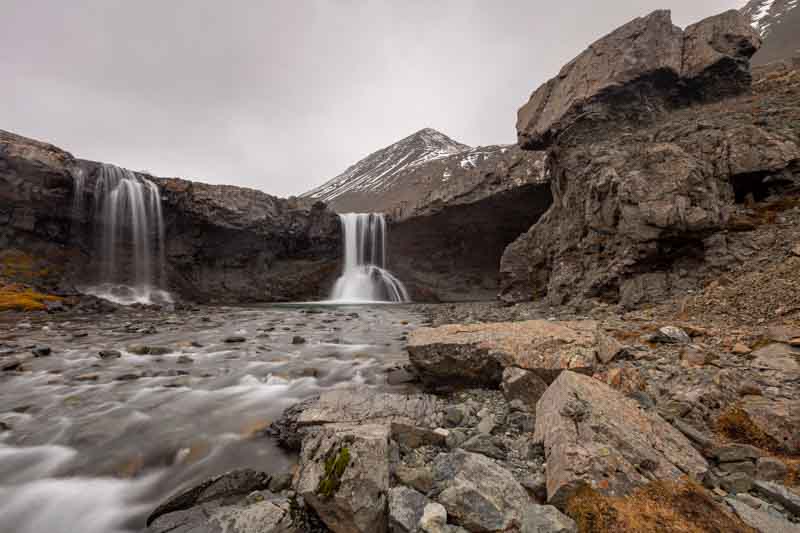
Unfortunately I’d left the drone in the car today, so we had the clamber up the side of the river bank onto the top to get a view from above
At this point it was raining heavier, so I think we were done for today – packed up and headed back to the Vestrahorn park to wander around a derelict Viking film set – but on the way, Hawkeye Vanessa spotted this……
Unfortunately it spotted my red jacket before I could get closer.
Tomorrow we’ve had a high wind alert, so we may have to stay in this area until the afternoon – oh well, at least we can read a book for a change.
Important – Keep an eye on the Weather Conditions
It is very important to keep checking the weather conditions as some roads will be closed if considered unsafe to travel:-
- Vedur.is (Icelandic Meteorological Office): The official, most trusted source for weather forecasts, alerts, and warnings.
- SafeTravel.is (App/Website): Provides real-time, comprehensive safety updates, including weather alerts and road conditions.
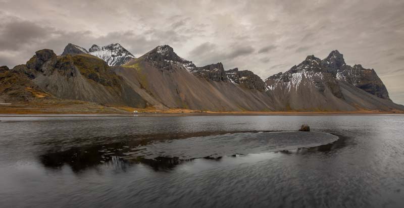
Back to Vestrahorn with Extreme Caution
Wednesday 24th November: The weather in Iceland can change quite quickly, so it is always important to consider your safety when travelling around. We registered our journey on line via safetravel.is and you’ll receive a text message if there is a weather warning. You can then check conditions via en.vedur.is/weather to consider the conditions for when and where you are travelling and adjust your plans accordingly. Note: for severe conditions the roads in some areas may be closed off.
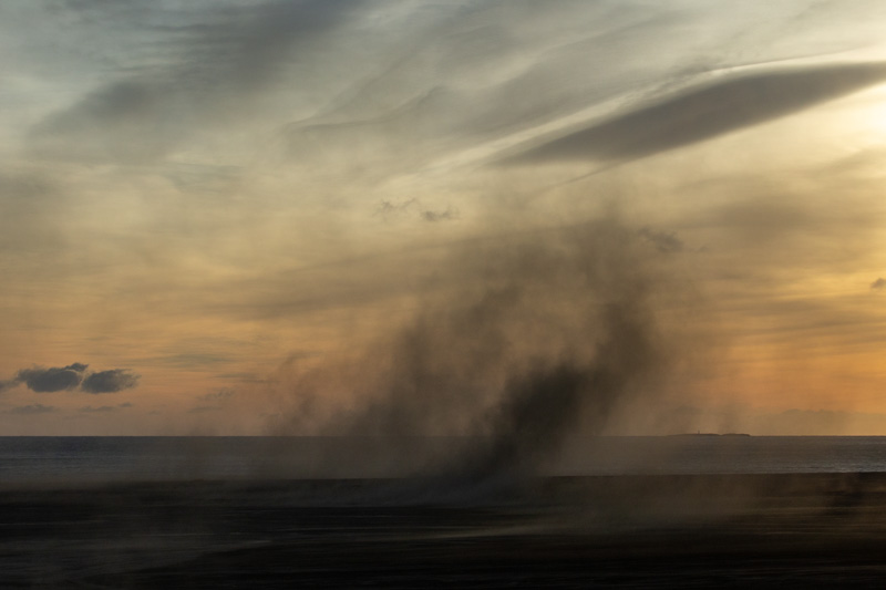
Yesterday we were warned that from late Tuesday night through to 1400 on Wednesday we would experience high winds in the area. The roads weren’t closed, but we needed to proceed with caution. So we headed back to Vestrahorn keeping the speed down – especially with high winds on icy roads. On arrival we had breakfast at the Viking Cafe whilst waiting for the sun to appear.
During breakfast we could see other photographers battling with difficult windy conditions…..
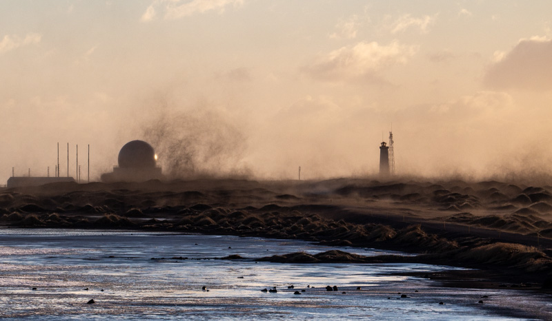
Hopefully you can see the sandstorm – just as bad for cameras as water. So we thought we get prepared in the car before venturing out. Firstly securing the camera inside the waterproof cover with only the lens protruding.
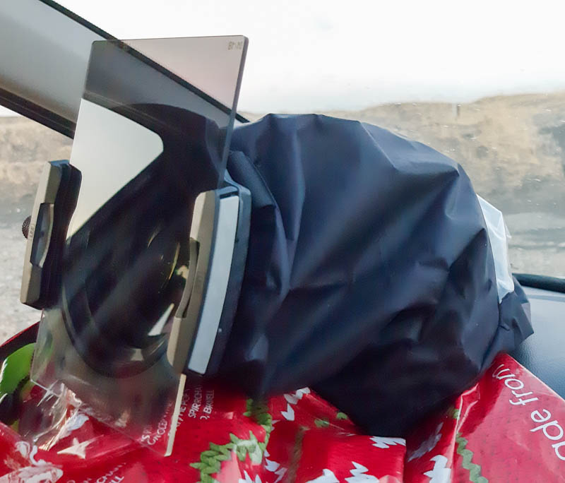
We used the carrier bag to protect the filter during transit across the sand. There were short calm periods in between the gusts and we had to ask ourselves – was it worth it?
We think it was worth the effort and risk, although Vanessa did lose her carrier bag and the ‘Lee filter lens cap’ – they’re probably in Scotland now…..
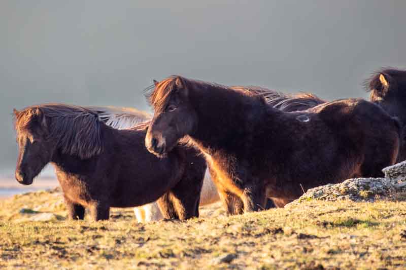
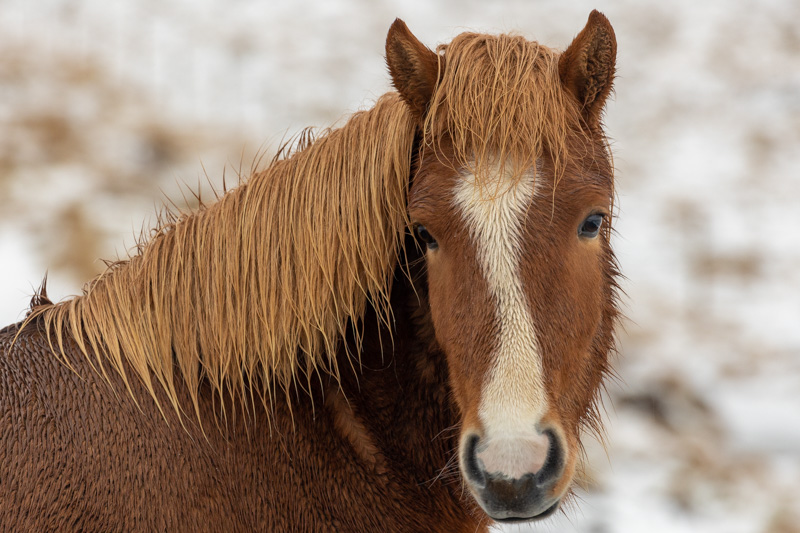
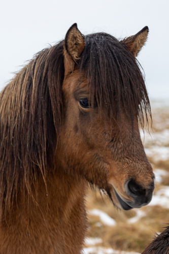
Moving away from the sand, Vanessa captured these ponies
Then leaving the area we saw more sand storms…

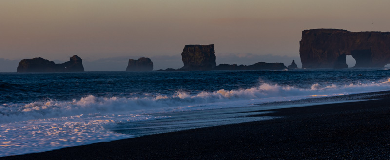
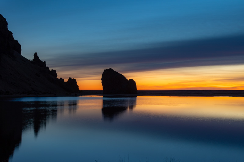
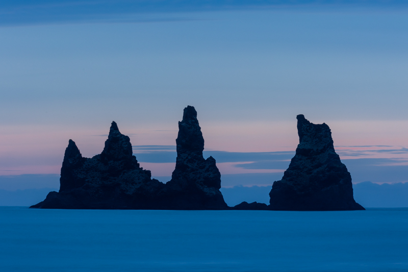
Heading West back to Vik
We continued on our 3.5 hour drive back to Vik, hoping to arrive in time to catch a sunset behind the sea stacks. Unfortunately we didn’t get the same deep red sky we had a few days ago, but this wasn’t too bad.
But a better image was this one
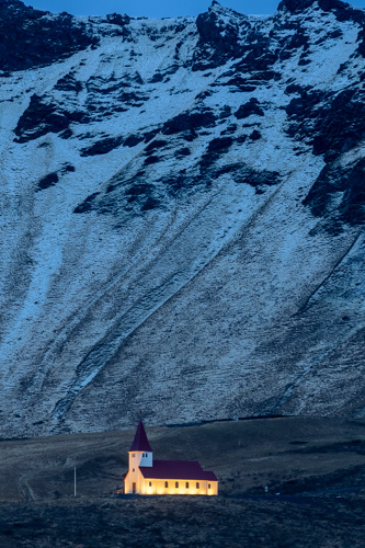
Just as we were about to leave we grabbed this last shot of Vik Church up on the hill.
We have 2 nights in Vik, so just plan to peruse the area – although rain is again forecast.
A very wet day – so plans change
Thursday 25th November: For once the forecast was correct – it was wet, so we headed off for a waterfall, but when we arrived 50 minutes later it was raining quite heavily and there were a lot of people there. So we headed off to another waterfall inland, but the uneven roads and icy conditions made our journey extremely difficult, so it forced another change of plan.
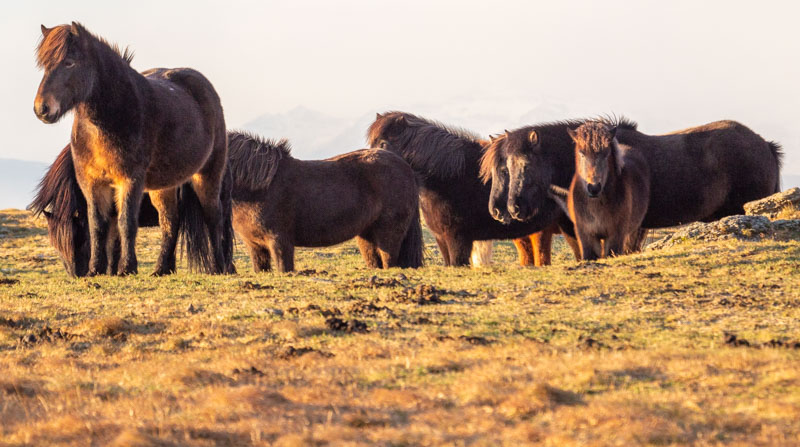
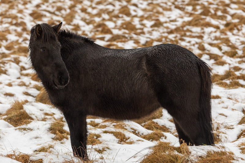
We photographed the ponies as there were hundreds of them in the area.
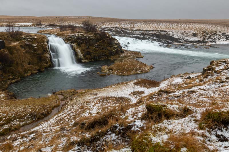
On the way back we came across a small church and whilst looking at this we heard running water nearby – and 400 yards away we discovered this….
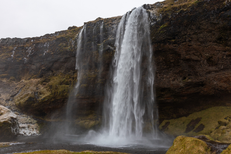
The weather was easing, so we headed back to our original waterfall, but stopped for a coffee along route. When we arrived there weren’t as many people and the rain had stopped. The problem now was too much water spray from the waterfalls, so quick hand held shots were required…
Sunset at the Black Beach
The sky was starting to brighten, so we headed back to Vik as I wanted to get closer to the stacks. The sea was quite rough but the tide was still going out, so it was safe to venture along the beach.
The trick here is to fire the shutter when the water starts to return to the sea.
So in the end, not a bad day after all.
Heading west to the Fagradalsfjall Volcano
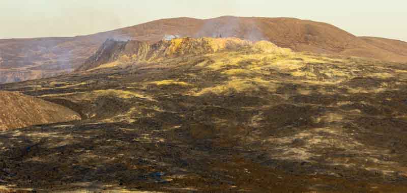
Friday 26th November: Clear skies overnight and through the day led to the coldest temperatures during our trip. We headed west on our last day and experiencing -9C (16F) temperatures. So what could two adventurers do today to keep warm – how about climbing in the mountains to get a glimpse of the Fagradalsfjall Volcano which erupted back in March.
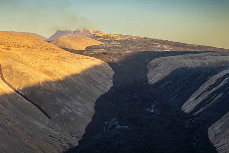
We walked up hill for approximately 2 miles to get as close as possible to the crater.
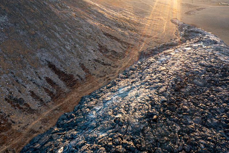
It was so cold up here my phone actually switched itself off, so drone flight was limited (as the phone is coupled with a transmitter to control it). The first image above was from the drone.
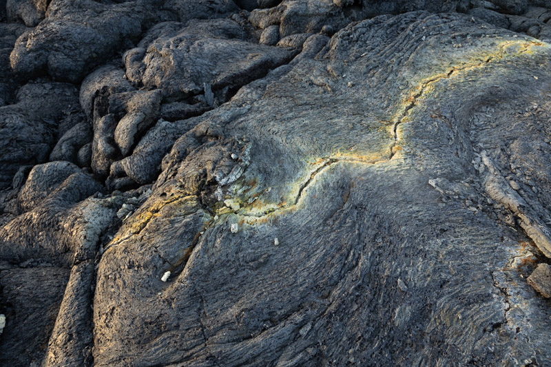
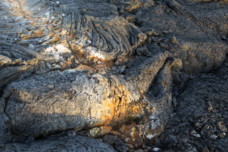
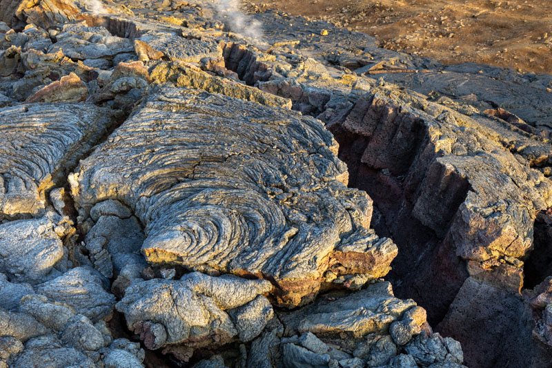
On our way back down the sun was casting a great light across the lava flow
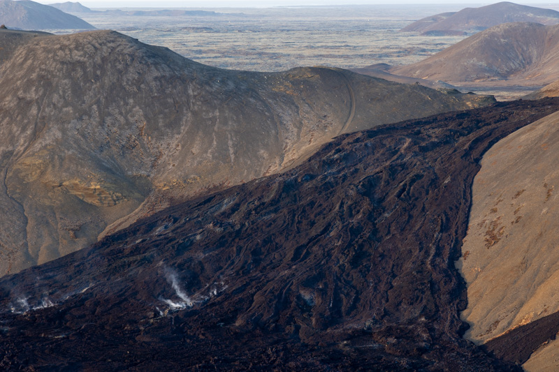
We eventually reached the lava flow for some closer exploration
Around the peninsula and returning to the airport
After the sun dropped behind the hills we headed further west to the end of the peninsula for a few last shots
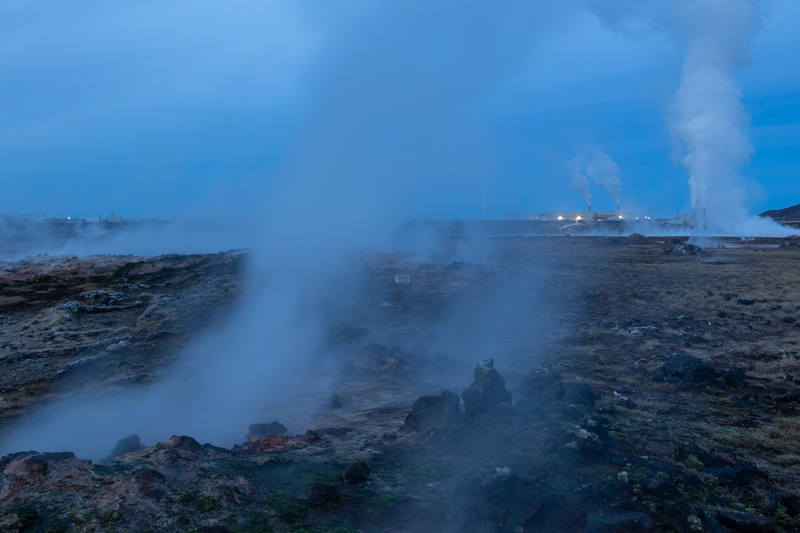
Finally we took a short trip to the nearby hot springs and this shot shows the Geothermal power plant in the background.
We are now back at the airport hotel and returning to the UK tomorrow, so this will be the last blog for a short while. We are hoping to get the motorhome out again before Spring – so watch out for our next update.
For now, we hope you’ve enjoyed our adventure across Iceland – we would recommend it for all keen travellers.
