- Lake District (Camping near Keswick)
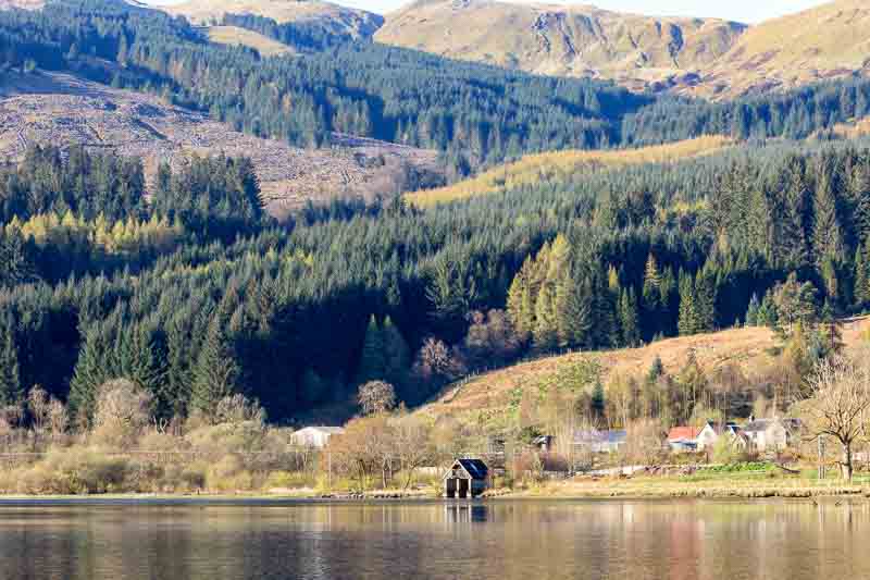
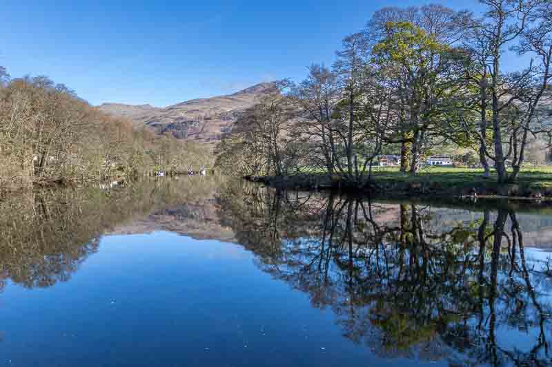
- Loch Lomond and the Trossachs
- The Lowlands of Scotland
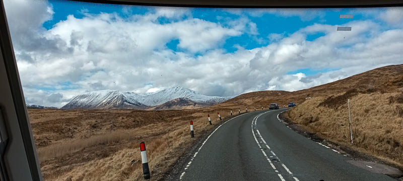
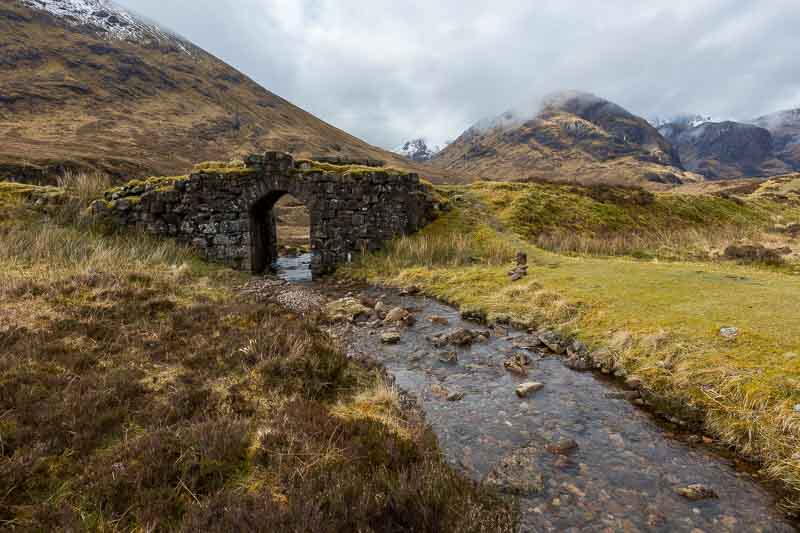
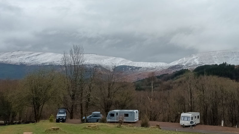
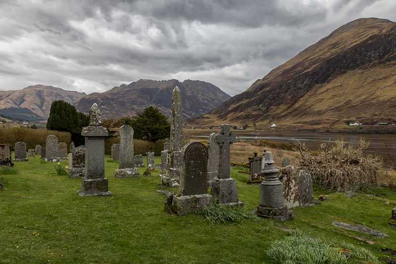
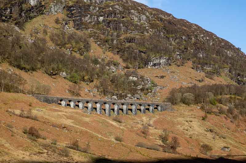
- Travelling to Glencoe
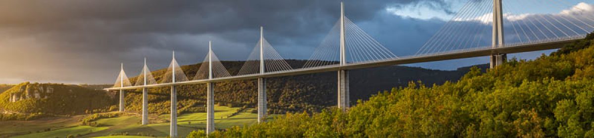
- Day Trip to Glenfinnan
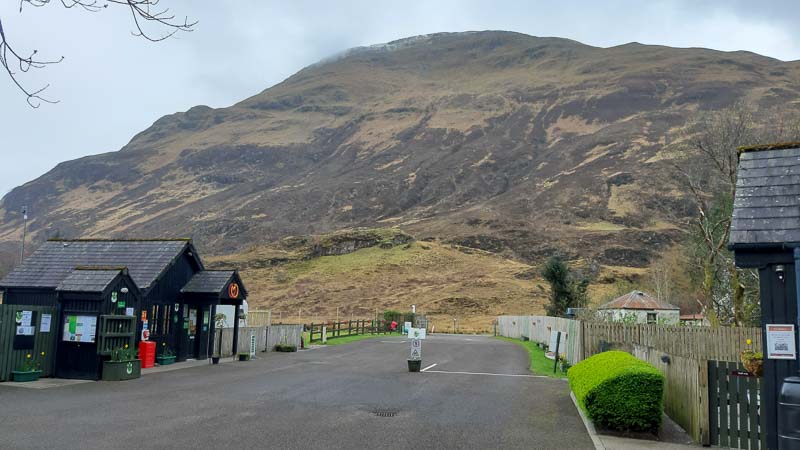
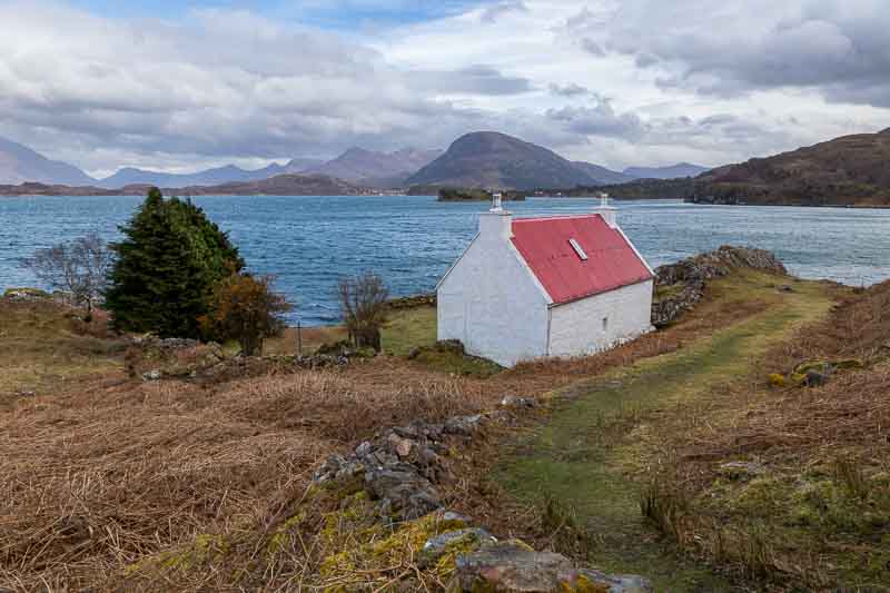
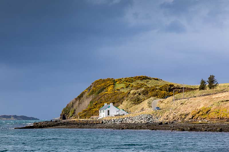
- Heading North to Morvich
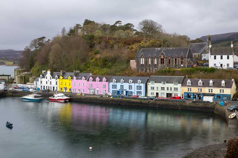
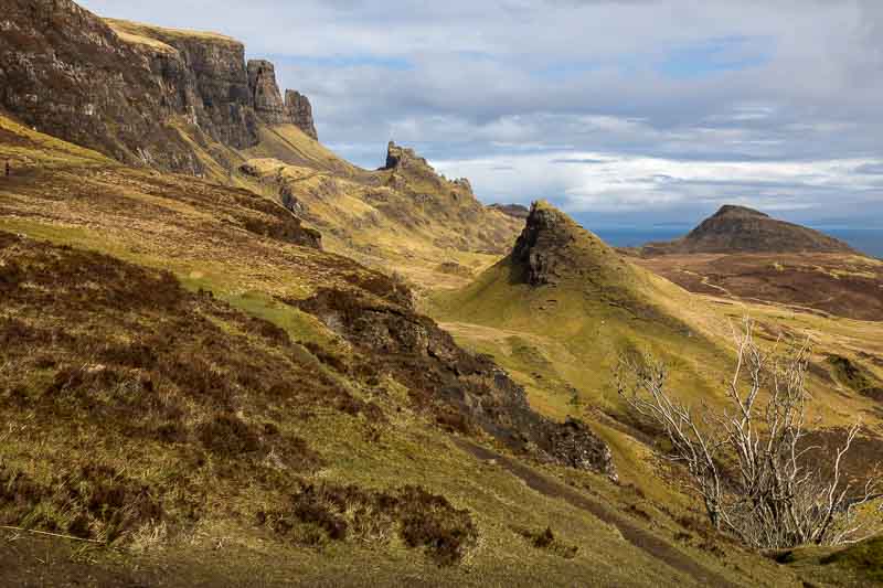
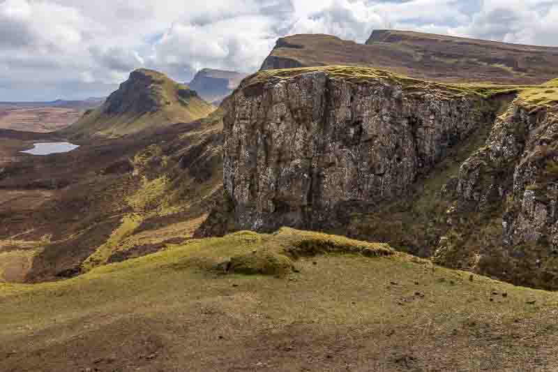
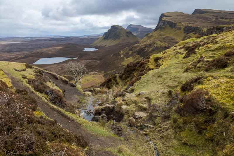
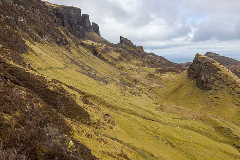
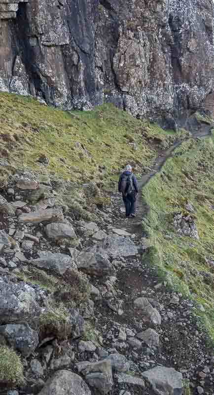
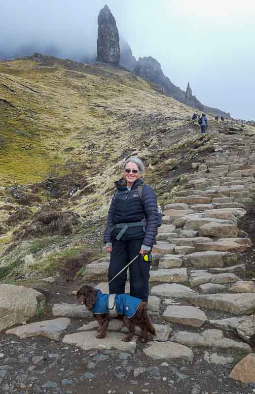
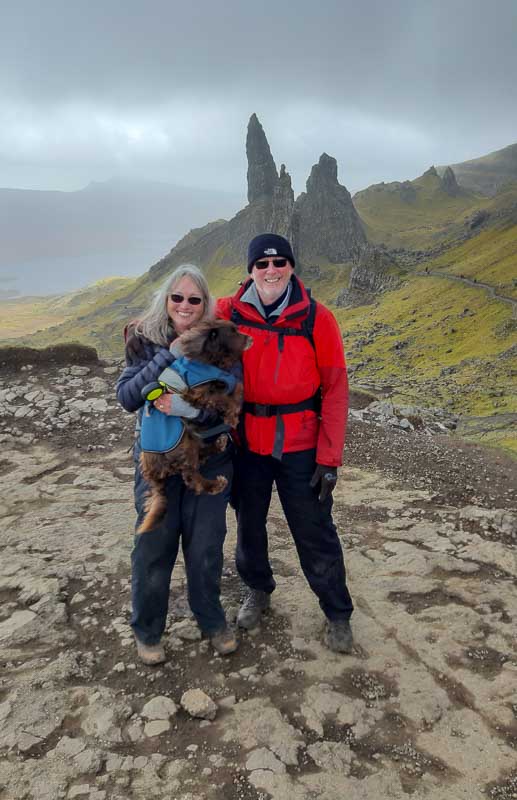
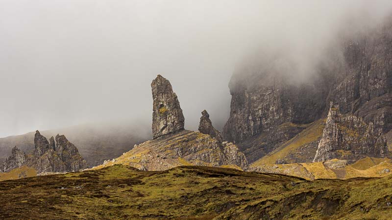
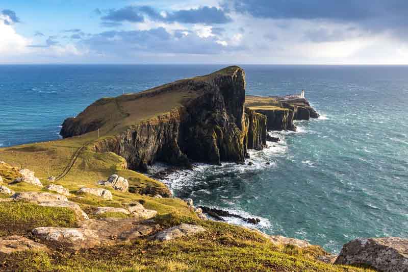
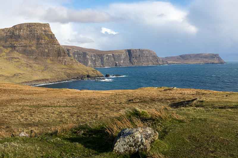
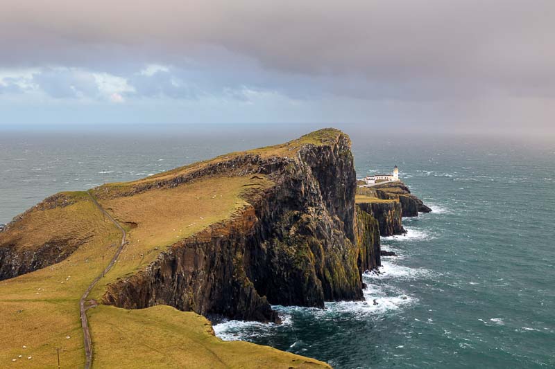
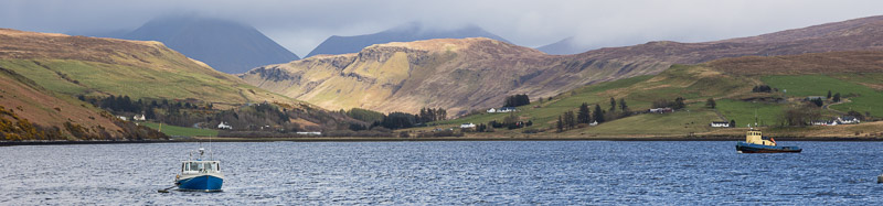
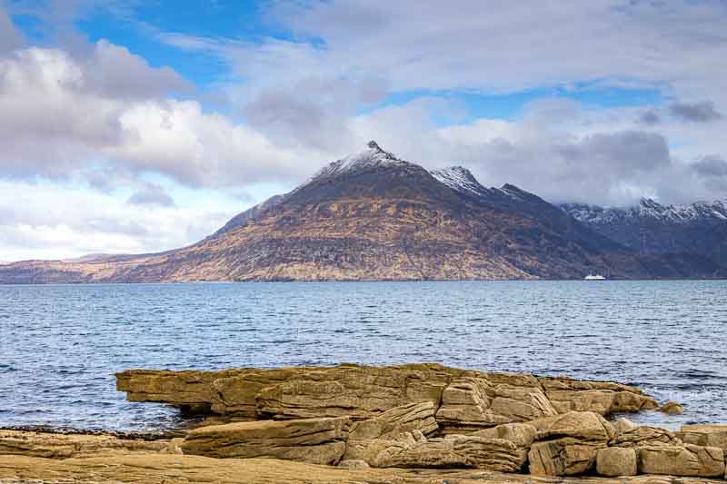
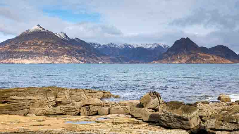
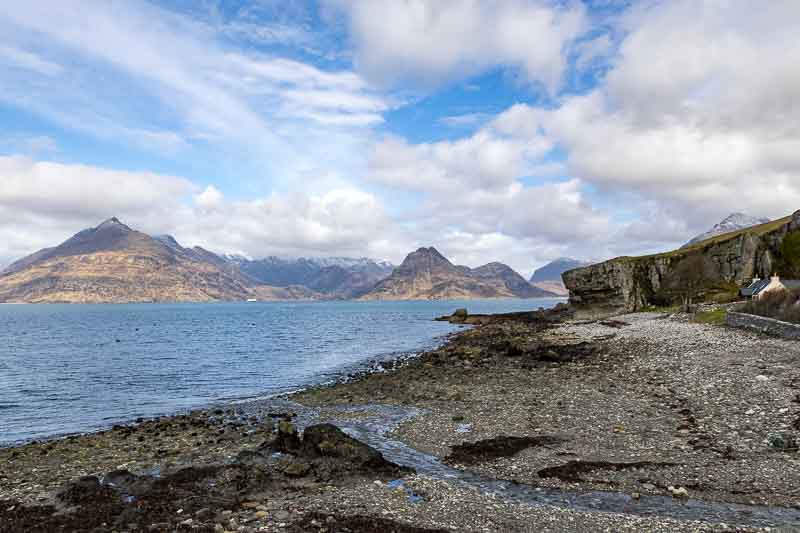
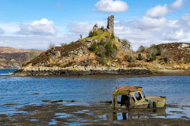
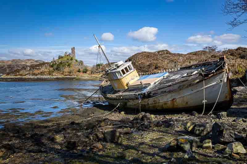
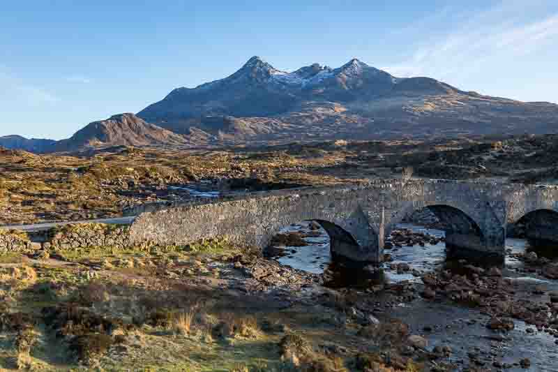
- From the Mainland to the Isle of Skye
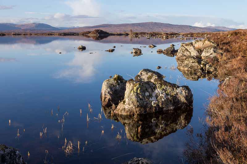
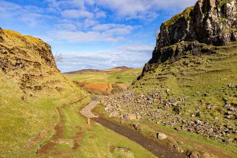
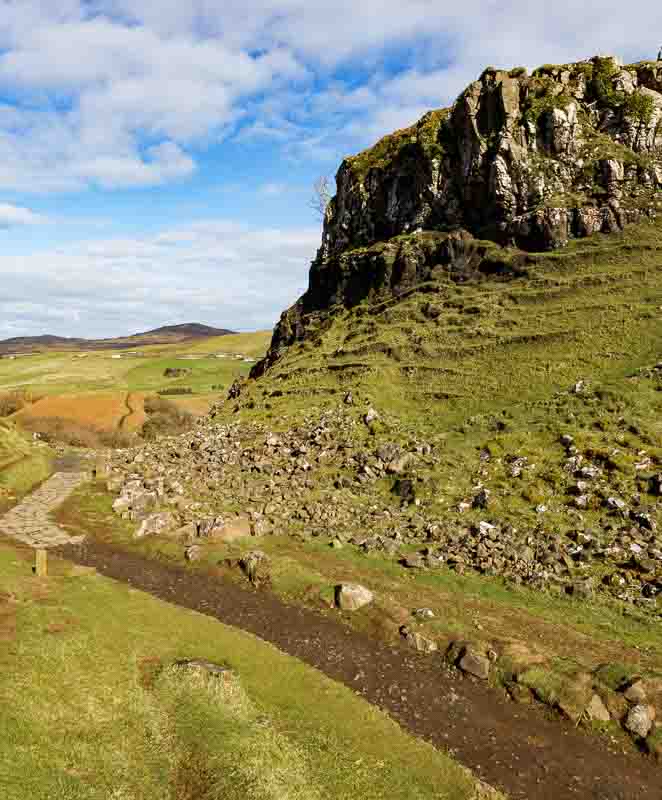
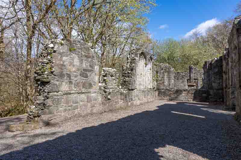
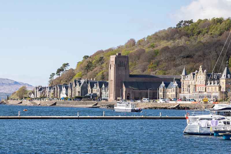
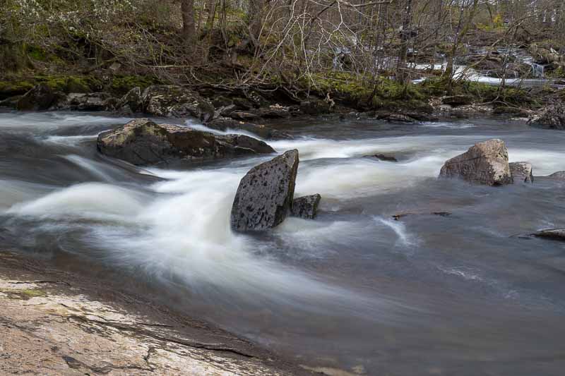
- Heading to Oban
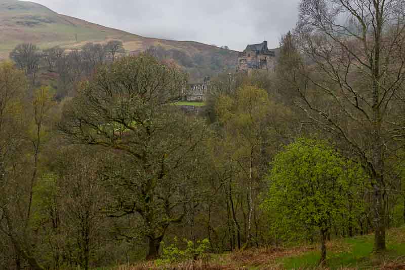
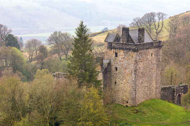
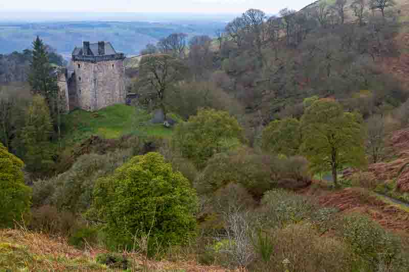
- Heading to Loch Tay and Central Scotland
- Leaving Scotland for the Lake District
22nd March: After a week of preparation, we finally started our journey. The actual planning started in July 2023, when I decided to book the Motorhome in early for this year’s MOT just in case we decided to get away in the spring. I also fitted a full set of ‘All weather’ tyres on the Toyota Aygo in case we experience dodgy roads up in the highlands.
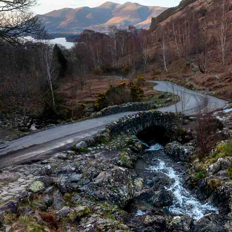
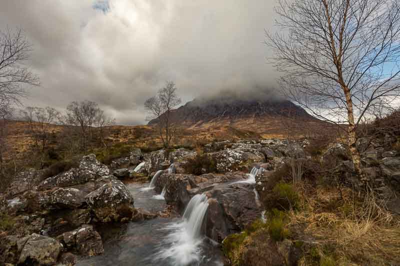
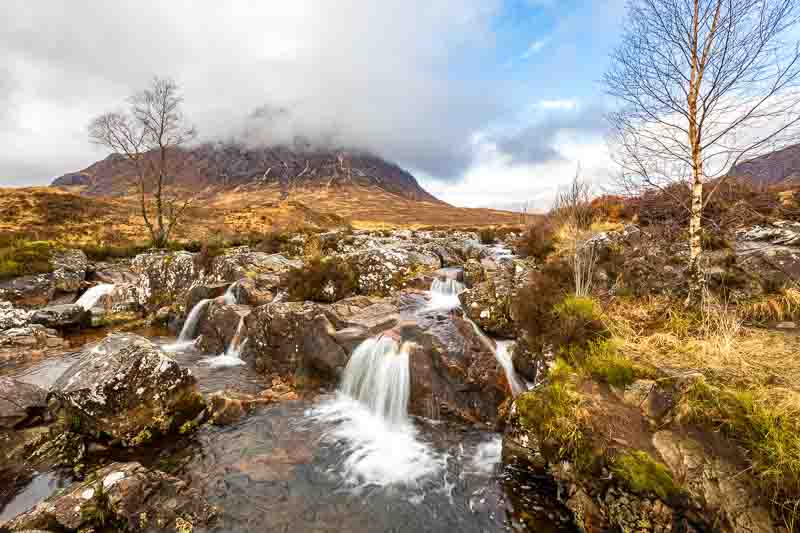
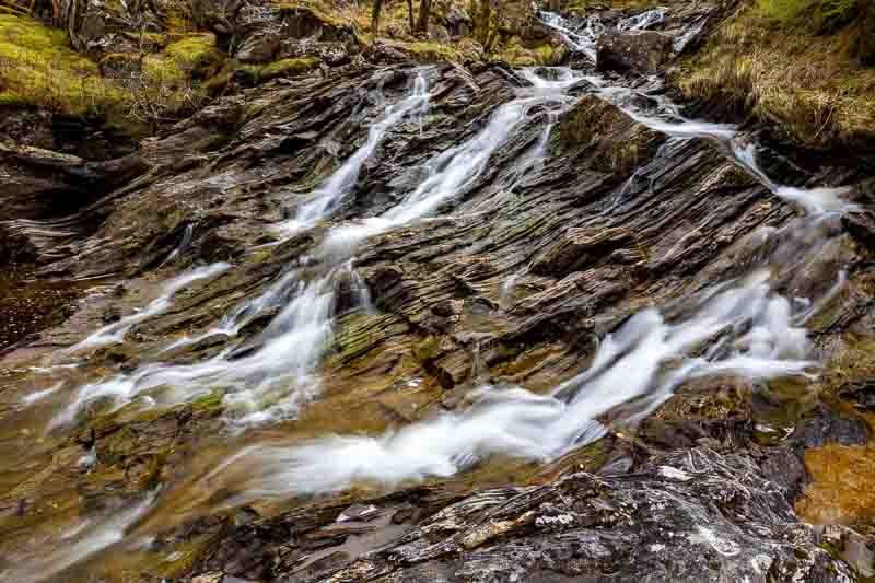
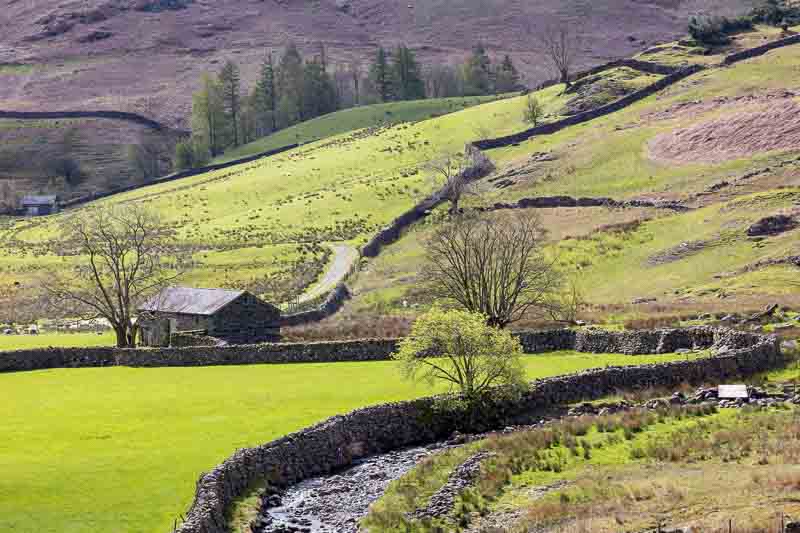
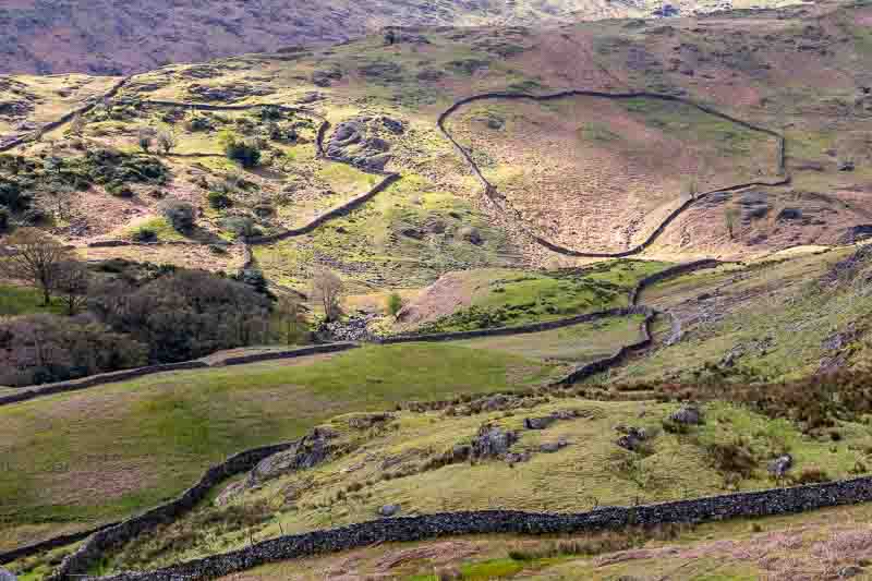
Lake District (Camping near Keswick)
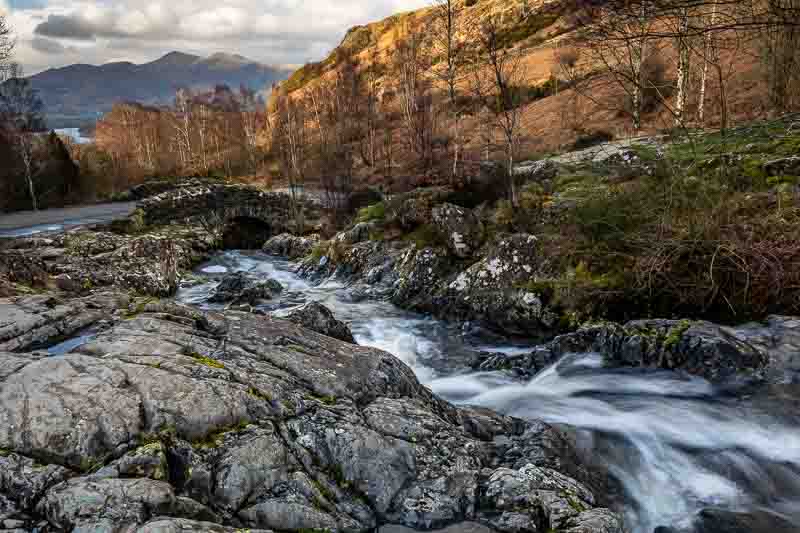
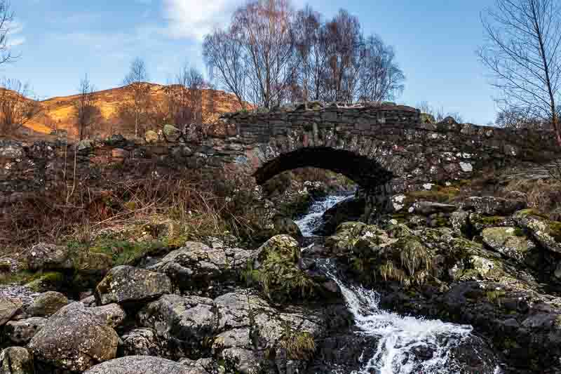
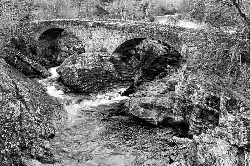
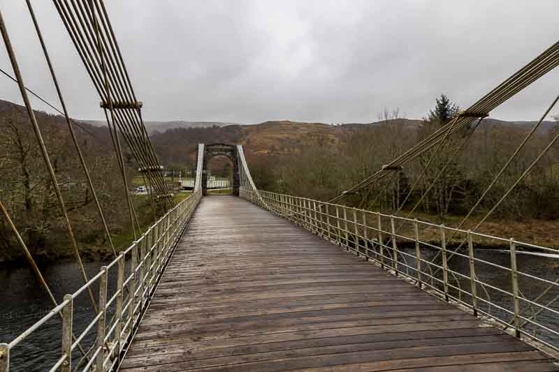
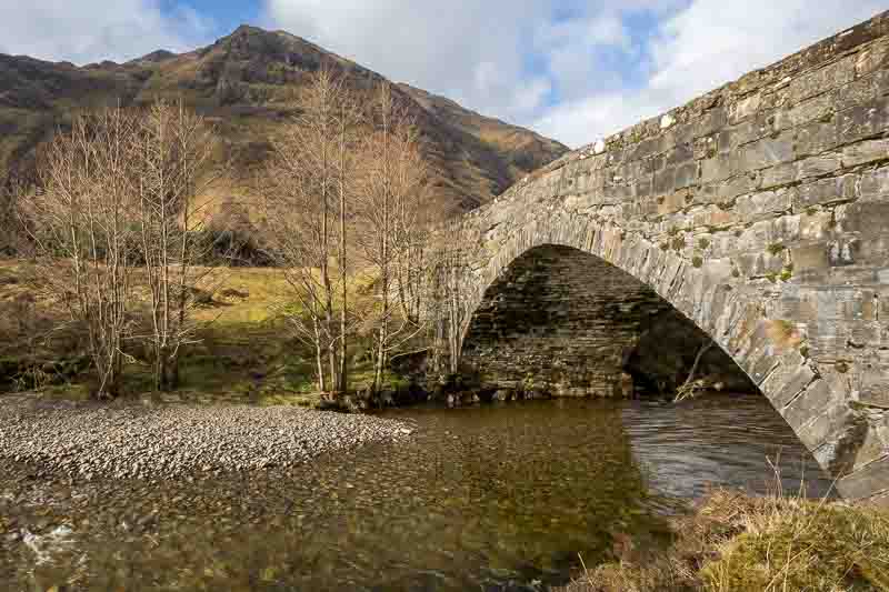
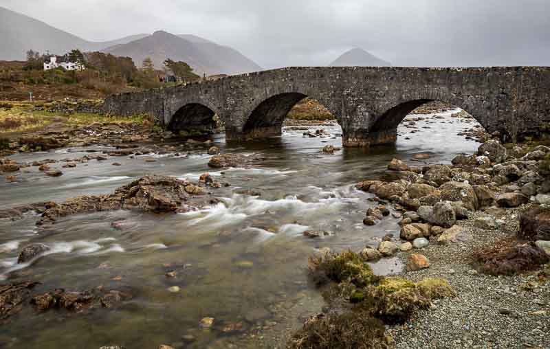
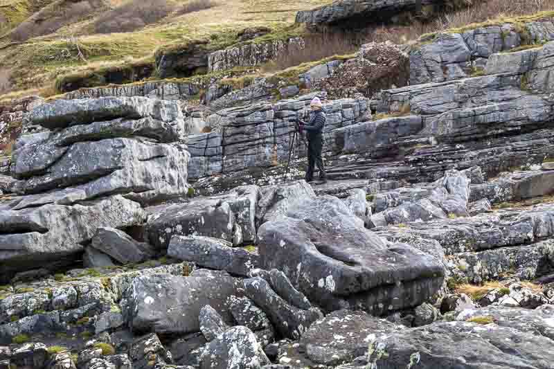
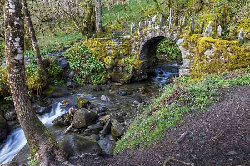
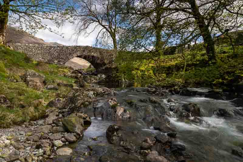
After a one night stop over at the Clock Warehouse near Derby (as it has a large enough carpark for Motorhomes), we reached our first campsite near Keswick. It is situated right on the shore of Derwent Water and was already very busy when we arrived. After quickly setting up the Motorhome we headed out with cameras to Ashness Bridge, which is one of the most photographed bridges in the country.
I spent a little time helping Vanessa with her new camera – we both have Canon R6 now. Then set up with an ND filter to slightly blur the water and a grad to tone down the sky and above is the result.
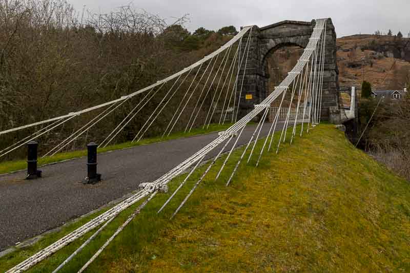
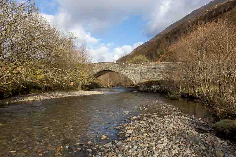
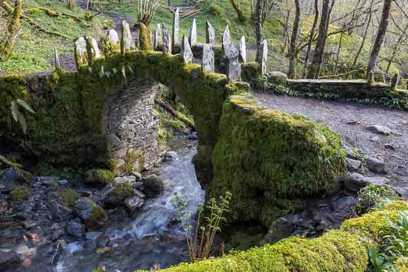
Switching to the other bank for this image:-

We’ll return again if we have time to try and get the light hitting the distant mountains.
Tomorrow has rain forecast until the afternoon, so we’ll probably do a bit of touring.
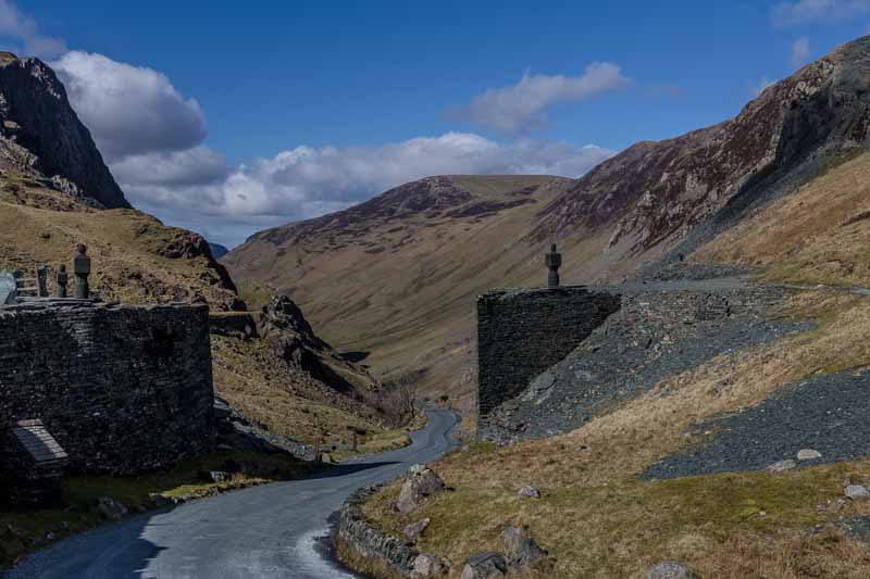
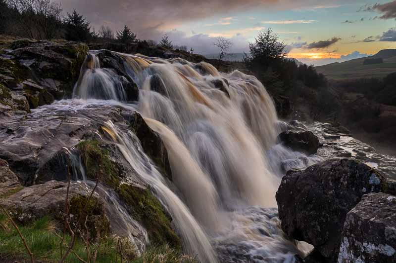
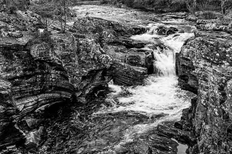
23rd March: The forecast wasn’t great, so we had a lazy start to the day. The rain hadn’t stopped by 11am, so we decided to tour the area in the car and take our chances. We headed south on the B5289 which led us through Honister Pass. Our little Aygo had to drop down into 1st gear to get up some of the inclines but it did manage it. At the top of the pass we called into the Honister Slate Mine for a coffee and lunch. It’s worth stopping here as they do sausage baps, sausage rolls, pasties etc. They also take trips down into the mine if you’re interested. After lunch we had to wait in the car for 20 – 30 minutes for the rain to ease before we had an opportunity for a photograph:-

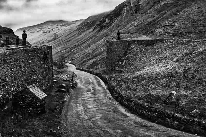
I’ve included a colour and a black & white version of the image looking down Honister Pass. I prefer the B&W version, but you may think otherwise.
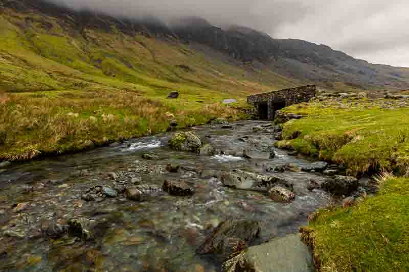
We then continued down the pass towards Buttermere lake stopping once for the photo below:-
Continuing on to Buttermere the weather wasn’t kind and so ‘no photos’, but tomorrow will hopefully be different as the weather forecast is much better. We continued on to Crummock water (still raining) and then Bassenthwaite (travelling back towards Keswick on the A66). Pulling into a layby we walked to the shore and sheltered behind some bushes waiting for the rain to subside. Whilst waiting I tried out my 2x converter on the 70 – 200mm lens to capture a heron we saw flying around.
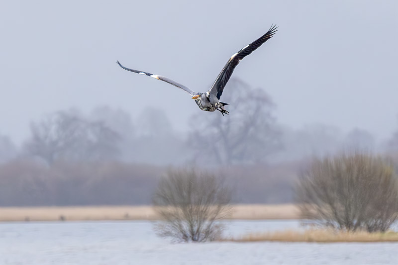
The sun was trying to break through at the end of the day, so we waited to see if the mountain background in the image above caught the light…. but we weren’t that lucky as the skies darkened again. So we finished for the day and headed back to the campsite.
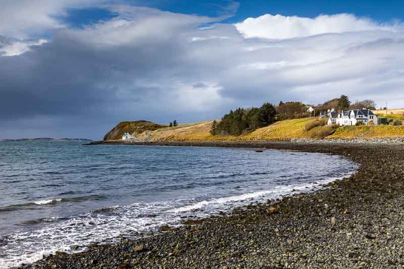
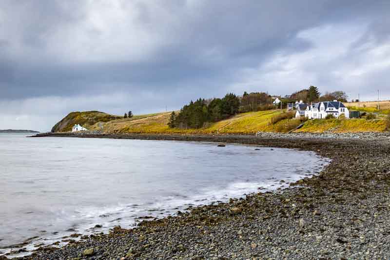
24th March: Yesterday rain dominated the day’s weather; but today we had sunshine and clouds – but only after the first 2 hours of daylight. The forecast was good, so we headed out to Derwent Water – a mere 200 yards from our motorhome. The Keswick Caravan Club site is superbly located and one we will definitely use again – we hoped to get a good photo of Catbells bathed in sunlight at first light:-
Catbells is the double peaked range top right
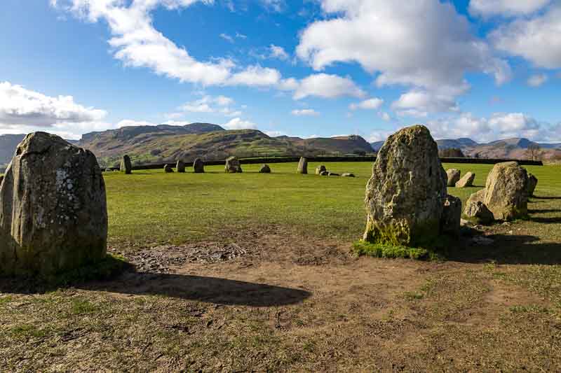
As you can see the clouds were stubborn and didn’t shift the let the sun shine through. So after 1 hour, we headed off to the Castlerigg stone circle and had to wait another 3/4 hours before we saw the sunshine.
Heading off once again down the B5289 we decided to retrace our route from yesterday.
Looking across Derwent water.
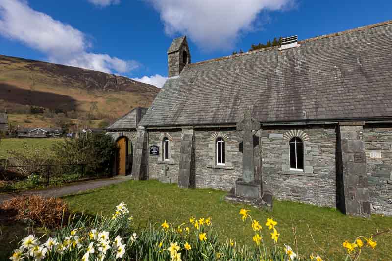
We decided it was time for a coffee to warm up, so diverted into Grange village to the cafe. We had a really great bacon roll and a hot latte – if you’re in the area, stop for something to eat!
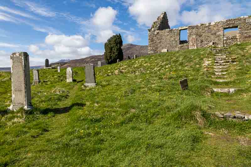
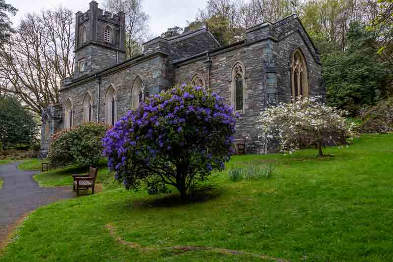
Across the road was a church which we thought might make an interesting photo. Looking over the slate wall it was definitely worth a photo.
Calling in again to the Honister Slate Mine, we retook the same shots from yesterday – ‘what a difference a day makes’
Personally, I still prefer yesterday’s images. But it was a much more pleasant day to take photos.
Continuing down the pass and on to Buttermere Lake, stopping half was along the shore for the following image – once again lacking the full sun we were hoping for.

Looking across Derwent water.
The next image was taken from the beach at the far end of the lake. The tree is a well photographed subject…
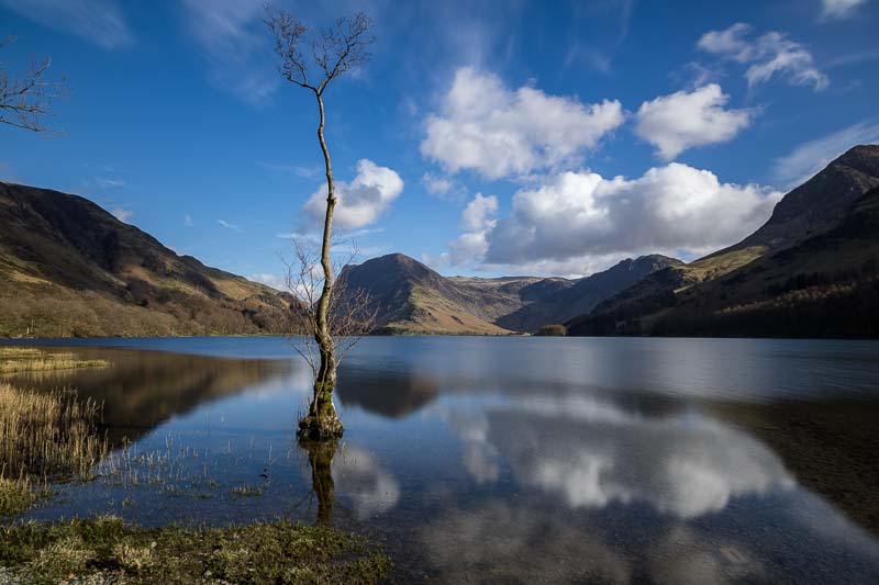
This was probably the best image of the day
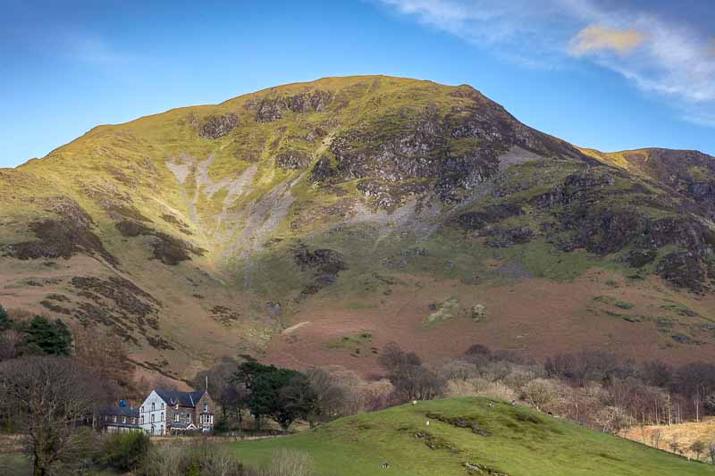
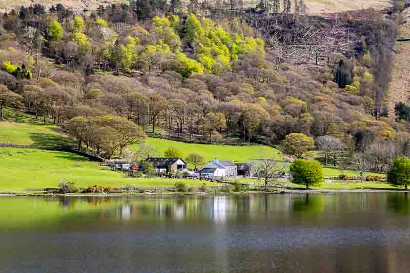
Heading back from the beach to the local village – this farm house in a great setting.
Time for another coffee at the Croft House Farm Cafe – then we headed back to Ashness bridge hoping the evening sunlight remained.
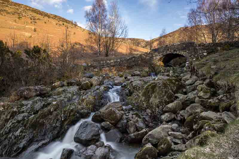
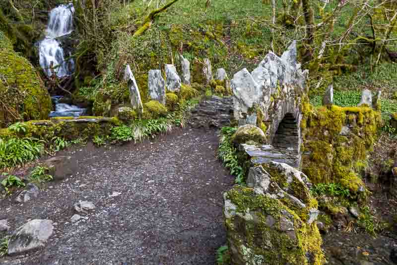
This image taken from the opposite side of the bridge to those taken before.
Fortunately there were no people around the bridge after taking this last image, so I got the drone out – it took me a good 5 minutes to remind myself how the fly it, but hovered it over the river to get the following images from this new perspective.
Tomorrow we leave Cumbria and head for Loch Lomond in Scotland.
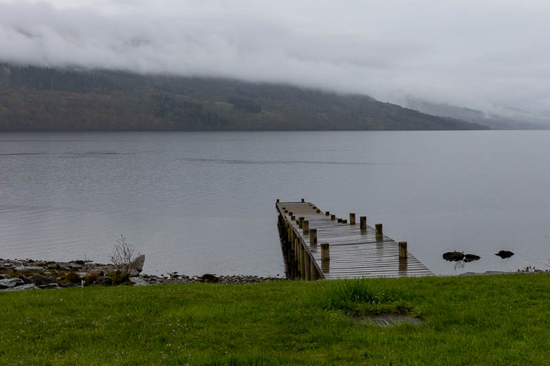
Loch Lomond and the Trossachs
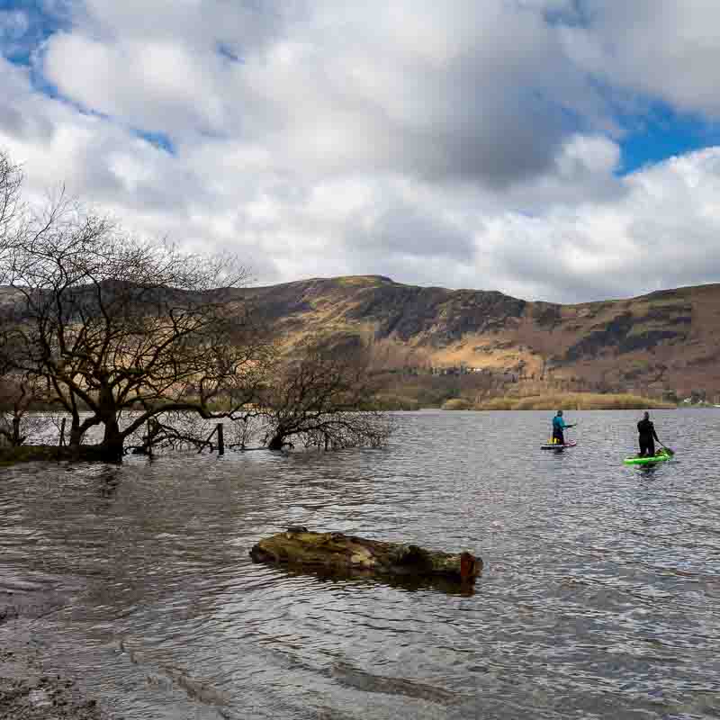
We had a wet journey north from the Lake District along a pot hole riddled M74. Not a good advert for Scotland, although to give the nation some credit, the countryside appears to be a lot cleaner than in the England.
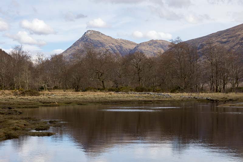
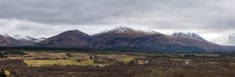
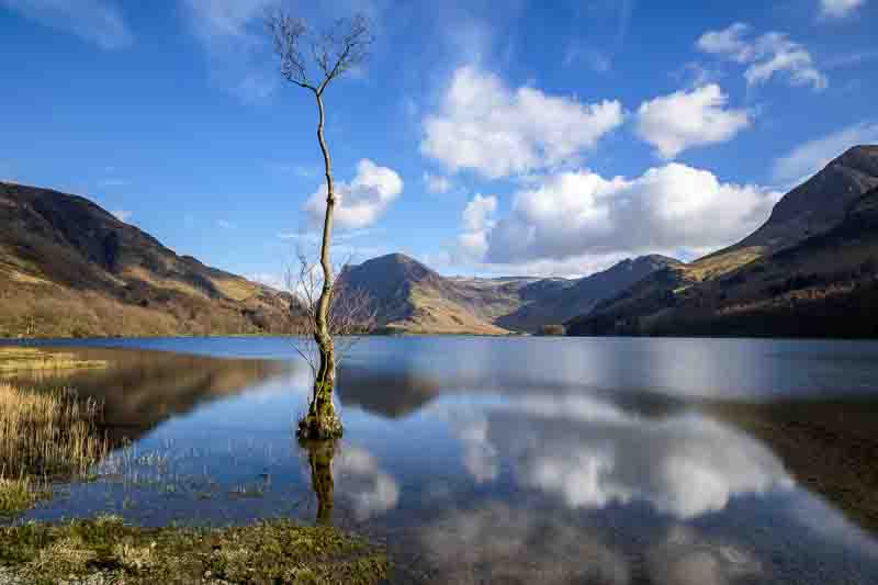
26th March: The following morning I awoke to walk the dog and was surprised to see the sun was lighting the mountains on the western side of Loch Lomond. We are camped on the eastern shore as the image below shows.

You can just see a campervan in the trees on the right – our motorhome was just in front of that.
I returned to the motorhome to drag the wife out of bed – it was only 0645, so she was still in dreamland! Returning to the shore this image clearly shows the snow on the highest peaks.

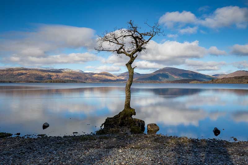
After a quick breakfast we headed 1/2 mile down the road to a carpark as there was another loan tree on the shore.

If you are wondering how we know about many of our subjects/locations in advance, then clearly we do some research which helps avoid time driving around looking for photographic inspiration. If interested, you can check out the ‘planning’ section of this website to get more insight into the books and apps and planning process that we use.
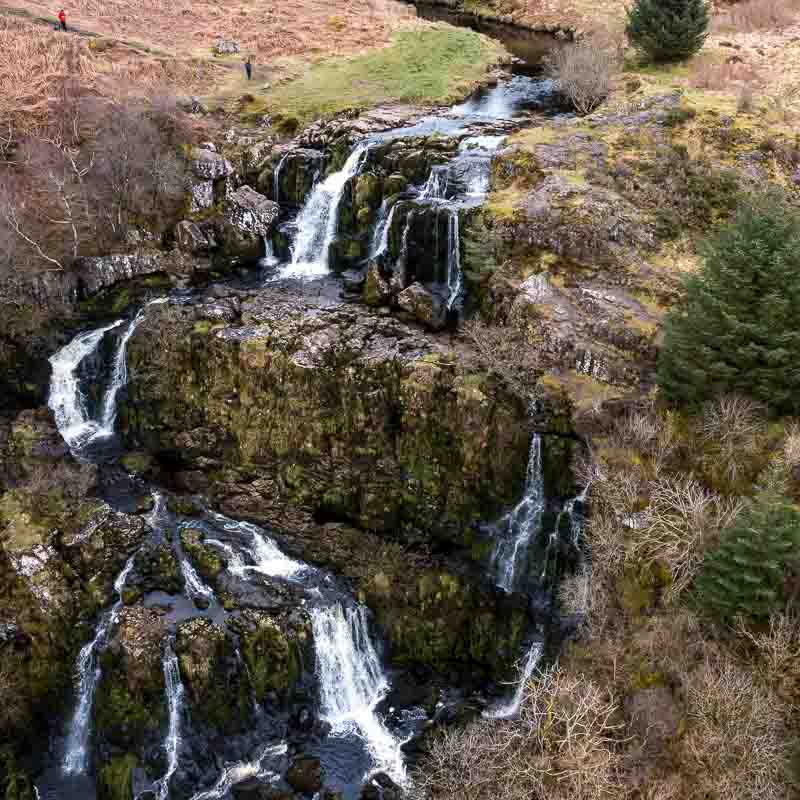
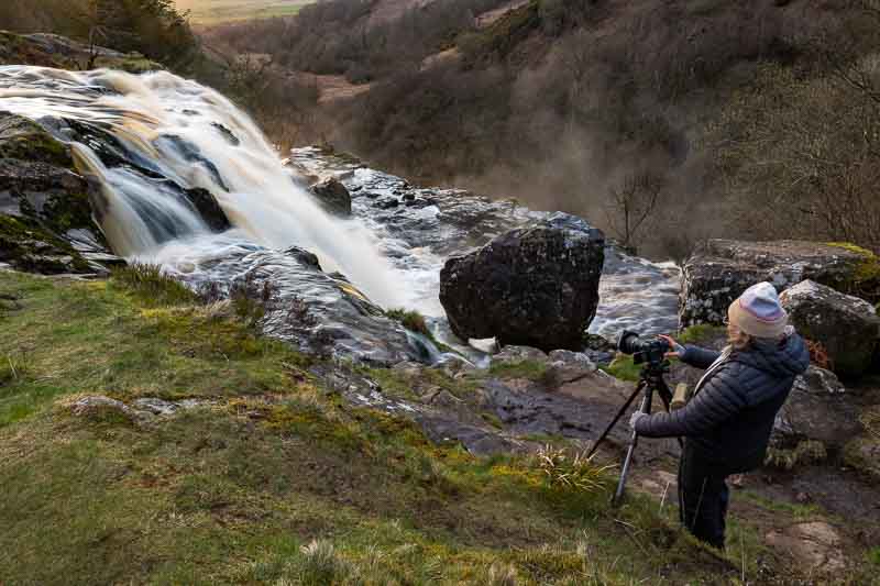
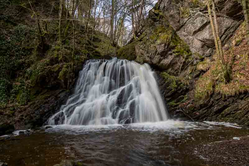
Next location was the ‘Loop of Fintry Waterfall’ which was about 40 minutes away. There’s probably enough safe parking for 6 cars on the side of the road and then a signposted short walk to the falls. I was unhappy with the photos I took with camera and tripod, so thought it was time to deploy the drone again. I had to wait for the two people on the falls to leave (as you’re not supposed to fly the drone within 50m of people, vehicles etc).
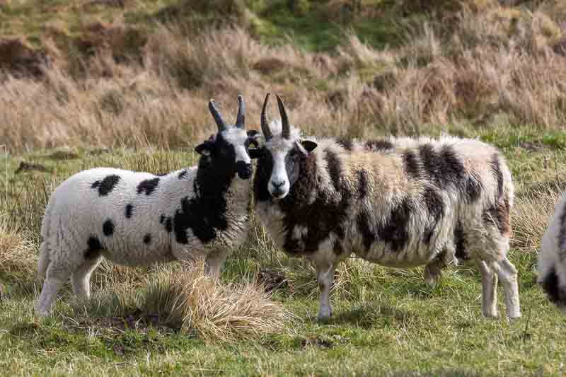
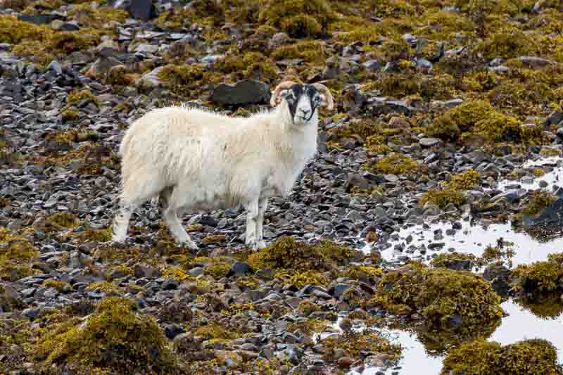
Just prior to this, when we stopped for Vanessa to book another family holiday, I put the telephoto on the camera and capture some images of these black and white sheep.
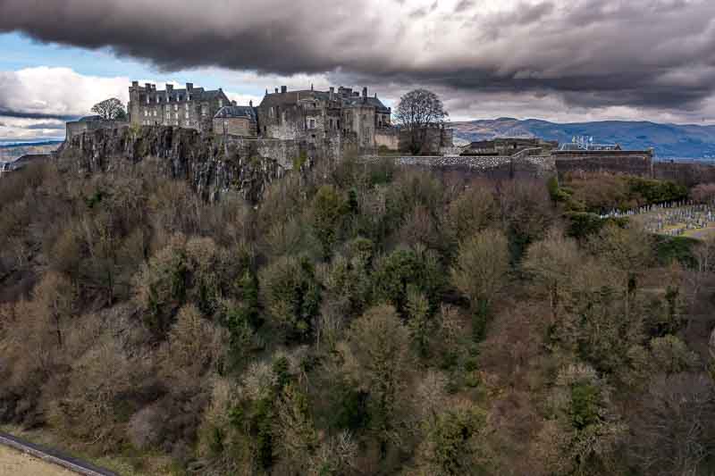
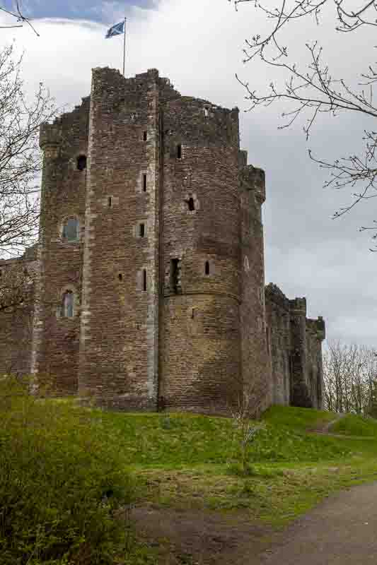
Next stop was the outskirts of Stirling to photograph the castle (last time I did this was about 25 years ago). We stood waiting for the sun to bathe the castle in light, before launching the drone again (from the middle of the nearby field). Below are the 2 images with the airborne version showing a completely different weather condition approaching the castle.

With that looming cloud we headed back towards Loch Lomond with one more stop planned – The Devil’s Pulpit, which involves a short walk from the road (with limited parking again). It was reported that there were steps down into the deep gorge, when we saw them they had almost completely collapsed making it unsafe to get down the 100 feet or so into the chasm. So I had to return to the car to get the drone.
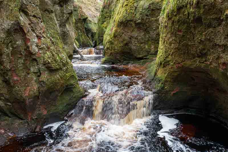

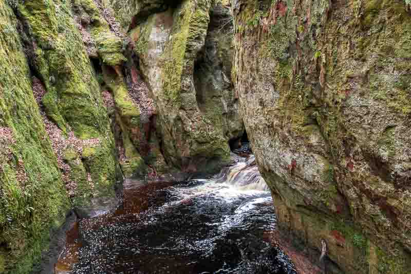
It was quite tricky flying the drone down into the chasm as the controller was continually warning of obstructions.
Drone information: If anyone is considering a drone then there are rules about safely flying them. Here’s a link to get an overview, but for mine, I need an Operator ID and Flyer ID.
Tomorrow looks to be another wet day, so we’ll probably have a relaxing morning with cooked breakfast before considering what we do.
27th March: Afternoon in the Trossachs – The morning was completely wasted due to the weather, so we spent the time catching up on general admin etc. By 2pm the sun was out, but rain was expected again at 4:30, so we set off for a quick tour in the Trossachs.
We set off for Loch Achray and a little church on the shore – Trossachs Church.

Passing the Tigh Mor Trossachs hotel set back from the shore:-
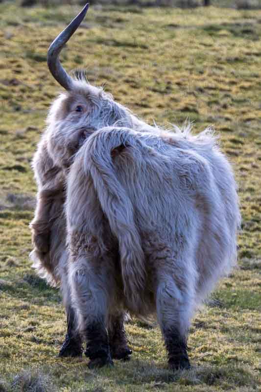
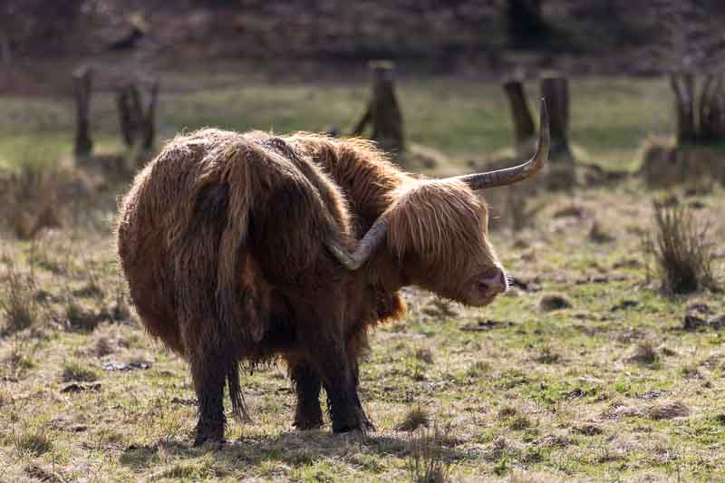
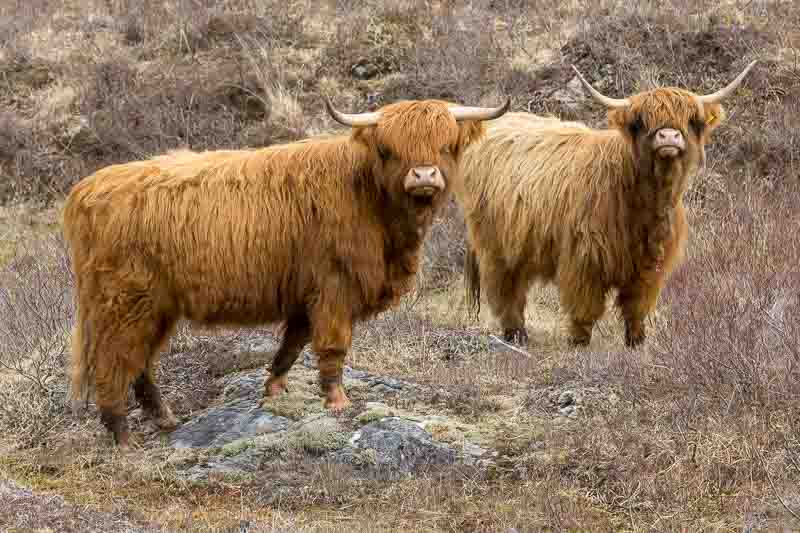
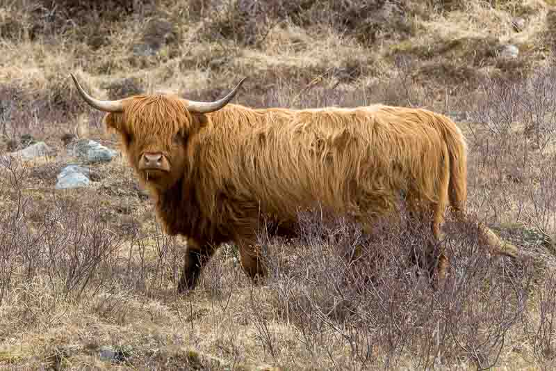
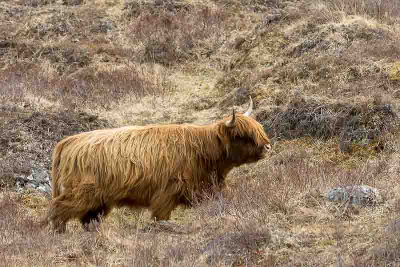
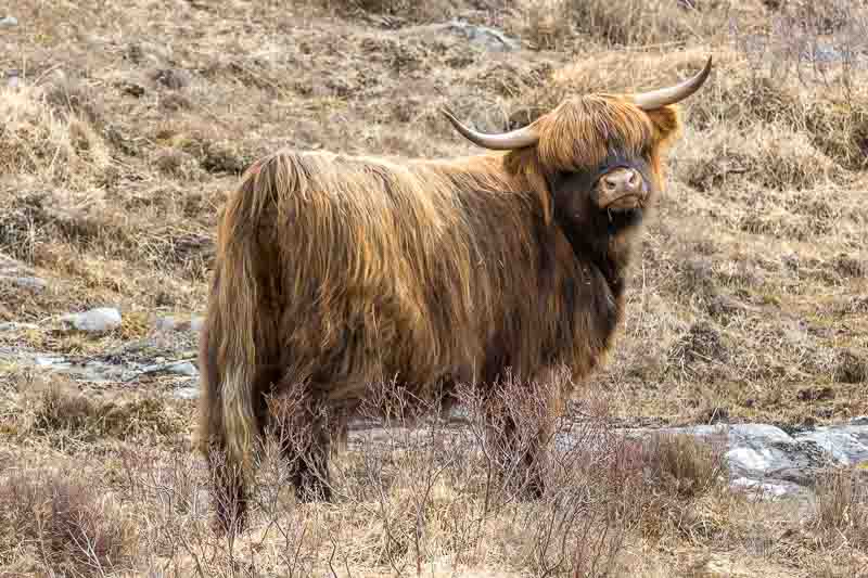
Along the Loch we finally saw some Scottish cattle which we wanted to photograph, although they didn’t present an ideal pose for me:-

We spotted a sign for a steamboat on Loch Katrine, but discovered the last trip of the day was cancelled. So we grabbed one last image and headed for the café for a coffee.
28th March: I woke at 6am and headed off to the washroom with a warm glow in the sky and the mountains across the Loch lit with a warm orange light. 10 minutes later when I headed back to the motorhome, the skies had darkened and the mountains were part covered in cloud. Unfortunately the weather didn’t improve, so we settled down in the motorhome for some admin tasks. I juggled the money around to pay the bills whilst wifey booked another city break to Belfast and Dublin later this year. This is the norm in our house – I work out how to pay the bills and Vanessa manages the spending.
The Lowlands of Scotland
The weather forecast (using the weawow weather app) was predicting some improvement after 2pm. I’ve been using this app for the last 2 weeks and so far it’s been fairly accurate. So we had an early lunch and headed off to Stirling for some essential shopping!
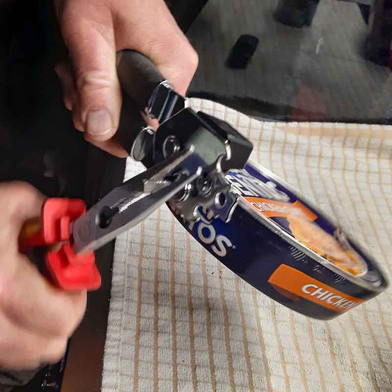
Yesterday we had to open a Fray Bentos pie tin with a pair of plyers as the tin opener broke. We have quite a few tins in the motorhome, so a new opener was essential.
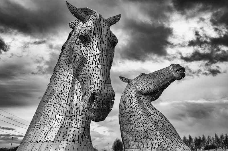
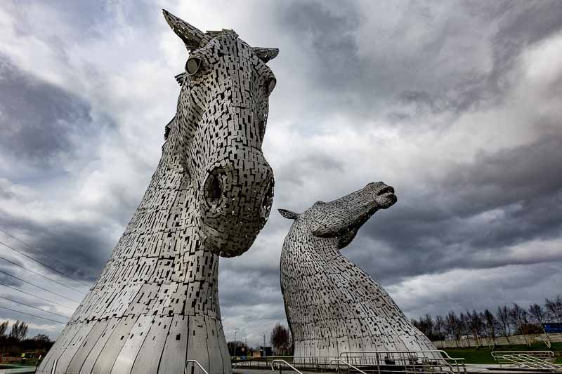
By 2pm we’d completed the shopping and the rain had stopped. So we continued on towards Falkirk to see the Kelpies. These are 2 large horse head sculptures…
After 30 minutes the skies had cleared and we had a great deal of blue sky – the weawow app was correct again. We finished our coffee and headed off to Alva Glen (a waterfall) – the town of Alva definitely needed a set of traffic lights as it took us 20 minutes to get to the town and over 15 minutes to drive through it!

This image was taken using a medium graduated filter, but fitted upside down (dark portion at the bottom) to brighten the river and gorge behind the waterfall.
On returning back to Loch Lomond, we decided to divert and return to the ‘Loop of Fintry Waterfall’ as my images a few days ago weren’t as good as I’d hoped. When we arrived there was a massive difference compared to 2 days ago (use the slider to compare the images)….


So we had another attempt to photograph the falls – this time was much better.

We eventually got back to our motorhome at 8pm, so had a much better day than we expected.
Tomorrow we move on to Glencoe, which according to reports is covered in snow.
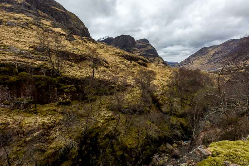
Travelling to Glencoe
29th March: The morning started well; a clear sky and with only 2.5 hours travelling ahead of us we didn’t have to leave early. As we were packing away I noticed that the side door to the motorhome’s rear storage had an issue. The side panel had dropped in the door frame. I very much suspect that all of the pot holes we’ve been driving over had broken the bond with the sealant. Fortunately I had a tube of fast setting Gorilla Epoxy, so I made good a speedy repair.
We set off in good weather for a 2 hour 15 minute journey – that is until the Garmin satnav took us on a pointless detour adding at least 20 minutes to our journey. Eventually I was pleased to be travelling north along the western shore of Loch Lomond. The scenery was stunning as the images snapped by the other half show.
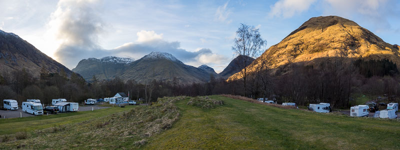
We arrived in Glencoe around 2pm, parked up and immediately had lunch. After setting up the motorhome we headed out to take in the sights. Unfortunately the skies had clouded over, but we still hoped to grab a photo or two.
The weather tomorrow may be changeable, so we’ll decide what to do first thing in the morning.
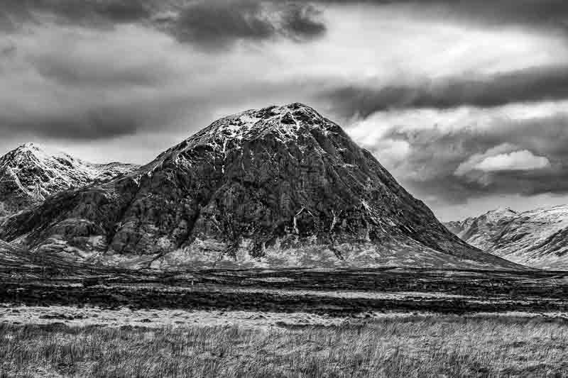
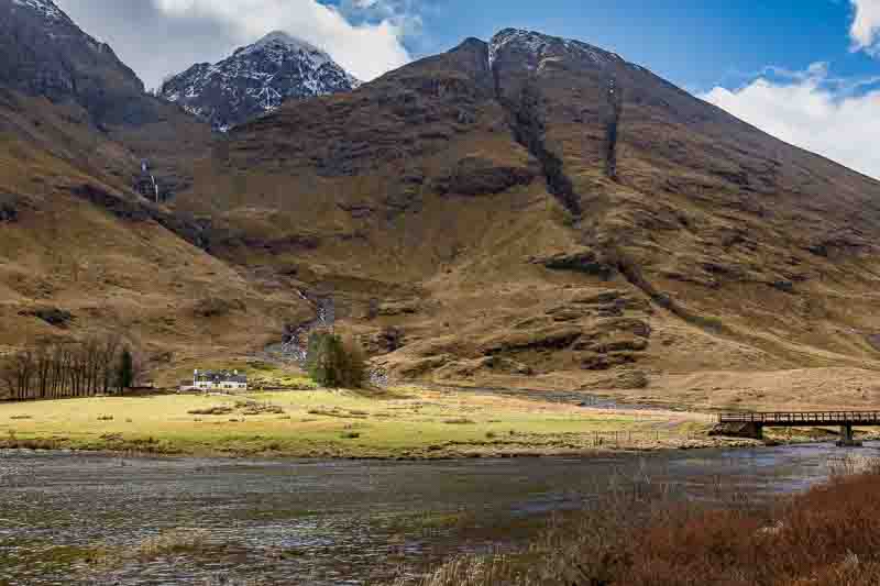
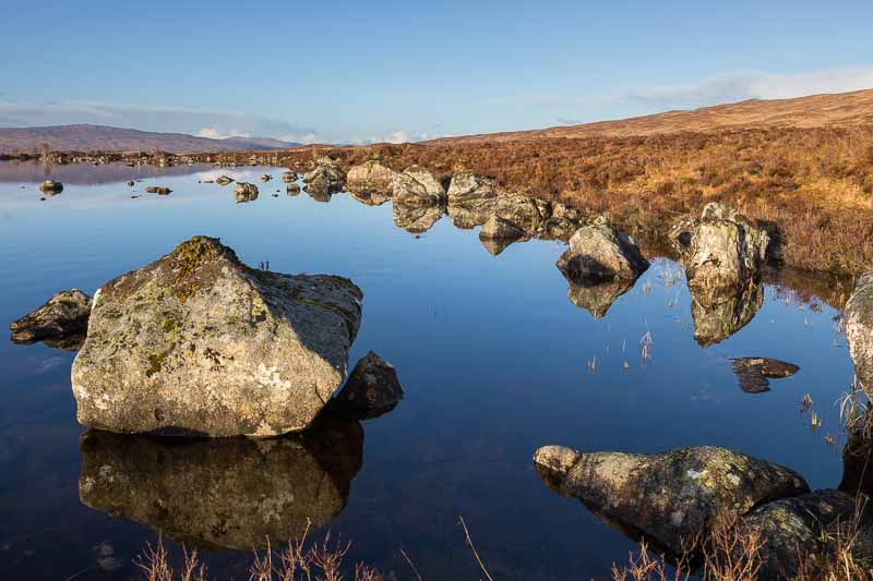
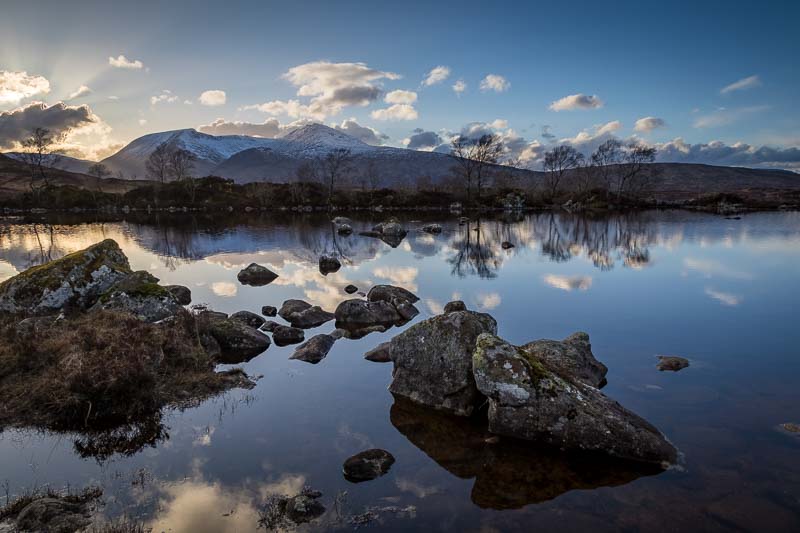
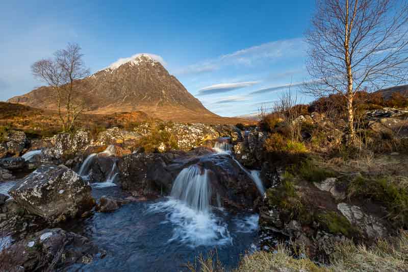
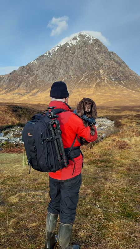
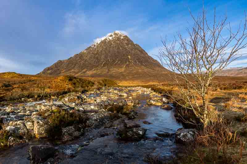
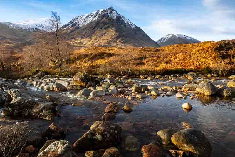
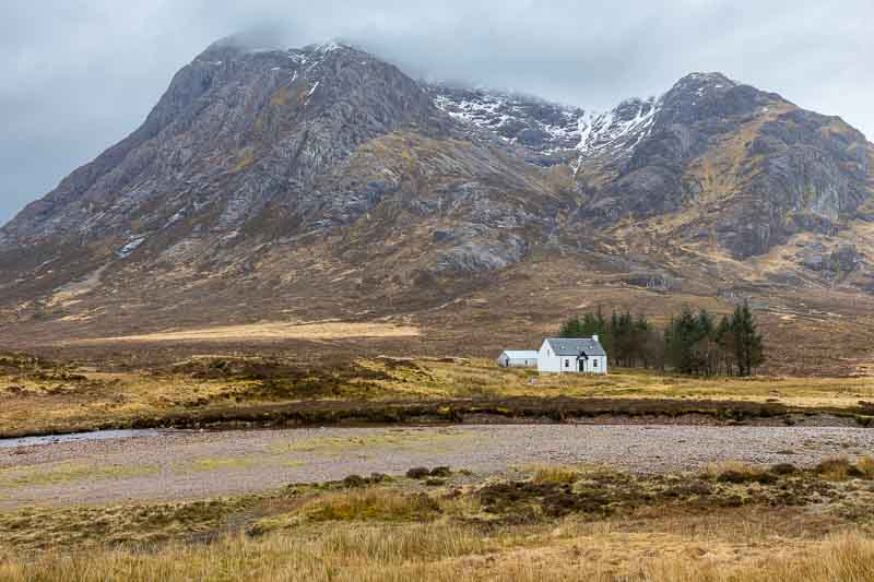
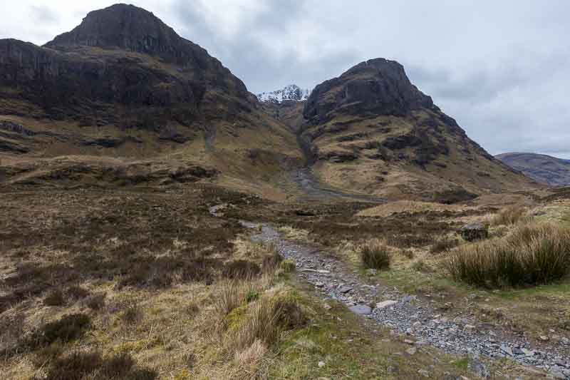
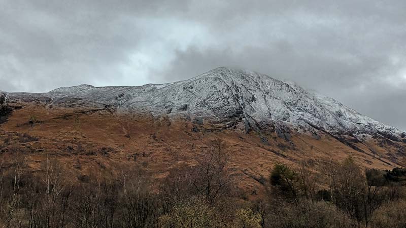
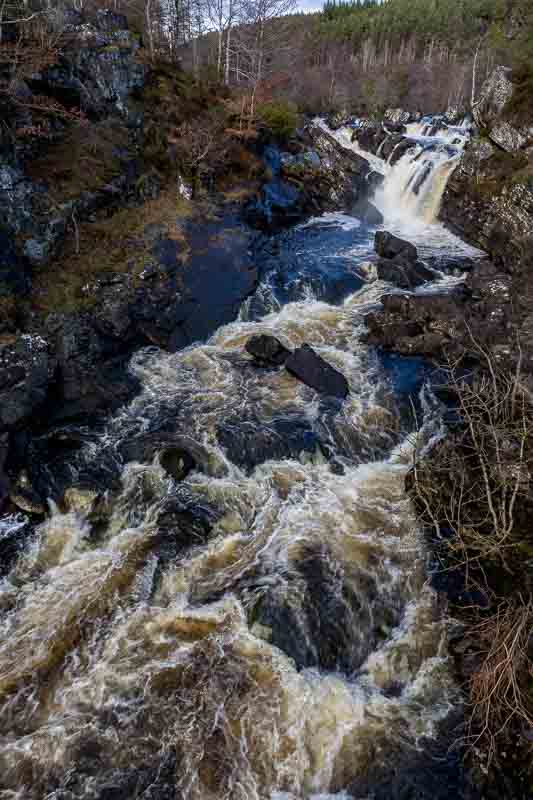
30th March: Circuit around Glencoe and Rannoch Moor. The rain was heavy last night – beating down on the roof of the motorhome, but at 0615 the weather looked more promising. So after breakfast we headed off to Etive Mor to capture a very well known image for ourselves:-
Whilst we approached this location, we noticed we were running out of fuel, so we had to alter our planned route – instead heading back to Glencoe to fill up. However it took us a while to arrive as we stopped off for several impromptu images.

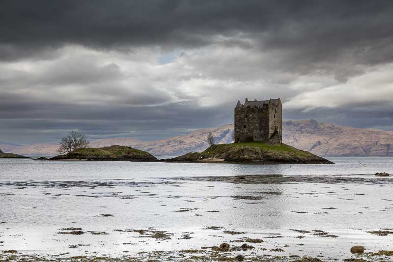
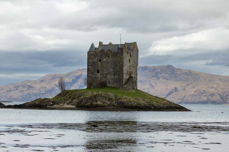
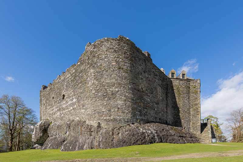
After filling up we continued around our planned circuit in the opposite direction and headed for Stalker Castle. We only just got the camera’s set up on the beach when the heavens opened again – this time hailstones. I had time for one quick photo before packing away and getting soaked returning to the car.

In a few weeks after visiting the Isle of Skye, we will stay near here on another campsite, so we’ll have another attempt then.
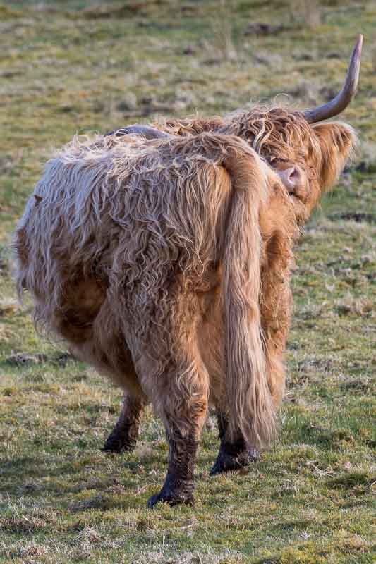
Time for lunch – at a café which overlooks this castle, but unfortunately the weather never improved from the hailstones and heavy rain. After lunch we headed south towards Kilchurn castle. Until wifey slams on the breaks after she spots her ‘Highland Cattle’ again….


We did eventually get to Kilchurn Castle and walked from the car park out to the castle – unfortunately it was is surrounded by wired fencing which impacted the photogenic appeal. Returning to the carpark I noticed several photographers all lining up with cameras pointed towards the railway bridge – bird watchers maybe?
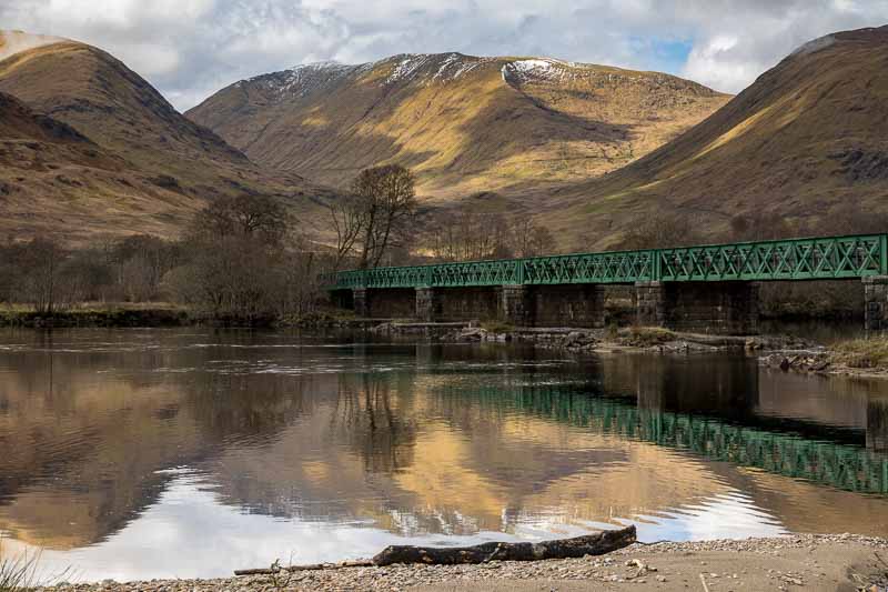
I nice image I thought, then I overheard one of the photographers saying they were waiting for a specific train to pass over the bridge – so thought I’d join the train spotting brigade for 10 minutes:-
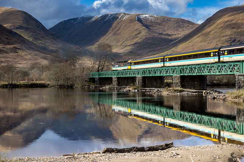
I have to admit, it does look better with a train on the bridge.
Drones weren’t allowed around the castle – but after a chat with the land owner who was selling photographs nearby; she advised us we could fly from woodland across the loch away from her sheep fields and approach the castle from over the water.
Firstly we took a photo with the tripod at the bottom of a very damp sheep field. Just after this there was a breeze and the reflection disappeared completely. So we headed back to the car ready to launch the drone.

We drove on towards the wooded area a few hundred yards away and launched the drone:-


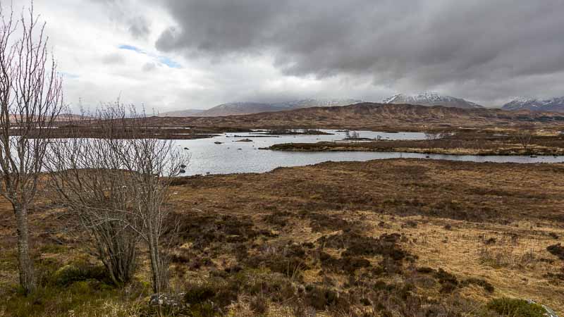
It was now 1730, so we continued on our clockwise circuit to Rannoch Moor to finish up for the day. A great end to the day it was….
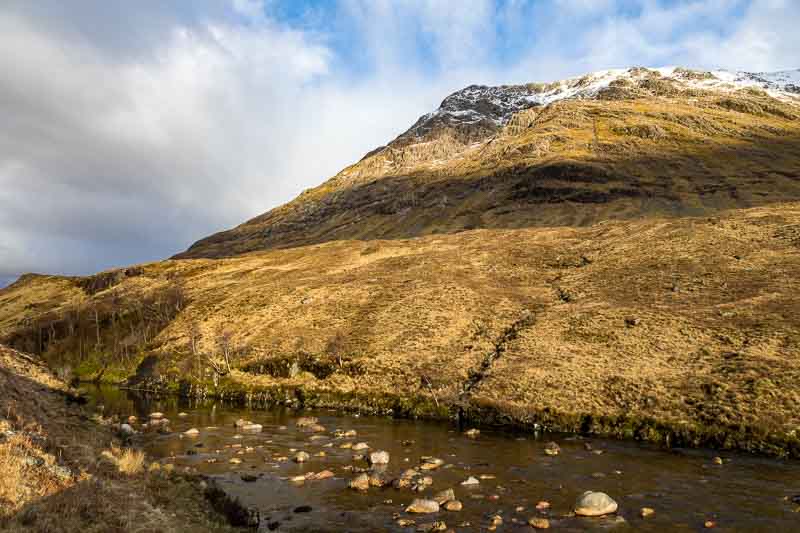
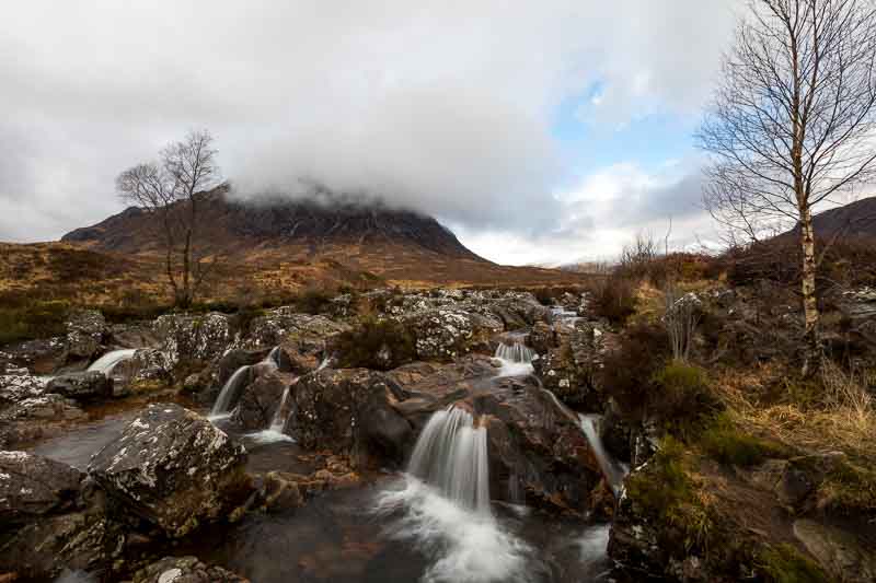
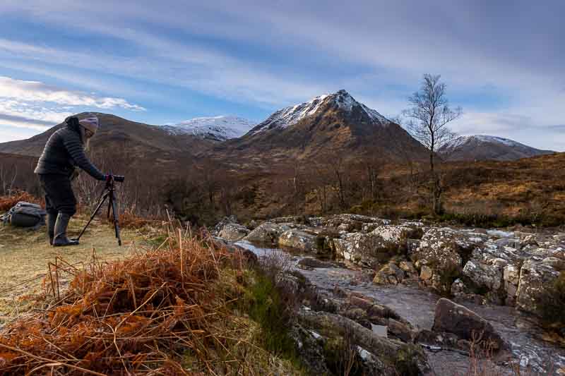
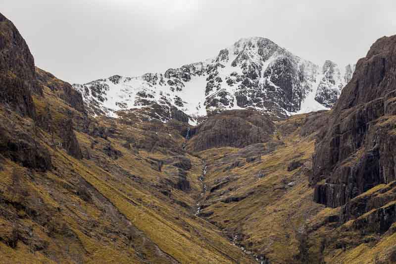
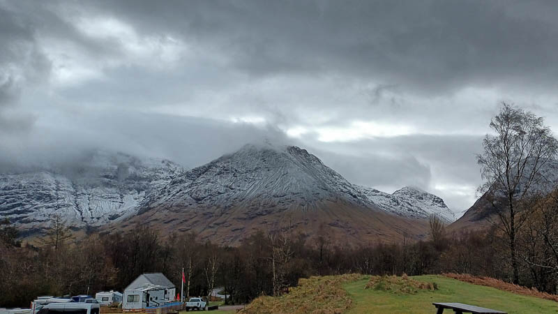
31st March: Early Morning in Glencoe. I woke early to check the skies – clear with red clouds; so I gently persuaded the wife to get up and be ready to leave in 10 minutes when the campsite gates open. We returned to the same spot as yesterday at Buachaille Etive Mòr hoping the light will present an entirely difference image – judge for yourself below…

Fortunately we wore wellington boots today as the ground was so sodden we had difficulty getting around this location. Even worse for our little dog Holly as she was always walking in about 3 inches of mud and water – so today she got a lift.
We made the most of the early morning and the light available whilst Holly sat on a dry patch of grass (which was difficult to find).
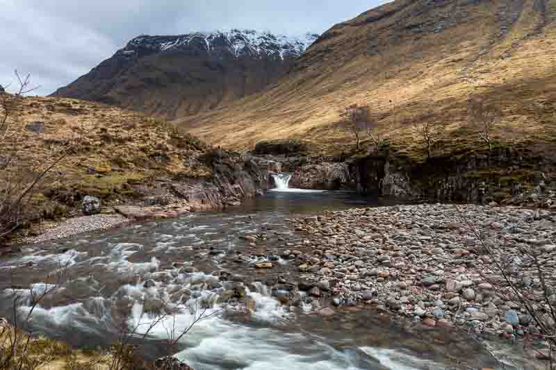
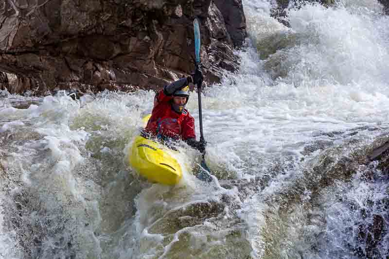
After this we headed back for breakfast in the motorhome, then returning to the same area – located along a single track lane from the Stob Dearg Car Park off the A82 (near to Ballachulish PH49 4HY). This lane must be approx. 8 miles long with passing places every few hundred yards – necessary due to the heavy traffic usage. The first point I had pinpointed on my google map was the Glen Etive Waterfall View Point, but when we arrived it was difficult to park the car as the area was extremely popular – we soon found out why…
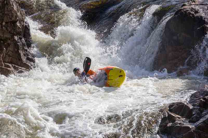
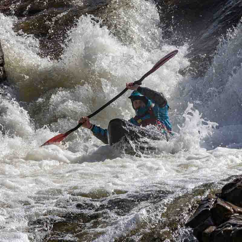
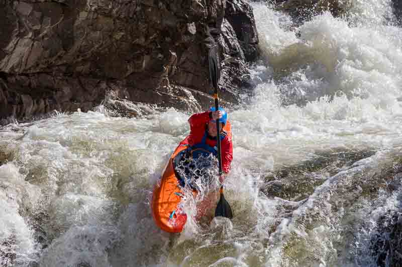
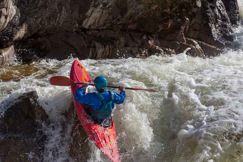
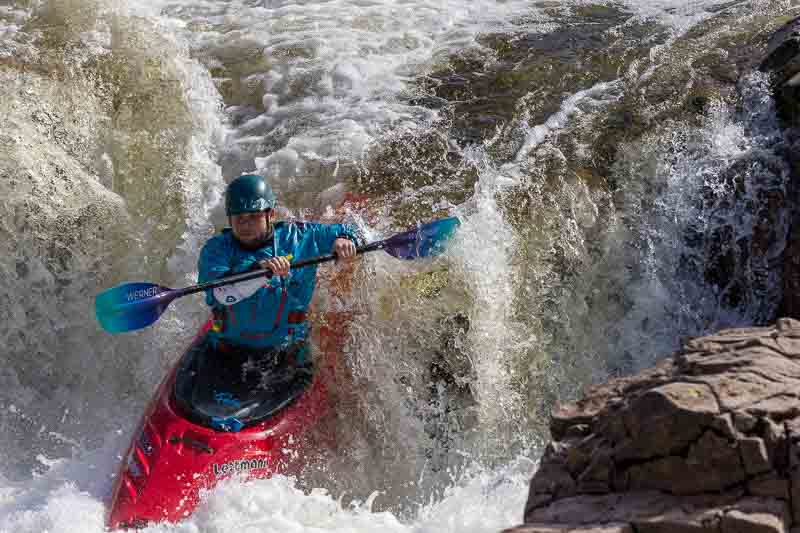
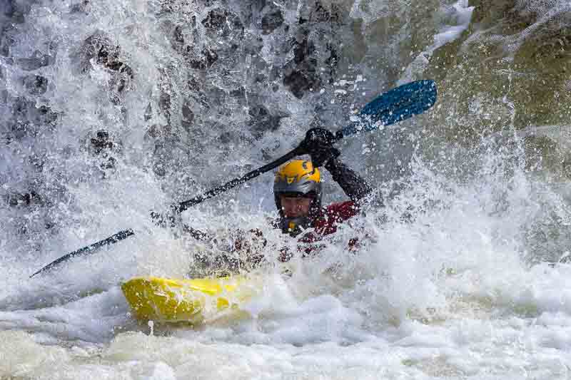
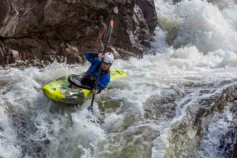
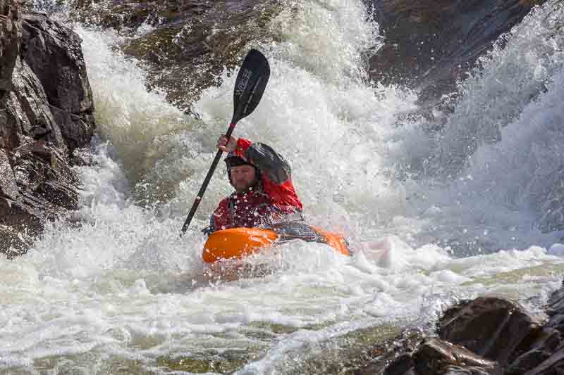
This gave us a very pleasant distraction from the landscape photography. We used our 70-200mm lens and stood on the rocks overlooking the event. The image below shows the first decent of the 3 in front of us.
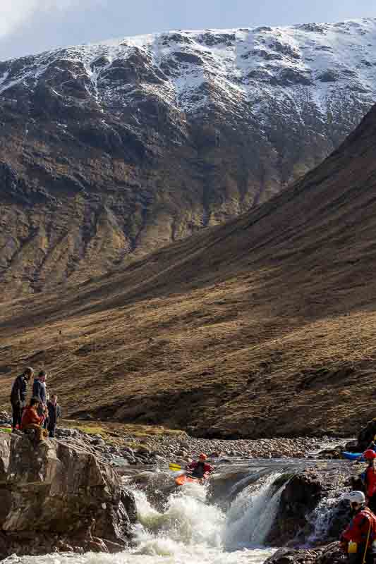
After 40 minutes or so watching these kayak’s, they continued on down the river, so we moved on past the Skyfall Waterfall (which had too may people around it, so we couldn’t be bothered to photograph it). We later came across some stags in a field…

The road ends at the sea water Loch Etive which coincidentally we drove along yesterday on the A85 when we returned to Rannoch Moor.
The end of the trail (shown above) wasn’t as exiting as we were expecting, but it was an interesting excursion. On the return we made 2 more stops for photographs (as the sunlight was now from the southwest – down into the valley).

Even though the clocks have changed and we’ll now experience longer evenings, we decided to return to the motorhome at 5pm to relax as we still have 4 days in this area. Tomorrow we may travel out to Glenfinnan – to the viaduct.
Day Trip to Glenfinnan
1st April: The morning was overcast, so half of us has a lie-in. Later we decided to head of towards Fort William and then Glenfinnan which was the location that Prince Charles Edward Stuart rowed up Loch Shiel towards the tiny hamlet of Glenfinnan with a small band of his most loyal supporters. It is also the location of the viaduct that became famous in the Harry Potter movies.
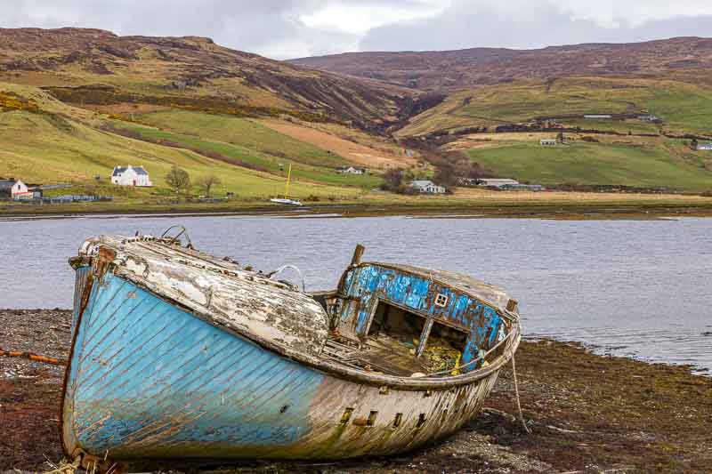
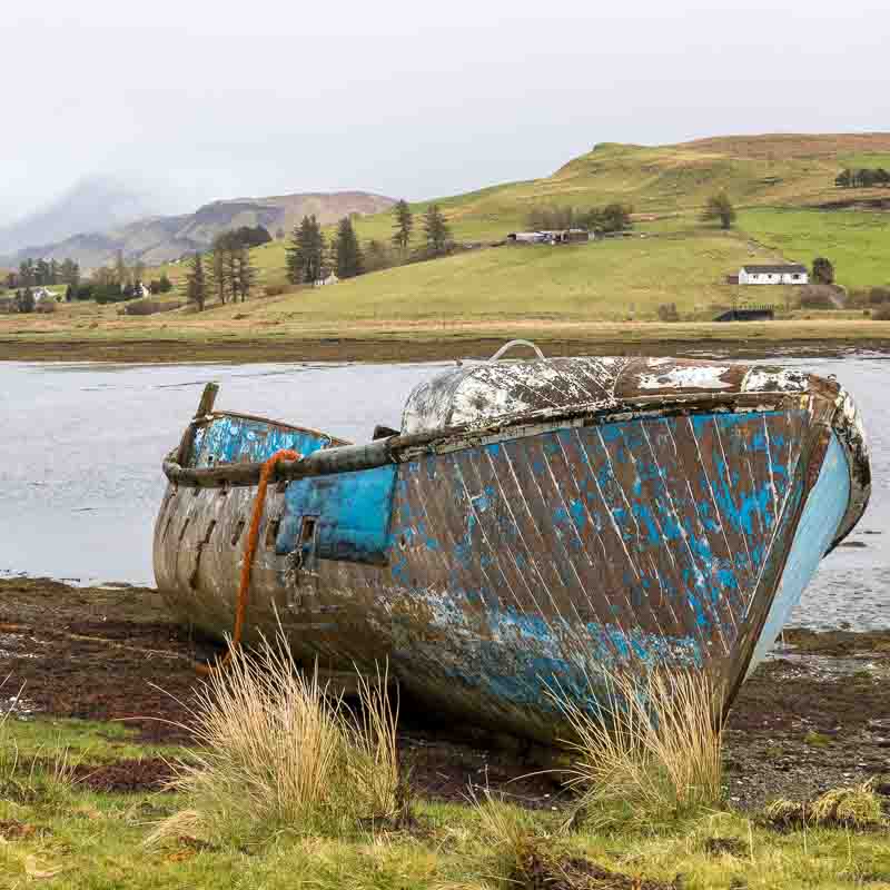
The first stop was in a little town called Corpach near Fort William, which was the location of the derelict Corpach Caol ship.
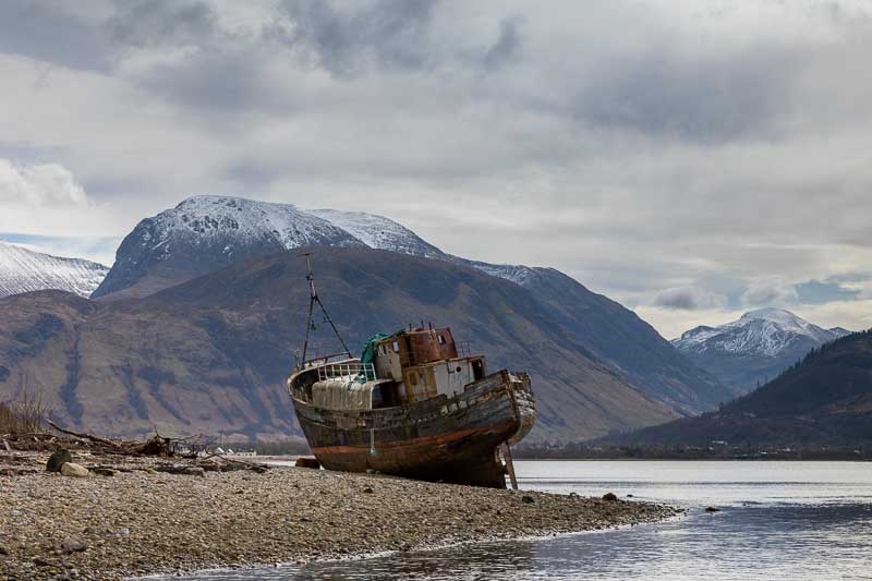
The mountaineers among you will recognise Ben Nevis in the background.
Unfortunately the light wasn’t kind to us – ideally we wanted the sun to bathe the mountain in light. However in situations like this I like to try out a black and white conversion on the image. See what you think…

I prefer the B&W version, but it’s all down to personal taste.
After lunch in the nearby ‘An Cafaidh Mara Corpach‘ (Café) we moved on to Glenfinnan. We already knew that the Jacobite Steam Train wasn’t going to be running in 2024 – so if you plan to visit for this reason, check the internet first. We walked up to the viaduct, spotting a deer stag on the top of the hill – typical as we didn’t have our long lenses with us.
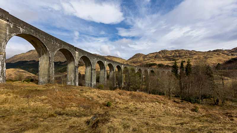

We did check the Scotrail train timetable for the local service, but weren’t prepared to wait for 2 hours for the train returning from Mallaig. Incidentally there were many Harry Potter enthusiasts around – some wearing costumes, playing the HP theme tune and one chap even hoping to see the flying car! We were only there for the photographs.
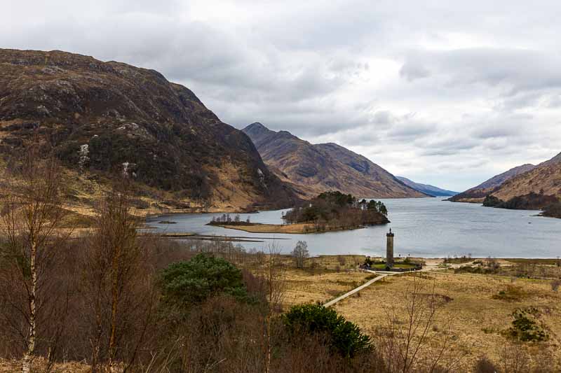
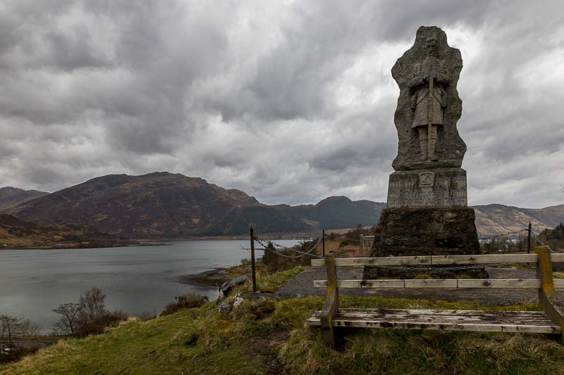
We couldn’t leave the area without a photo of the Glenfinnan monument which supposedly marks the location that Bonny Prince Charlie came ashore on the 19th August 1745.
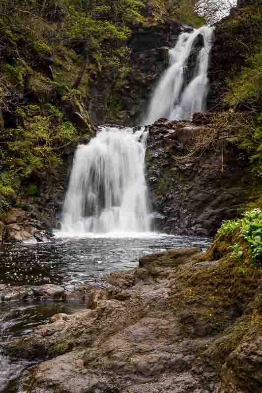
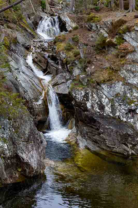
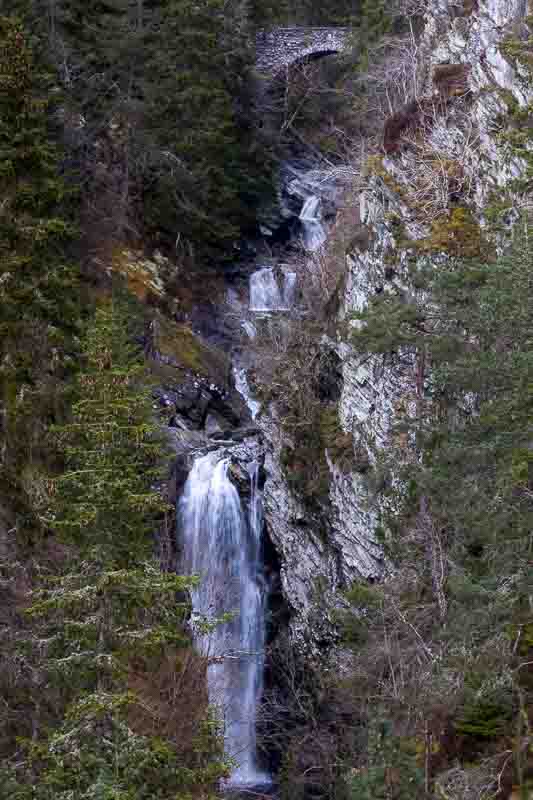
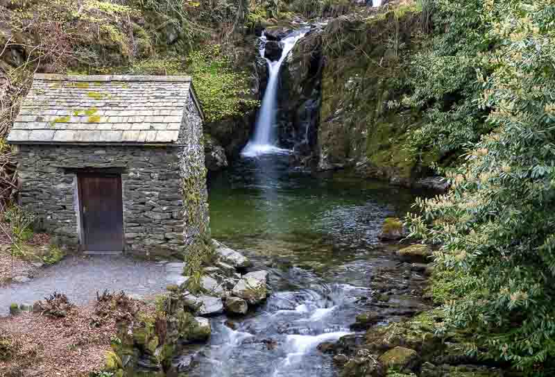
Time to return back to the campsite, but after visiting the Inchree Waterfall. The waterfalls were a 20 minute walk from the carpark, but they weren’t as impressive as others we’ve visited.

On the way back to the campsite we fancied fish and chips for tea, so stopped off at the Quarrier’s Kitchen Fish and Chips in Ballachulish. The food was OK, but I had to wait 30 minutes from placing my order to getting my food. So make sure you’re not in a hurry.
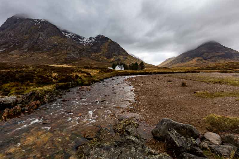
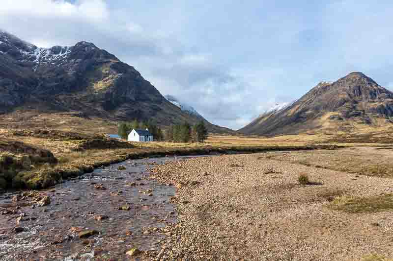
2nd April: There have been several locations we’ve avoided photographing due to the crowds. So today as the campsite had thinned out, we hoped a lot of the people have returned home. First stop was Lagangarbh Cottage – the only challenge now was which view to take?

I believe this cottage can be rented out from the National Trust of Scotland – an impressive view to wake up to.
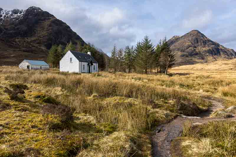
The next stop was ‘Black Rock Cottage’, which the past few days had cars parked in front of it – how very inconsiderate.

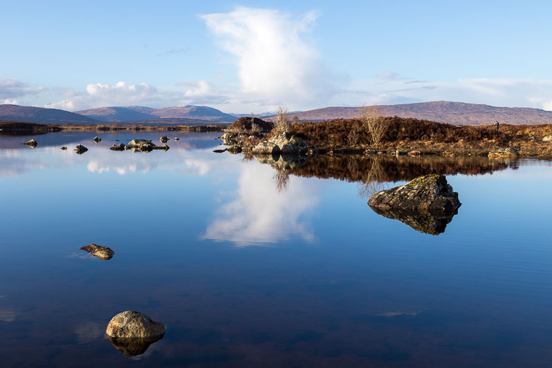
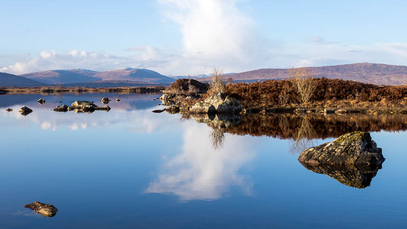
So we were on a roll – two locations devoid of people. We then returned to Rannoch Moor to see the contrast of today with the clearer skies of a few days ago. The images weren’t great, so we didn’t stay long…
Next we returned to the Glen Etive Waterfall which if you recall was covered with Kayakers – not that we minded that issue.


The weather stayed overcast all day, but the wind picked up whilst we were photographing these falls giving a significant wind chill factor – it felt like 4C. We also couldn’t get near to the ‘Skyfall Waterfall’ – this time we had it to ourselves.

It was now 13:30, so we returned to our motorhome for lunch. Discussing where to go next; Vanessa fancied another crack at photographing Castle Stalker. This time no hail stones…
The café nearby had just closed when we got back to the car, so we travelled back and toured around Loch Leven for inspiration – but without any sunshine it wasn’t worth stopping.
We have two more days in this area and if the weather remains dry, we may cover all the photographic location we had planned.
3rd April Finishing Off our Photographic Itinerary: We have 2 full days left in this area and covered most of our points of interest. If you’ve not had an opportunity to check my Planning section of this website, then we research and create a map to save time on location:-

This is a copy of our map showing the points of photographic interest in this area and the material we research is described in the aforementioned section.
The day started well – the Glencoe waterfall below was always covered with people clambering over the rock, but today we were lucky.
This image taken from the roadside which has plenty of layby parking nearby.
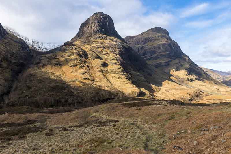
Next on our list were the ‘Three Sisters’ mountain range which has a large carpark viewpoint – today we could park there with ease.

Heading further down the valley we stopped at the Coe River Waterfall (just past Loch Achtriochtan). This time the road hidden behind the trees had virtually no cars, vans or lorries passing by.
So our morning was going extremely well. Being this lucky we returned to Loch Achtriochtan to try to improve on a previous photo we took – the sunshine actually being a distraction that time.

We wanted the cottage in the photo, but wanted to obscure the car parked in front. As we approached this location Vanessa had a little accident. Now I’m not normally one to benefit from anyone’s mishap, but on this occasion….

I couldn’t resist it….

Fortunately for her, we weren’t very far from the campsite, so on completion of the photos, we returned so she could have a shower, change of clothes and of course lunch.
We were now expecting the weather to close in with some rain, so we decided to head off towards Loch Ness, especially as our time in the next campsite is currently expecting some heavier rain and this next location might be difficult to photograph. Travelling along the A82 there was a distant view of the Ben Nevis mountain range.
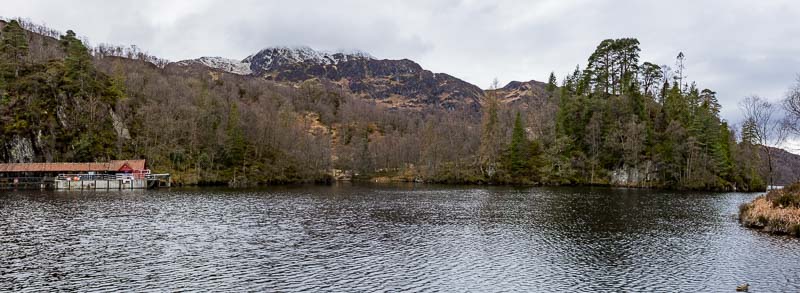
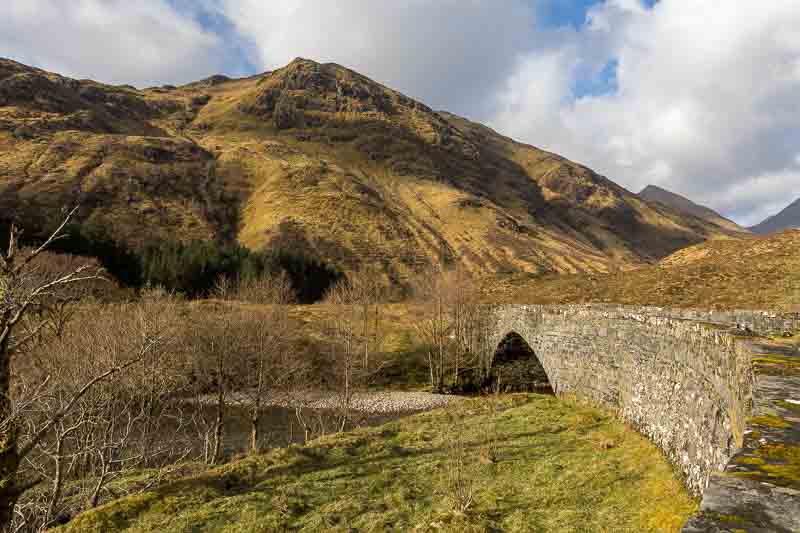
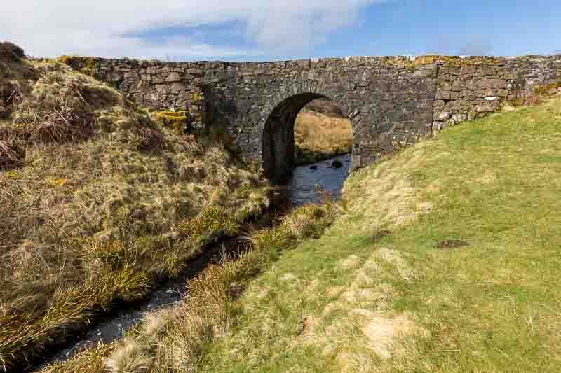
We arrived at Invermoriston to photograph a bridge and waterfall
Moving back to the road bridge nearby we grabbed this image – not sure whether the colour or B&W version is better?

It started to rain again, so returned back to Glencoe – stopping on the way for one last photo.
Bridge of Oich near Aberchalder. We finished just in time as the rain was getting much heavier.
4th April – The Weather Forecast wasn’t Correct: All our plans were in place for our last day in Glencoe. The forecast was for overcast skies again, so there was no advantage in heading out with cameras as we believe we’ve covered everything we intended. Our plan was to get all the washing done as we were running low on clean clothes and then make sure the motorhome was ready for tomorrows trip to our next site.
Well I was out before 7am with the dog and totally surprised to see clear skies as you can see in the photo of our campsite.
Vanessa suggested that she could handle most of the washing and tidying herself and that it seemed pointless us both missing the sunlight. So I was dispatched into the field with camera and dog for a few hours – fully expecting it to cloud over as per forecast (which still hadn’t changed).
First stop was revisiting the Three Sisters which looked totally different in the sunlight.
I then headed back to the little white cottage – what a difference!
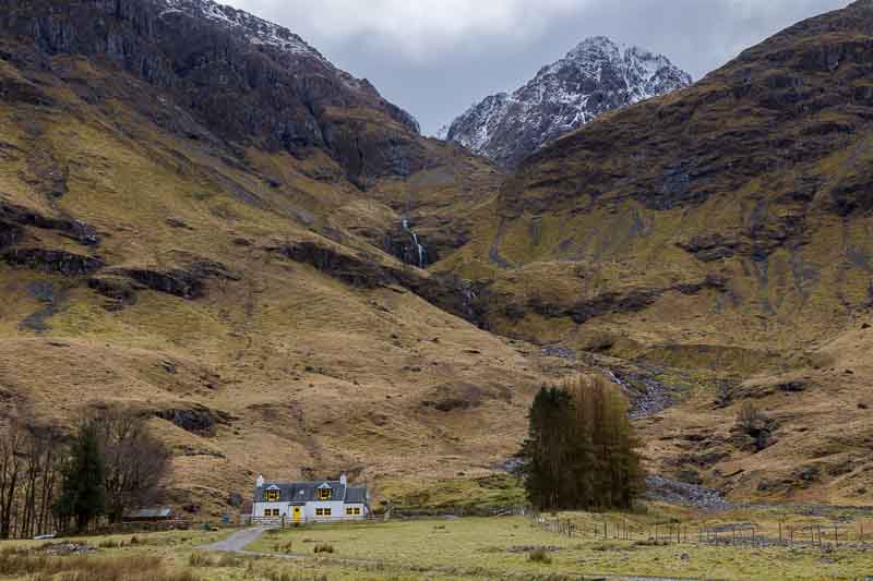
It was a totally different scene to the one a few days ago, although I still like both. Checking in with the boss, Vanessa was nearly finished so I returned to the motorhome for lunch before heading out together. Unfortunately the weather had finally caught up with the forecast, so we looked around for a different view to capture – after another visit to the Achtriochtan cottage; this time no cars.
We then stopped the car near to the Glencoe waterfall to try and capture the river flow through a deep gorge.

We ended our photography session with a walk through the valley with a few final shots.
We ended the day with a trip back to a nearby inn for another coffee. Yesterday we called in to the Clachaig Inn for one of the smoothest coffees we ever had. So today Vanessa had the same idea – I however went for a pint.
Tomorrow is a travelling day, so there may not be an update. But weather permitting we’ll be out and about with the cameras again soon.
5th April – Stormy Weather: We’ve been away from home for 2 weeks now (3 to go) – I don’t know if we can keep up the daily excursions, but when the weather is OK, then we’re off. Last night was a really stormy occasion – the motorhome was rocking around in the high winds whilst we were getting a good downpour outside. The reason was…
The constant rocking motion had actually dislodged one of the wooden blocks I used below the support struts – I found it about 2.5 metres away from where it should be. Looking around the campsite in the morning we could see that the higher ground had a significant covering of snow.

We started a little later than planned as Vanessa accidentally seized up the towing ‘A frame’ by driving the Aygo forwards without realising that the frame was still resting on the ground. The air was a little blue for a while!
But after dismantling part of the frame with spanners – freeing it up and reassembling it, then all was well again.
Heading North to Morvich
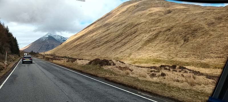
Fortunately the roads appeared to be clear, but we weren’t sure what to expect as we travelled further north towards Skye. Just over half way, we started to climb and the temperature dropped to 2oC so I slowed down especially as there were a lot of bends.

Yes, we had snow all around us for the next 15 minutes.
The valley we drove through looked very photogenic, so depending on the weather we may return in the car. Eventually we arrived at our campsite at Morvich which was also in a beautiful setting.

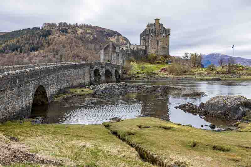
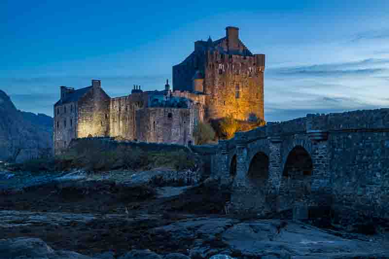
Not wasting any time, we quickly had lunch and headed out for Eilean Donan Castle.

After this I did a little shopping for Salad leaves and bread (plus a few other things that weren’t on the list – including wine) – it did all fit into one carrier bag.
Tomorrow the weather looks as though it might improve a little during the day, so we’ll take our chances.
The NC500 (or part of it anyway)
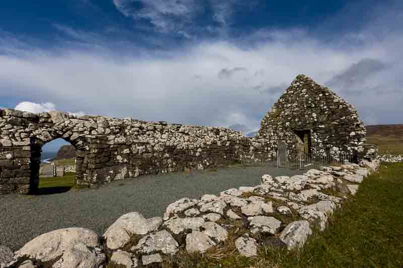
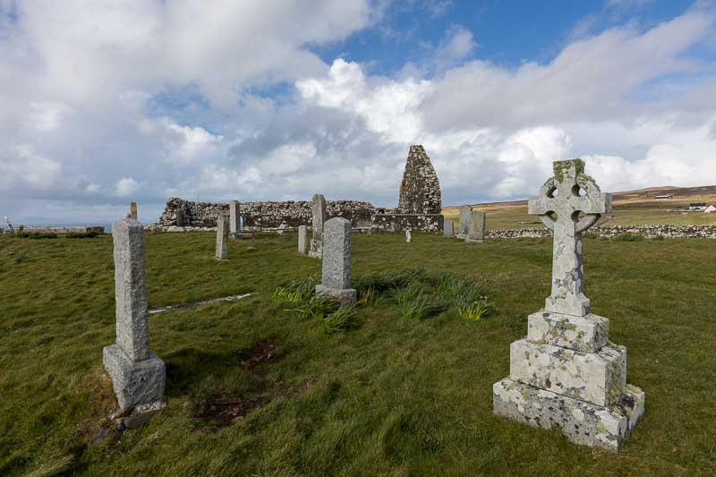
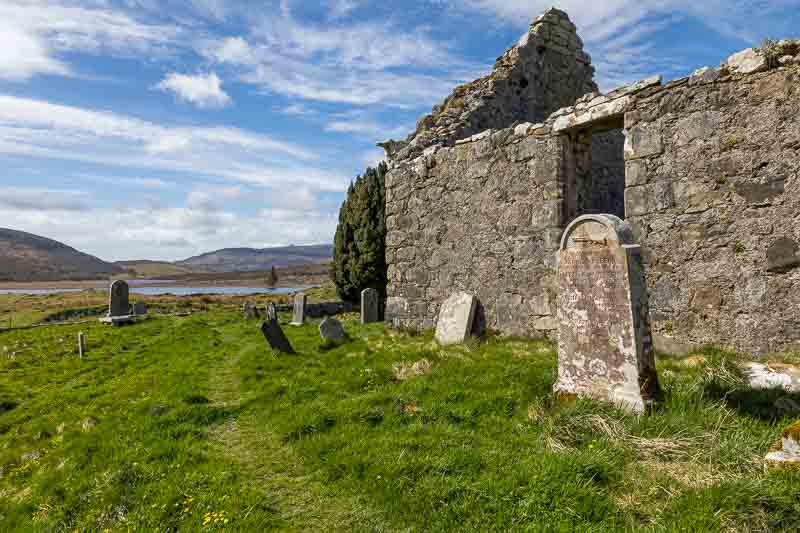
6th April: The forecast today wasn’t expected to be good, but that’s not stopped us before. So we first stopped at a nearby grave, thinking the moody sky would be fitting for the subject. The Clachan Duich Burial ground was less than a mile from our campsite and had a number of Commonwealth War Graves.
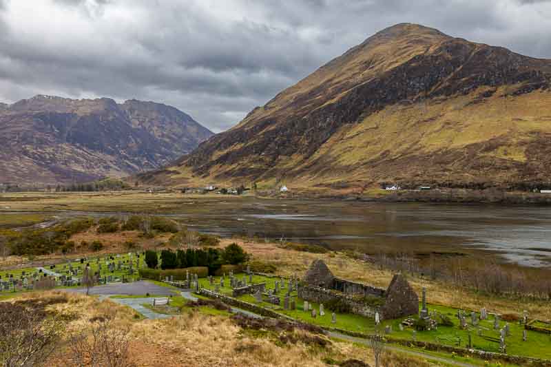
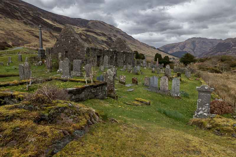
It was a wonderful setting which must have been a small comfort to the relatives of those buried here.
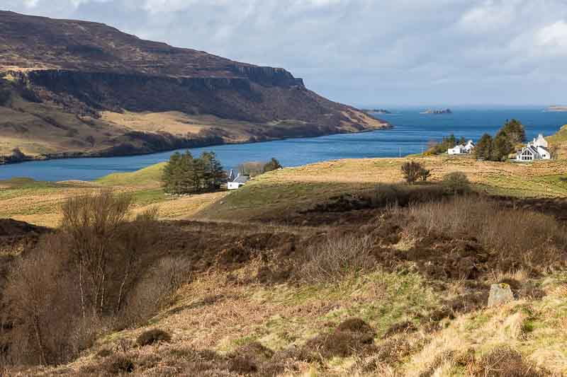
With rain expected we travelled north along the A890 and the A832 to Loch Maree. The intention being to just enjoy the ride and take in the scenery. But as we approached the Loch there was a viewpoint with a great scene before us.
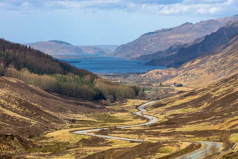
We drove down into the valley and along the southern shore in the sunshine – totally unexpected. We actually had difficulty finding a good vantage point through the trees for another view, but eventually found a carpark that suited our needs.

After this we just had to find somewhere for a late lunch – but had to pass 2 closed hotels before finding a small village store (at Kinlochewe) for some snacks. We then turned down the A896 heading for Upper Loch Torridon. Almost immediately we found a café and went in for a coffee – whilst I was considering sharing a scone with Vanessa, the sales assistance stated that bacon rolls were still being served. With no will power we immediately caved in and sat down for lunch.
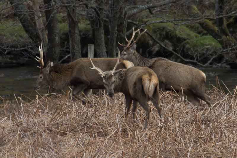
The weather was extremely changeable as we continued our journey past Annat and stopped at another viewpoint over Loch Torridon. Whilst waiting for the light to change, Vanessa spotted some deer heading down towards us. They settled within 30 metres of where we were…
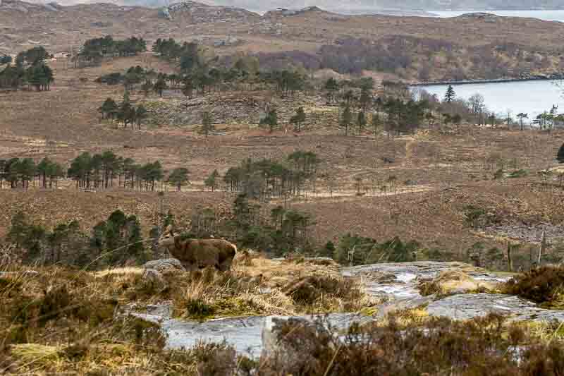
So with a quick change of lenses we get these…

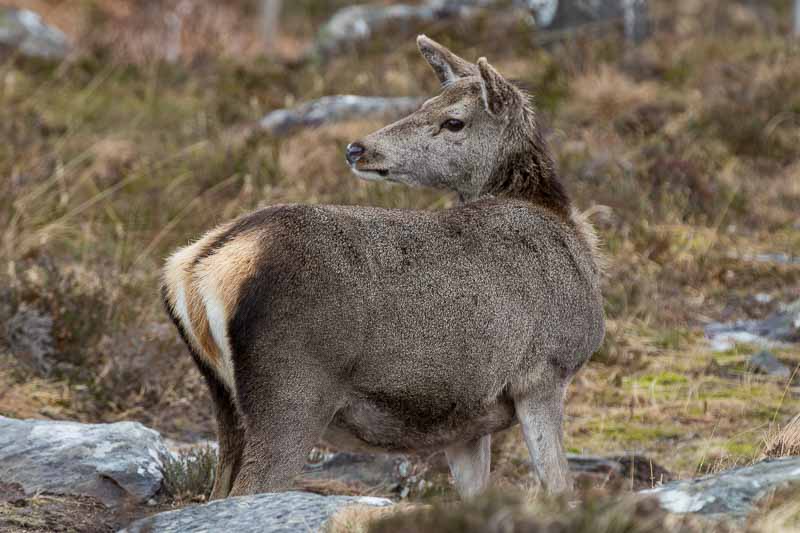
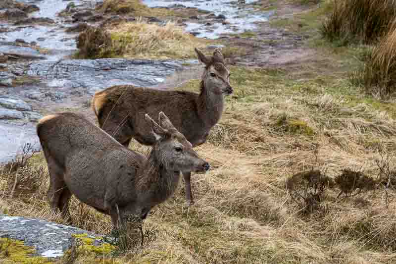
They must have been used to people because they weren’t bothered about our presence. The rain started yet again – an occurrence we were getting used to – but this time there was an added bonus…
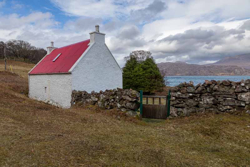
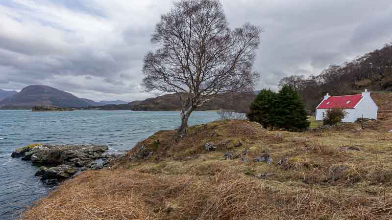
Leaving this area in the pouring rain we diverted again towards Applecross Pass, as I had previously located a red roofed cottage along the route. On arrival the rain was easing, so we took our opportunity to get the cameras out again.
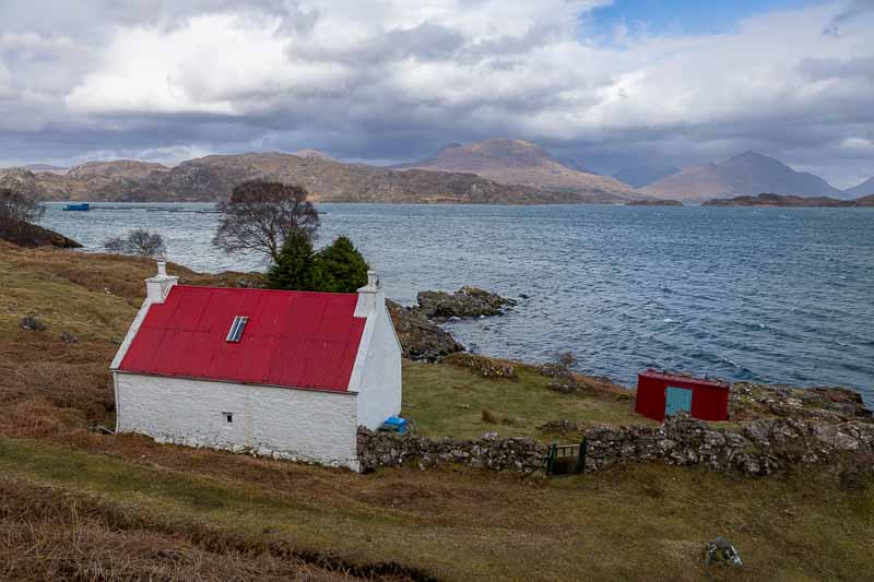
I finished my photographs before Vanessa and sat in the car waiting – a good decision as 5 minutes later the heavens opened yet again. This put an end to the day and we headed back to the campsite in the pouring rain.
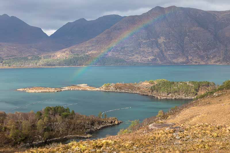
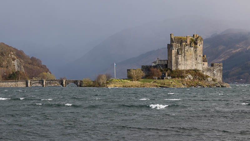
Just as we approached the Eilean Donan Castle the rain eased with a gorgeous light on the castle – cameras to the ready again…
In summary, one of the most changeable days, weather wise, but also one of the most rewarding photographically. Since we started our holiday, we’ve been out with the cameras every day – not bad considering the weather we’ve experienced.
7th April – Storm Kathleen forces us east: Last night the wind continued to rattle the skylights on the motorhome and in the morning the door nearly got ripped from my grip as I opened it. The local forecast was for more heavy rain, so I checked the forecast in the east – sunshine and clouds all day. So I planned to head off to Drumnadrochit and Urquhart Castle.
It didn’t stop raining until we reached the castle but unfortunately they didn’t allow dogs in the grounds, so we continued on to Drumnadrochit. Well the shortest stay in the car park was £2 for 4 hours – what you could possibly do here for 4 hours was a mystery – we managed 40 minutes which was all spent in the café.
Where to next – no idea, so I opened up an app I frequently use called ‘LocationScout’ and selected ‘Around me’ to see what points of photographic interest there were near us. Note: you can find out more about this app in the planning section of this site: location-scout
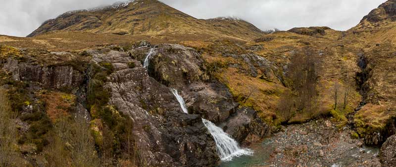
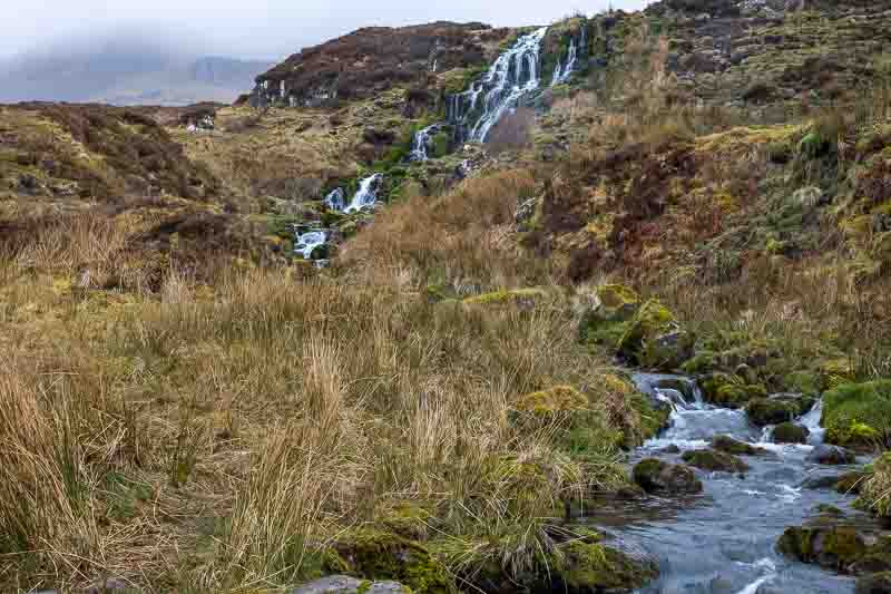
I found 4 points of interest, so we set off to the first – the Fairy Glen Falls…

It involved a 20 minute walk from the carpark, but was worth the stroll.
By this time we were getting hungry and walked to the local beach café, but they closed the kitchen just as we arrived. So we went to the local pub – that didn’t do food! So a pint and a packet of crisps please.
Unfortunately Google made a complete mess up in getting us to the next 2 locations – gated farm tracks and private roads that didn’t allow us to pass. So we moved on to the 4th point of interest – the Rogie Falls which are 10 minutes away from the nearby car park.
This photo taken hand held from the suspension foot bridge across the river.
After this we returned back to the west along the A835 and A832 only to find ourselves back in the rain storm.
Tomorrow we move onto the Isle of Skye where we are staying for 12 nights to give us a good chance of covering all the locations planned.
From the Mainland to the Isle of Skye
8th April: After the intensity of Storm Kathleen we were expecting a clear morning, so I had a plan to get up at 5am and photograph the Eilean Donan Castle in the ‘Blue Hour’ with it flood lit. I did get up to cloudy skies and more rain, so went back to bed.
As we were moving campsites today, we had to leave before 12, but as the morning had brightened up, we headed out for some last minute photos from the area. We headed for a small bridge over a stream, but came to a sudden stop as more deer were spotted…
…but we weren’t really close enough this time to hang around.
The bridge was a short walk from the road and was bathed in sunlight – not something we were used to.
We did head out to a nearby Loch, but the skies clouded over and I couldn’t get an image I was happy with so we returned to pack up the motorhome ready for our trip to Skye.
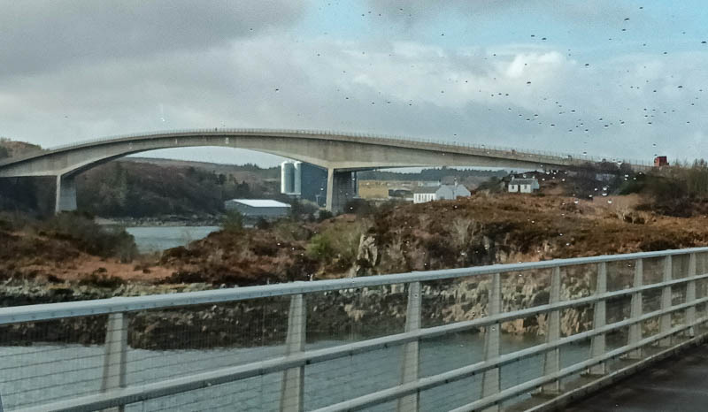
We were so pleased the winds had dropped significantly before crossing the Skye bridge.
Like on the mainland, the roads had too many pot holes and some of the roads were single track with passing places. Our campsite is small and privately owned, but seems to be OK for our needs. We set off again at approx. 2:30pm for the western side of the island (where the sun should have been shining). Our first stop had to be Uig for fuel for the car as we only passed 2 fuel stations during our 70 minute journey on Skye.
We headed to Duntulm Castle and waited patiently for the sun to appear from behind the clouds.
The castle ruins weren’t much to look at, so we moved down the hill for this view.
Whilst travelling east on the A855 back to the campsite we stopped off for a few more shots,,,
Hoping tomorrow’s weather is better than forecast as there are many locations to visit.
9th April – From Portree to the Quiraing: As soon as we set off in the morning it started raining, so we headed south to Portree to have a wander around the town. Fortunately the rain stopped just as we arrived, so we got the cameras out to photograph the harbour.
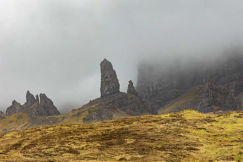
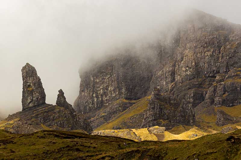
Back on the road north towards to my first view point – Loch Fada; you can see the Old Man of Storr in the distance.

Moving on past the Old Man of Storr – hoping to return when the weather is better. We arrived at the Bride’s Veil Falls and faced a common problem – people on the waterfall. So I decided to take a distant shot of the falls and edit out the people.
The rains started again, so we headed back for some lunch.
The Mountain Goats
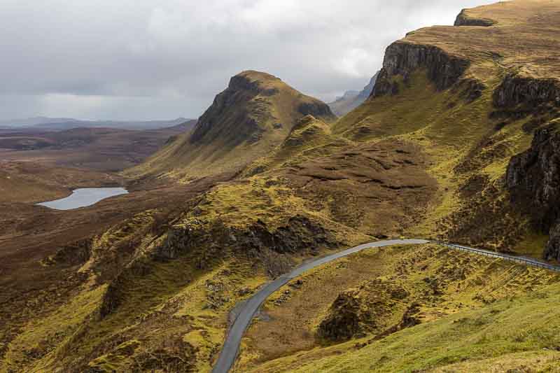
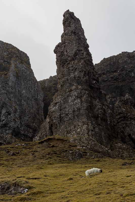
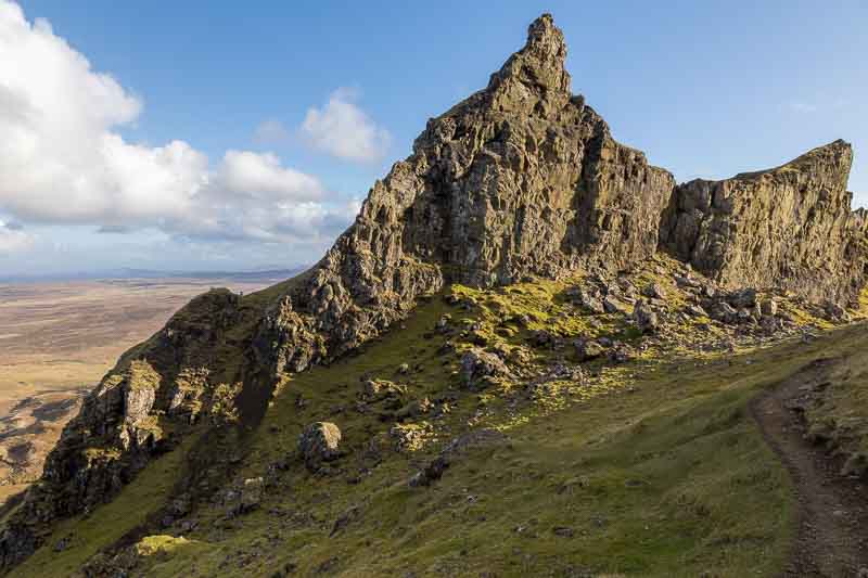
No not the animal type – I’m referring to us. After lunch we decided to venture up into the Quiraing Hills. First we drove up from the A855, turning left in the village of Staffin. Arriving at the Quiraing, there is a large carpark which is close to the main trails. We set off towards ‘The Needle’, but had to turn back because of a dangerous stream crossing in a narrow gorge and significant drop below. But the pathway revealed many wonderful images…
I still fancied seeing ‘The Needle’, so we headed back down the road towards Flodigarry. There was another approach to ‘The Needle’ past Loch Langaig. The round trip was 3.6 miles and for aging retirees, it was quite challenging.
We made it to ‘The Needle’ in 50 minutes, which was quite incredible. As we had expected, the light had gone from ‘The Needle’ as it was nearing 6pm.

But when we turned around, the sunlight was still striking another rock formation.
We had a good day and Vanessa surprised me with making the climb with no moaning; but also a mention for our 12 year old dog Holly who managed the climb with reasonable ease – although as I write this, she is now snoring heavily in her bed.
10th April -Relaxing in the motorhome: At 6am this morning I thought the weather forecast was totally wrong – the sky to the east was a gorgeous intense pink with the clouds later getting that lovely golden light on them as the sun appears over the horizon. However a few hours later the wind and rain started and has been building with intensity during the day.
We are under this storm – it still hasn’t eased off and it’s now 7:30pm.
So I thought that as me and Vanessa were discussing the holiday so far, I’d include a few key point for the blog.
Best 3 photos:

I’ve had a little time today to work on these to improve them.
Our best and worst moments: The worst moment was just before we were leaving Loch Lomond and I realised the rear ‘garage’ door to the motorhome was hanging off
Fortunately I was carrying Gorilla epoxy which set in 5 minutes – so a hasty repair, which still seems OK.
Our best moment was accidentally coming across the Kayakers down the rapids of the Glen Etive river.
Funniest and saddest moments: The funniest moment had to be Vanessa falling on her backside in a bog in Glencoe – I’ll avoid her further embarrassment by not adding the image again.
Our saddest moment wasn’t really a single moment, but the fact that we lost our oldest dog a few months ago. If she was able she would have loved this holiday, but we are now resigned to taking Holly alone with us.
Best and worst weather: Our best weather was in the Lake District which gave us a great start to the holiday – yes, we still had some rain but we were out most of the time. But there are no prizes for guessing the worst day – Today of course.
Best and worst roads: We’ll not complain about the roads in England again as many roads in Scotland have many potholes. But the worst road we experienced was the M74 which I’m convinced was the cause of the motorhome’s rear door damage.
But the best road we experienced was here in Skye – it was one of the minor roads which had been almost completely re-laid. We think it was the one that heads across the Quiraing hills. Perhaps it was in a really bad state beforehand, but now it’s great.
Photography: This has been our main passion and so far I’ve taken nearly 2000 images and selected about 600 from those – the rest get deleted. I use Adobe Lightroom every evening to hastily process those images and select a few for the blog. So I hope my efforts are giving you a good impression of the journey so far.
Tomorrow morning the forecast is looking good, so we hope to tackle the ‘Old man of Storr’ – Keep watching the blog to see how we get on.
11th April – MountainGoats – R – Us: Well as the heading may tell you, we didn’t learn from our hike two days ago. The weather was dry but the high winds remained as they had done all night. So I checked with reception at the campsite and the owner gave me all the confidence I needed that the hike up to the Old Man of Storr was safe, as the pathway was wide and reasonably well prepared. Below you can see the route we took and the expected incline.

A total climb of 1.72 miles with the steepest incline of 27% (which is just over 1 in 4). If you are interested, the app I use in Komoot for all my hiking and cycling.
Vanessa is standing at the base of the first section of the rock stairway. We even saw someone with a walking stick coming back down. So we had no excuse for not continuing. The other problem we had to face was the severe gusts which we believe would be around 40mph plus the additional weight in our camera back packs.
As you can see from the ‘Weawow App’ forecast – Skye was definitely in the severe gusting area.
We started off the walk taking the gentler route which actually gave us earlier views of the rock formations.

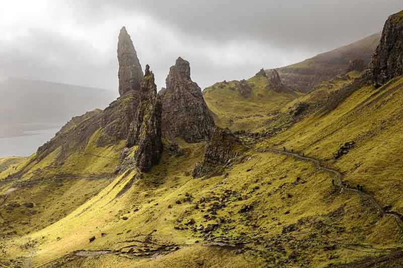
The Old Man of Storr
We did succeed in making it to the main viewpoint, giving ourselves a pat on the back as it wasn’t easy for us carrying weighty camera bags. But even more credit should be given to our little 12 year old Cocker, Holly. I had to carry her up the steepest parts of the stairway, but otherwise she made the journey without a drink – despite us trying several times to give her a drink.
The return journey was relatively quick – taking the direct route this time. There is a small café near the carpark, so that was our second stop – the first was the loo. Meanwhile, Holly was on the back seat waiting for a treat – which she deserved.
You may be asking yourself why the formation is known as the ‘Old Man of Storr’? Well if you travel north on the A855 to a point a few hundred metres past an old barn (set back from the road) and look back to the mountain you’ll see this….
Hopefully you’ll have better light, but to make the subject more obvious I converted to B&W.
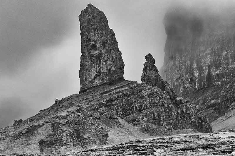
Do you see him now?
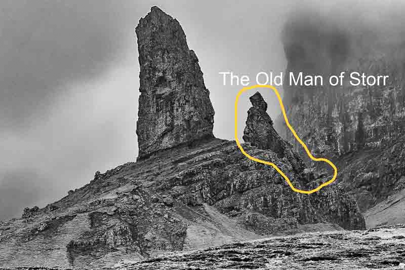
The Old Man, sat on the rock wearing a hat with legs and boots resting over the rock.
After this we planned to return to the motorhome before the rain that was forecast. We pass two other waterfalls on the way; The Lealt Falls and the Kilt Rock Waterfall, which falls over the cliff into the sea.


Neither impressed us much, so a few snaps and then returned to the motorhome – just before the showers started.
Tomorrow is another travelling day when we move to another part of Skye.
12th April – Moved to Edinbane (North West of Portree): We planned very little today as (a) we were moving campsite and (b) the weather for most of the day was going to deteriorate. But in the morning the sun was trying to break through, although the winds today were higher than yesterday. We headed back to the point we captured the Old Man from to see if we could get some more light on the subject and we were lucky.
Unfortunately the images look slightly false as the sun made some of the ground too bright. In one of these images I toned the brightness down which I think makes it look a little more natural.
Yesterday I forgot to mention again about the potholes – we spoke to drivers of 2 separate vehicles who had blown tyres due to the state of the roads. So if you do come to Scotland make sure you have some form of breakdown cover as we suspect this might be a very common problem.
Today’s drive was going to be challenging for two reasons, (1) the potholes and (2) the high winds, so we took the decision to drive our motorhome and car separately. This also gave Vanessa an opportunity to stop for more provisions in Portree.
I managed to set up the motorhome on the new site just before the rain started and 4 hours later, it’s still raining. Unfortunately tomorrow is going to be much worse, but we’ll have to wait and see.
PS, Holly has been sleeping for most of the day, so I think yesterday definitely tired her out.
13th April – Sunshine, Showers and Rainbows: Today was a mixed bag – the forecast wasn’t too good, although predicted to brighten up later in the afternoon. But it was cold, wet and windy in the morning with the breeze circulating within the motorhome from the roof windows (they were closed) and the air vents, so I had to put the heating on high. Then with the toaster and kettle we had a power failure. It wasn’t the camp supply that tripped so I had to resort to the manual which suggested the 230V mains fuse may have blown, but I couldn’t find any description as to where to find it. So I called our good friends who we purchased the motorhome from and he came to our rescue, suggesting if may be the thermal cutout in the mains reel. How stupid of me, I normally unwind most of the cable but forgot on this occasion. Resetting the cutout resolved the issue – many thanks Dave.
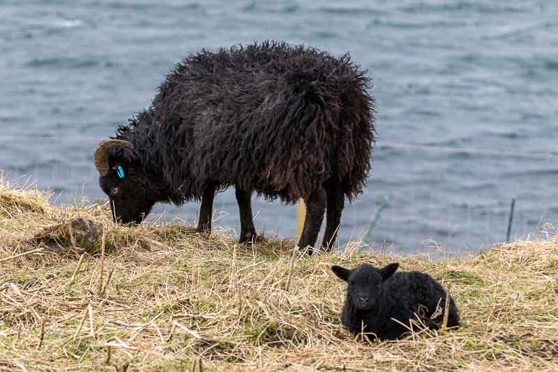
The day started to brighten earlier than expected with an improved forecast through the day, so we decided to have lunch first before setting off. Just adjacent to the camp is a field of black sheep that had just had their lambs, so I couldn’t resist a snap.
The first stop was the Fairy Bridge on the Lochbay road just off the A850. We took several shots, but this was the best.
In the car park next to the bridge were some pamphlets covering the ‘Waternish’ area that the Lochbay road travels through. This identified a few locations I hadn’t found in my research. Along the road, this was the first great view we saw.
This was listed as ‘Anait’ in the pamphlet.
The next stop suggested was Stein – a little village on the coast. There was a row of cottages which included the oldest pub on Skye – the Stein Inn. The village also includes a fine dining Lochbay restaurant which had a Michelin star in 2024. We also liked the view along the coast from here.
One of the images had the sea ‘smoothed’ with a 6 stop filter (to significantly extend the shutter open time).
We did consider the pub for a drink, but it appeared to be closed, so we headed up the road for a coffee at the Skyeskyns tannery. The coffee ‘tent’ is just outside the tannery and should be visited if you’re in the area. The beverages and cakes in the Yurtea & Coffee were superb.
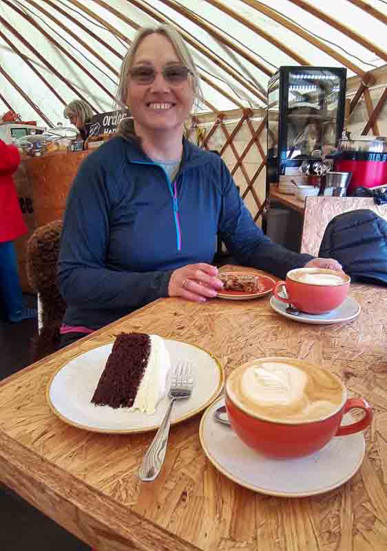
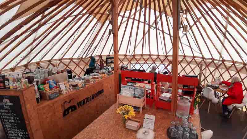
We both had a latte, but I tried the ‘Chocolate and Guinness cake and Vanessa the Grenola Flapjack. So call in if you’re in the area.
Next stop was at the end of the road – The Trumpan Church, which was a ruin in amongst commonwealth war graves.
During all this time, we were dodging the frequent, but short showers. As you can see from the images, when the sun did shine, it was very clear and bright.
Heading now for Dunvegan castle, but with the dog, we were only allowed into the grounds (as we expected), so we paid for the privilege to have the opportunity of a photo.
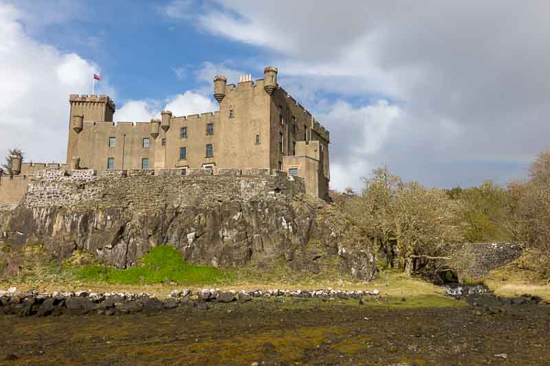
If you look carefully on the right of the photo you can just see the fading rainbow (we weren’t quick enough getting the camera ready).
Another reminder about the state of the roads and the potholes – there was another car with a space saver tyre fitted to the near side rear and the driver was pumping up the offside rear – after another clash with potholes!
Our last planned stop for the day was Neist Point which was approx. 25 minutes from the castle – mostly on single track roads. We hoped to get the distant photo of the lighthouse as the sun was setting, but to avoid disappointment in case we missed it, this was our first stop.
This was taken approx. 3 hours before sunset.
Back at the carpark we took the following images (approx. 30 minutes apart)

You can see how quickly the skies changed which was our experience all day. We set off for a 20 minute walk to the lighthouse, but as we approached it, we could see the light wasn’t right and there was another rain cloud heading our way – so we turned around and headed back to the car to shelter until the storms had passed. It was amusing to see all the other people rushing back to their cars after getting drenched from the hail storm – we saw it coming; obviously everyone else ignored the signs.
We were now 35 minutes from sunset and the storm was still in progress and lasted another 15 minutes. Then we dashed off across the cliffs to try and get the last rays on the scene, but this was the best I could get before the rain arrived again.
You can just see the the approaching rain on the horizon to the right.
Tomorrow is forecast for rain again, so we’ll wait and see what happens.
14th April – Rain, Rain and more Rain: Don’t you just hate it when a bad forecast turns out correct. One positive is that we managed to cover a large number of our locations yesterday, so today after a late start we returned to one we missed in the first few days on Skye – The Rha Waterfalls…
Just after this, the rain started again… So we went for lunch.
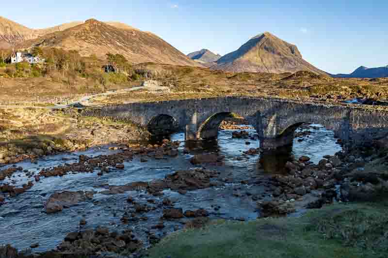
The rain didn’t stop, so we went for a drive to check out some of the locations we have listed when we are in the next campsite. The first of these being the Sligachan Old Bridge. The rain did ease up (but not stop), so we grabbed a few quick snaps…

Fortunately we are very close to this bridge from our next campsite, so plenty of opportunity to retake it in better lighting (if we are very lucky). We then headed off to ‘Fairy Pools’ which are a series of many individual waterfalls. We arrived in the carpark (charge being £6), but weren’t confident about the weather so left to return another day. Two minutes later the heavy rain returned, so good decision.
Last journey was to get to Talisker beach – it rained most of the way there, but stopped when we arrived, so we put on our waterproofs and immediately we were pelted with hailstones, so got back into the car. As we left and headed up the hill we could see a bright sky behind us, so we turned around, parked the car and walked the mile to the beach.
There were other shots we took, but weren’t really happy with them. In the distance we could see another rain cloud approaching so scrambled back over the large beach boulders and got half way back to the car before we got another soaking. Back to the motorhome to dry off.
Tomorrow we have booked a wildlife tour which should give us an opportunity for capturing something new; so watch this space.
15th April – Wildlife Tour: The day started with our fridge failing – it’s done this before and I managed to kick it back into life. As I write this, I’m still trying, but it’s looking promising. It didn’t ruin our day out with Andy who ran the Isle of Skye Wildlife Tours. Now before I continue it wasn’t a photographic wildlife tour – the preferred observation tool is a pair of binoculars, which Andy can provide if you don’t have any. But cameras are welcome – just don’t expect to be traversing the countryside for that elusive photo as most observation will take place from the roadside. So you don’t need to be too concerned about the weather with the minibus close by.
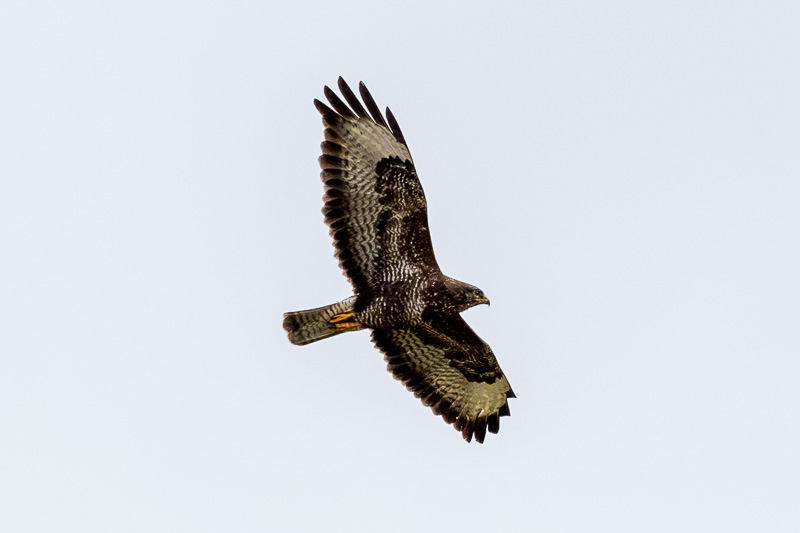
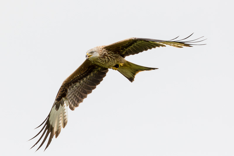
We left Portree around 10am and went in search of eagles and otters. To avoid later disappointment I’ll put you out of your misery now – we didn’t see any otters. However we sighted a number of eagles. Unfortunately they were all quite happy staying distant from us waiting for better weather conditions. The first sighting was a pair of Fish Eagles – perched in trees on the opposite side of the Loch. After this, we saw 6 or more Golden Eagles – but just to prove it, here is an image of one of the sightings.

Perhaps we only have the word of our guide it was a Golden Eagle – wrong; Andy brings a sighting scope that clearly magnifies the image unlike the 1000mm lens I used to get this close.
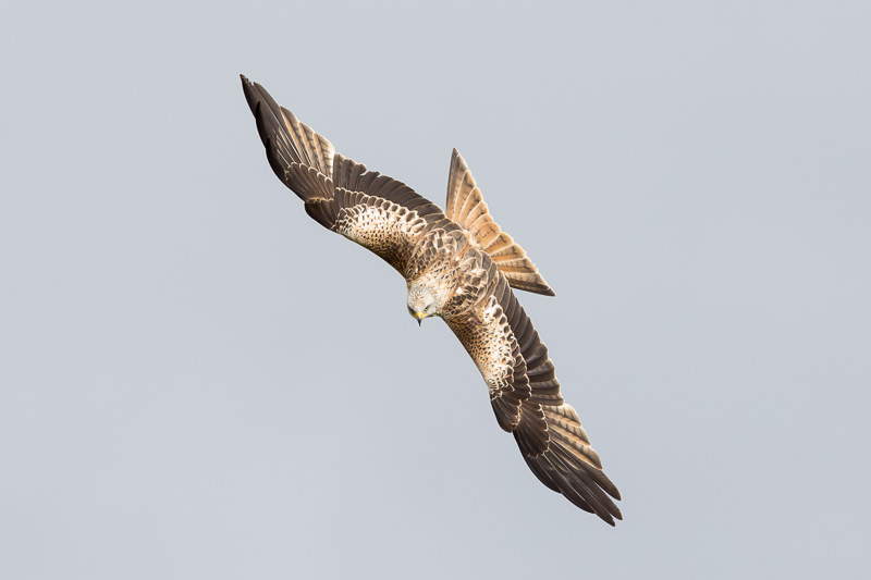
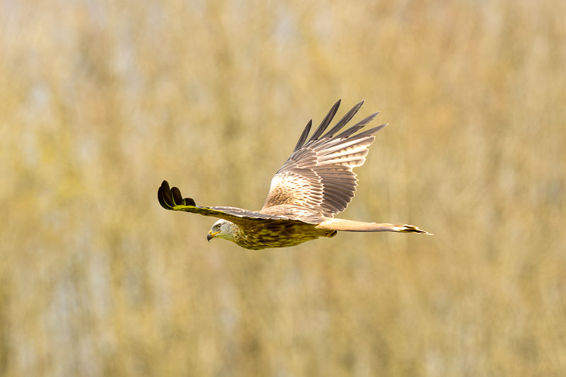
We did spot many other different varieties of birds, but not many were captured clearly enough by my camera and lens. Unfortunately I’m not good at remembering their names – Andy was very quick to spot and identify the birds and in virtually ever case he expertly predicted where to find them. I promised not to divulge the locations in this blog, but here are a few that looked OK after processing.

Let me re-iterate, we saw many more birds than I’ve shown above – but the image quality wasn’t good enough for me to publish. To be honest, I haven’t used the long lens much and definitely need more practice, but also the wind wasn’t helping me get a stable stance.
We asked Andy about deer as we hadn’t seen any on Skye – so he took us to another location where we immediately spotted 3 deer. I did manage a photo of the very rare sheep on the island.
Of course they’re not rare, but I hadn’t seen one down on the shoreline before.
The light in the afternoon improved significantly so I reduced the lens power down to 700mm and took a few landscape snaps.

The first image of the series looks to have a colour cast to it – that was the start of another rainbow.
The tour ended around 4:30pm and we left content that Andy had delivered what he set out to do. It was just unfortunate the birds weren’t accommodating us by flying closer. The sighting of an otter would have been good, but now we know the locations, we will try again over the next few days.
Arriving back at the campsite, the highland cattle in the next field graced us with their presence.

Tomorrow is another moving day, but we hope to get out beforehand to another location we missed. Until tomorrow….
16th April – Moving to Sligachan, or was it Oban?: Another travelling day today, so we used the bright clear morning to head off to the Fairy Glen (up near Uig) – another missed location.

After this, we returned to the motorhome to prepare for the journey to our next site. Then we realised we had two sites booked for the same period (my fault)- Oban and Sligachan. But 4 days at Oban wasn’t needed as we had already covered most locations nearby, so we’ve compromised on 2 days at Sligachan and 2 days at Oban.
Sligachan was only 30 minutes from Edinbane, so we arrived early, had lunch and headed out in search of those elusive Otters from yesterday. Still no otters, but we had all our kit with us, so managed a few landscape shots along the way.
The weather wasn’t as forecast – it was supposed to be a sunny day with showers. We actually had showers with an occasional glimpse of the sun. So not many landscape images, but on our return to the motorhome towards the end of the day, we did spot this…

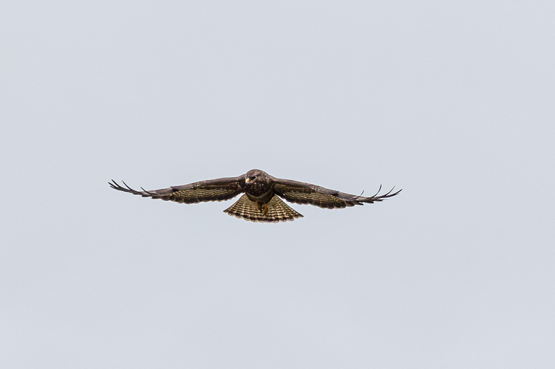
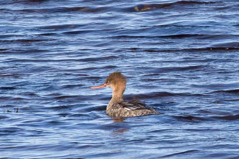
A quick internet query seems to suggest this is a common buzzard – maybe any enthusiasts amongst you can confirm or correct me.
Tomorrow we will have a look down at Elgol – on the way back we will still keep our eyes open for otters and birds of prey.
17th April – Blue Skies in Scotland – how rare.: The intention was to get up early for the 50 minute drive to Elgol, but when I got up at 5:30am it was raining again, so no need to drag Vanessa out of bed. We eventually left the motorhome just after 8am for the 30 mile journey around the Cullin Hills. We arrived at what should be a spectacular location, but it was still very overcast, but we set off carrying the dog over the large rocks to get to the shoreline facing the Cullin Hills.

This is how the scene looked when we arrived, so you can imaging we were quite disappointed. But we had nothing better to do, so we waited… patiently.
I think we waited for about 1 hour before the skies showed any possibility of clearing.
Eventually we were shown some of the potential for this location, but unfortunately the sunlight never fully penetrated into the Cullin Hills. But these images are the best we had for the day.


After a few hours here we decided the weather may not improve any further, especially as the skies to our right were clouding over again. The journey here was through some lovely countryside, so we decided to stop along the road back for more images. Our first stop had to be for a coffee, so we pulled into a carpark with a mobile kitchen. As it was nearly 12, we also had a bacon bap and sat in the sun – yes, the skies hadn’t clouded over, which was just typical. But this was the view we had for lunch.

This location was on the opposite side of the hills from Elgol, so we had a very pleasant lunch.
We spotted a derelict church with graveyard on the way to Elgol, so that was our next stop.
The Loch in the distance behind the church had lots of reeds in the water, so we backtracked to see if there was any wildlife lurking within.
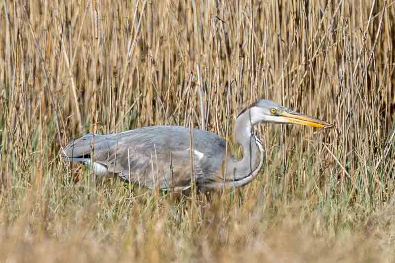
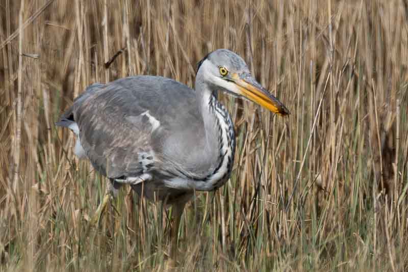
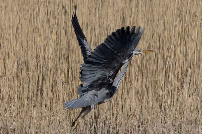
If you look carefully, the Heron has a small fish in the first shot and what looks like a dragonfly larvae in the second. The images were taken at the side of the road with my 500mm lens and 1.4x converter whilst resting on the roof of the car.
As we were passing, there was another location not far from the bridge between Skye and the mainland, so we drove to Kyleakin to photograph the Caisteal Maol Castle ruins.
Clearly more than just the castle ruins in the images. From here we headed back towards the motorhome, but would stop along the way in case we were lucky spotting the Otters – not a chance, but as we had the cameras out, I took pictures of these feathered friends.


We returned to Sligachan to try again photographing the old bridge, but the light was very harsh and as is now the norm it was swarming with tourists. So it was time for an early evening meal as it looked like the clear skies would remain with us for sunset.
On returning to our car we noticed the car next to us had a flat tyre – this was the second we’d seen today, so we reported it to the hotel where we assumed they might be staying and headed off the 200 metres for a pre-prepared spaghetti bolognaise.
At 7pm we left the motorhome again for the Old Bridge – at this time it had to be free of tourists? Wrong, there were about 30 people all posing on the bridge for a group photo, then another photo and another…. you get the idea. Anyway we waited patiently for these 2 images, although I did have to remove one stubborn tourist from the bridge. I do realise they have as much right to be there as anyone else, but after a while our patience does run out.
What next – well since before we left for Scotland, there has been one image in my mind that I wanted to capture in the ‘blue hour’ after the sun had set. So we headed east for 45 minutes and set up our cameras alongside a group of German photographers. We tried a few different views whilst we waited for the perfect light.
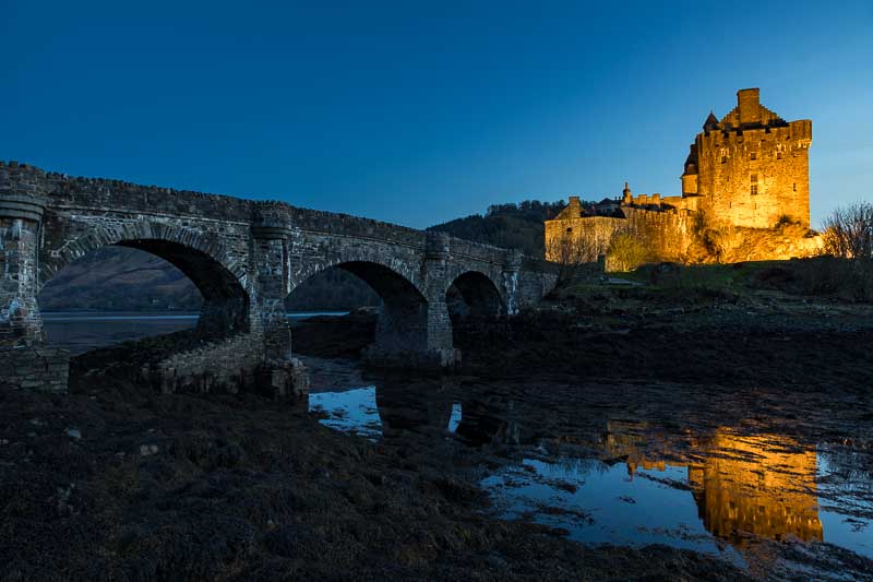
Yes, we had returned to Eilean Donan castle and as the tide was out we ventured down the rock nearer to the bridge. If you look carefully in the first image, you should just see a heron – they get everywhere. Then we moved back next to the Germans for that final image of the day.

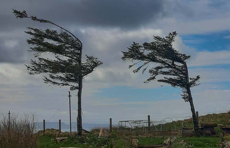
It made a wonderful change having blue skies today, but also a shame the earlier morning light wasn’t better. But despite the sun, it still only reached 10oC although when we took this image it was back down to 4oC. Today was also different because all the high winds we had become accustomed to had gone.
I’m writing this update on the morning of the 18th as the late evening didn’t give me time to complete it last night. But we leave Skye today for Oban and I’ll leave you with this one parting image that might show you what weather conditions we have been experiencing.
Heading to Oban
The journey to Oban will be in the pouring rain – let’s hope that tomorrow improves.
19th April – What a difference a day makes: Apologies for the lack of any post yesterday, but my wishes for the weather to improve fell on deaf ears. The rain yesterday was constant and at times torrential throughout the day which meant I got drenched preparing the motorhome and car for the journey south. So for the second day since we started our holiday, the cameras stayed in their bags. But the forecast for today was much improved and so we managed to escape the confines of the motorhome and get out again.
We had a few locations to visit today (not all new) and set off for the ‘Fairy Bridge’. This was one of the most fantastic little hideaway locations we have been to. After a 200m inclined walk along a small stream we heard waterfalls and then we saw the bridge.

This was taken with the tripod down the muddy bank and set up in the stream.
We then set about photographing the stream and bridge from several different angles. I’ve included several images below and hope you agree what a little gem this location was.

It was very sunny, but there was enough cloud to tone down the harsh lighting for most of the images. From here we headed off to a previous location – The Castle Stalker Café for lunch and later took these images in entirely different light to the previous visits.


I checked to see if this would be a good location for a sunset, but the sun wouldn’t be shining from a good direction. However, it may be better at sunrise if the skies are clear in the morning.
We then moved on to Dunstaffnage castle and chapel which are on the way to Oban (as I promised wifey we would have a look around the town).
It was here that we had our first ice cream of the holiday as it was definitely feeling warm in the afternoon sunshine.
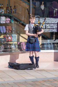
Now off to Oban to look around the port town, but our first stop was for a beer and enjoying it outside in the afternoon sun. Then we heard our first set of bagpipes from a busker in the street.
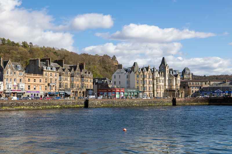
The next 2 images are of the town from the harbour jetties
With the unusually warm weather we went into a store and I came out with two thick jumpers. I suspect I won’t be wearing them now until the end of the year.
We headed back to the campsite and picked up some fish and chips for our tea as neither of us could be bothered to cook. Tomorrow we are travelling again, this time inland to Loch Tay for 3 nights before leaving Scotland for the Lake District; so we are now entering our last week.
Heading to Loch Tay and Central Scotland
20th April: We had hoped to get out for some early morning sunshine, but the skies had a thin layer of cloud which defused the morning light. Once the cloud had burned it off, it was too late to get the best lighting conditions so we relaxed in the motorhome until 11am when we left for Loch Tay.
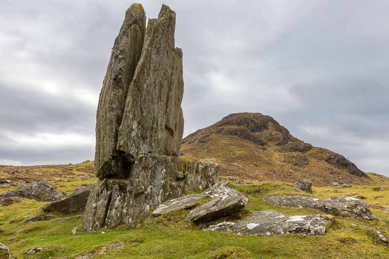
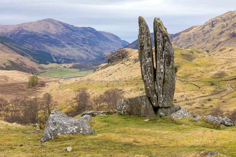
The roads were relatively empty and for once there weren’t too many potholes to avoid. We stopped for lunch to ensure we arrived after 1pm when the campsite opens for new arrivals. By 2pm we were out again in the Aygo heading into the hills for Fionn’s Rock which is also known as ‘The Praying Hands of Mary’. More on this later, but we stopped along the route for the Ben Lawers Dan, which surprisingly wasn’t full.


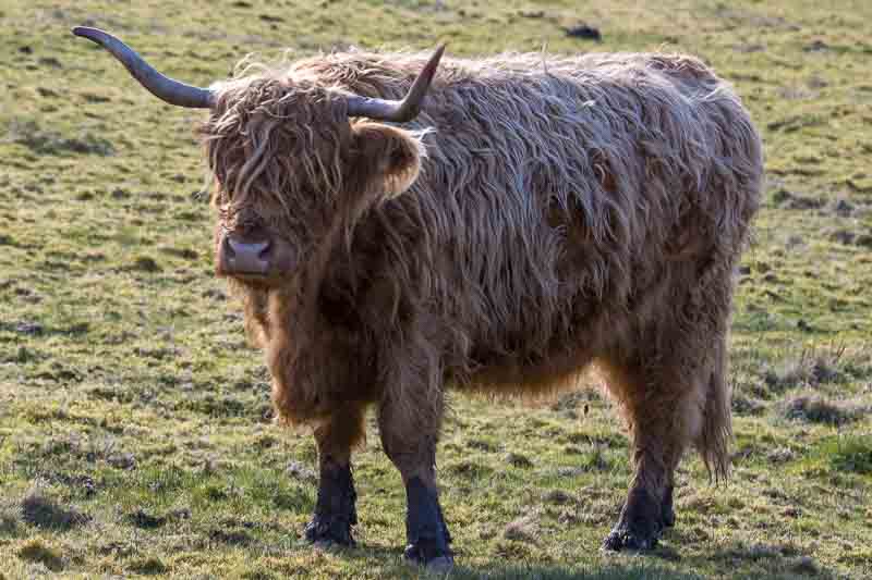
Moving on, we can across a herd of highland cattle, but this time they were actually roaming free across the terrain, so we had to stop to photograph them.
Distractions out of the way, we followed the ‘Google’ route to start the walk to Fionn’s Rock. Part way down a dirt track a friendly local advised us this wasn’t the correct route and gave us new directions. It extended the walk, but it was a better option to losing our sump.
We had just over a mile to walk up to this rock which proved worth the effort once we arrived.
As I mentioned before it was also known as ‘The Praying Hands of Mary’
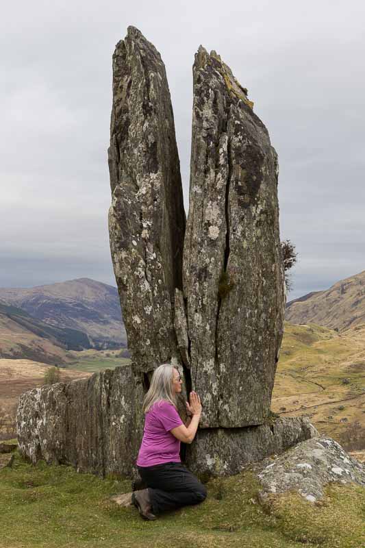
Or was it the Praying Hands of Vanessa?

Heading back down the hill there was a river cascading down to our right, so we stopped to grab one last image for the day.
There were many other viewpoints, but the light was fading and Holly (our dog) wanted her tea!
Tomorrow we’ll head out again as the weather looks OK. So watch this space for the next update.
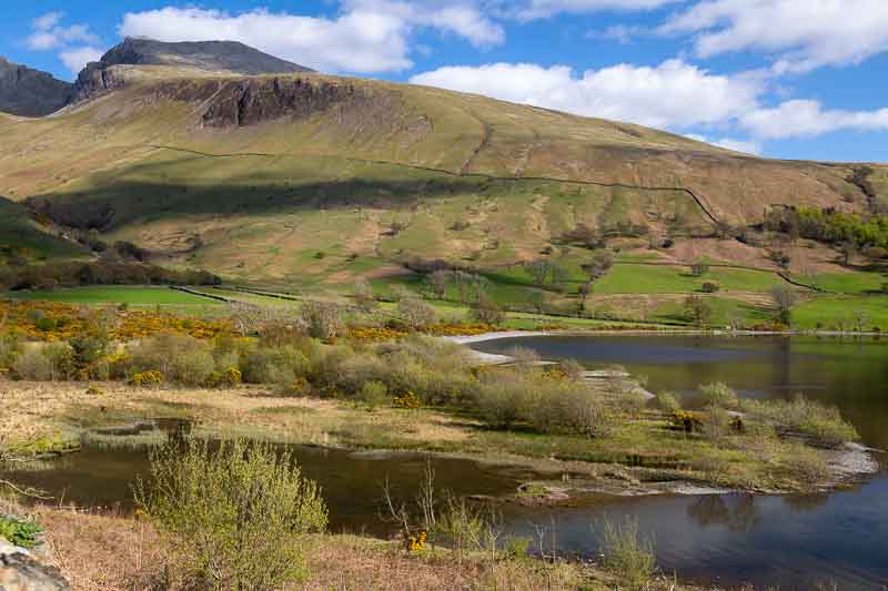
21st April – Tour around the Central Highlands: Well it was a typical start to the day – at 5am I heard the rain on the roof of the Motorhome and when I checked the forecast it wasn’t due to stop until about 11:30. We headed out at 10 to hopefully arrive at the ‘Falls of Bruar’ when the rain stopped. First a stop along Loch Tay as the miserable weather was so inviting – photographically speaking.
It didn’t stop until after 1pm, so we travelled 11 miles to Pitlochry for a coffee. We did try for coffee in 3 other cafés along the way, but they didn’t accept dogs, although they would accept small children wearing muddy boots!
Anyway after 1pm it did stop raining so we headed up to the lower falls.

We continued on to the upper falls, but these weren’t as impressive.
After the falls we continued south to Perth to look at the ‘Scone Palace’, but a look at the exterior didn’t interest us, so we moved on heading west to the town of ‘Dollar’ which has a hidden castle in the hills.
This was Castle Campbell – home to a well known Scottish clan.
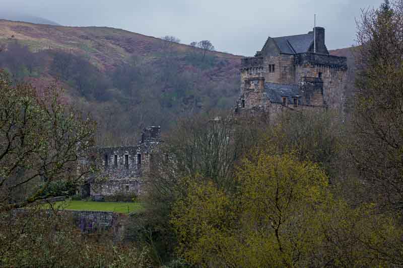
We waited a while on the hillside to see if the sun would break through the clouds, but after a 30 minute wait we gave up and headed back to the Motorhome.
22nd April – Last Full Day in Scotland: The morning was dry for once so I had breakfast and we headed off to the local Falls of Dochart which were about a mile down the road from the campsite. As you will see from the images, they appear more like rapids instead of falls.

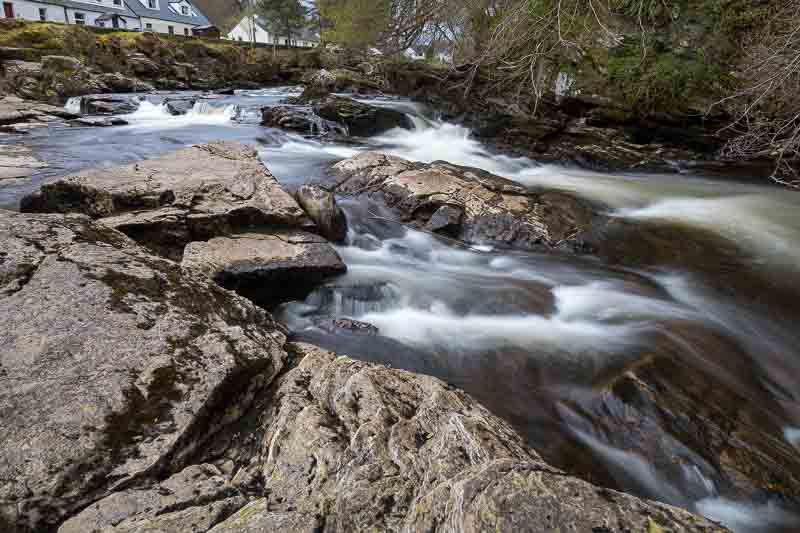
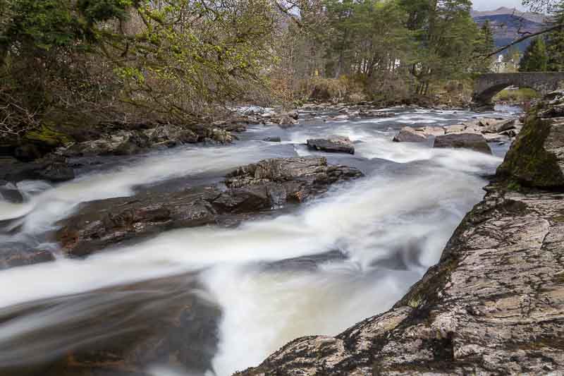
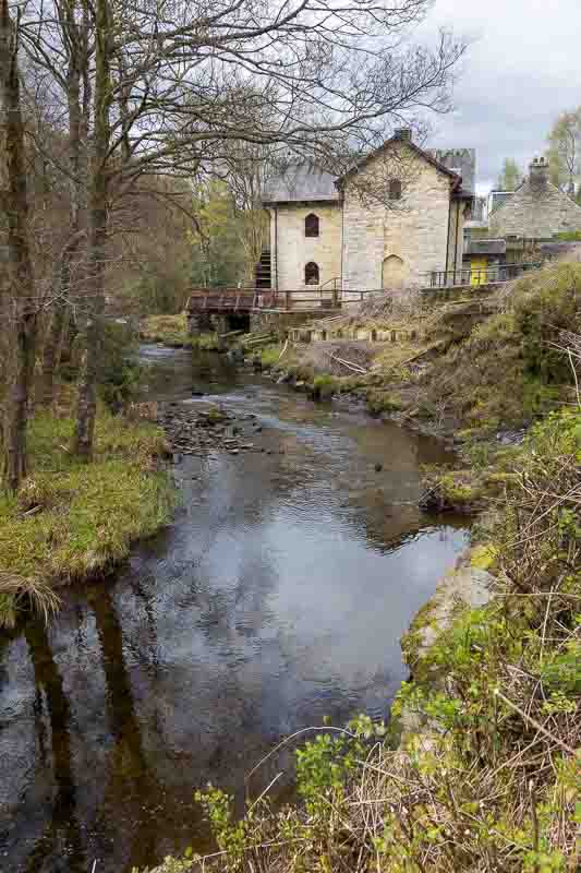
The falls are extensive and we could have spent a lot more time looking for viewpoints. There is also a disused watermill nearby…
We had a special event booked later in the afternoon, so we headed off to a castle near to the event location to use up a little time. We arrived at Doune Castle but as we were just looking around the grounds (which is free) we were told we had to park in the town and walk the 4 minutes back to the castle.

Walking around the grounds we came across this unusual bridge.

We just had time for a coffee before arriving at the event nearby which involved sitting in a hut for 2.5 hours looking out across the countryside. It was actually my birthday today and this proved to be a great way to spend it.
So what were we looking for…


These were wild red kites which have been ‘rewilded’ at Argaty livestock farm. In all we counted 9 kites in all and they flew around in front of us for the majority of the 2.5 hours. We weren’t sure about booking because of our dog, so Vanessa phoned Lynn at Argaty and she confirmed we could take Holly into a photographic hide (max 3 people). If anyone is near to Doune, we strongly recommend that you book a visit here – you won’t regret it. You don’t have to be a photographer and they have several hides for observing birds, squirrels etc. If you are interested, check out their website which describes all the options available.
If you’re interested in the technicalities, I started off using a 500mm lens with 1.4x converter, but at one point the birds were too close for me to track them, so I dropped back to the 500mm lens. Most of the time I was resting the lens on a bean bag on top of my camera bag.
After all the excitement we headed off back to the motorhome with one more stop on the way to another waterfall, but it was difficult to get a good image – I should have remembered to take the drone.

The Bracklinn Falls are in a deep ravine which proved very difficult to get a better image. We returned to the ‘Falls of Dochart Inn’ for our evening meal to finish off a great birthday.
One last point – in the last few days we have started seeing the midges so we are leaving Scotland (tomorrow) at just about the right time.
Leaving Scotland for the Lake District
23rd April: For once the day started with a really clear morning (not as per forecast) which is typical as it is the day we leave Scotland and head south. But first I headed out in the car just after 7am in search of a good reflection across a Loch. We passed Loch Lubnaig a few days ago and noticed a terrific reflection (but didn’t stop), so I returned there – unfortunately there was a gentle breeze which ruined any chance of a good reflection. So I headed back, but stopped a few times for these images.
This was the best semi reflection I noticed on Loch Lubnaig.
Disused railway viaduct viewed from the A84
Then back in Killin I grabbed this reflection looking along the river Lochay which runs adjacent to our campsite nearby
Back to the motorhome for breakfast and prepare to leave for the Lake District. We left at 10am for the 4 hour journey – the roads were fairly clear, so the drive wasn’t too stressful. We always stop during our longer journeys to give me a break; arriving in the Lake District around 3pm and would have gone directly to the correct campsite if I hadn’t programmed the wrong site into the Sat Nav.
We unhitched the car and made ready the Motorhome – had a cup of tea and then headed out to Rydal and Rydal Water. First stop was Rydal Hall to check out one particular location in the garden – identified from the LocationScout app.
At the back of St Mary’s church nearby, Vanessa spotted some bluebells, so we headed there to check out it’s photo opportunities.

The plants around the church made it very unusual – you normally expect to see gravestones, but not here.
The last location we visited was actually in Rydal Water – it was a well photographed subject, but we lacked the Autumn colours. Here was my effort…
Arriving back at the campsite we were informed that the water was off on site, so all facilities were off limits until they can get the experts in tomorrow.
A Fantastic Last Day of our Holiday
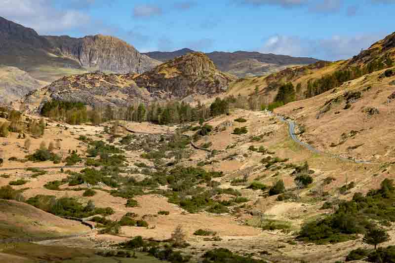
24th April: The forecast was good, so we planned an earlier start to head down towards Staveley to photograph some of the stone walls in the morning light. We also treated ourselves to a bacon roll and drink in Wilf’s café whilst making use of the facilities that we couldn’t use at the campsite due to the water issue. After this I fancied travelling through Hardknott Pass (which last we did about 18 years ago). The scenery was fantastic although the very clear skies weren’t the ideal photographic conditions – but we had to make use of the conditions presented to us.
The first stop on the route was to pick up half a dozen free range eggs for £1.50 and then we saw all the views around us

We continued up the pass when I spotted the Langdale pikes to the right. 18 years ago myself and our son Graham walked up these, so they brought back good memories.
The Langdale Pikes in the distance.
Walking around this area we captured these additional images
The pass started to get much steeper, but we hadn’t travelled far until stopping for another photo.
To our surprise the road continued to get steeper again and my poor little Aygo had to struggle up in first gear all the way. Not as impressive as the many cyclist we saw on route doing this hill climb for fun!
Going down the other side was just as challenging – keeping the Aygo in a low gear and applying the brakes occasionally to keep our decent speed under control. If you come to the Lake District, this is a road you must try – just leave the motorhome behind.
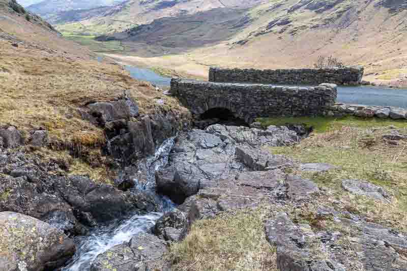
We stopped at the Cockley Beck Bridge for these images

We hadn’t travelled far until stopping again for another photo, but the sun just wouldn’t hide behind the clouds to soften the harsh lighting, but whilst waiting, I was distracted by a bug in the grass. So I fitted an extension tube to my lens (which allows very close focusing to grab this image).
I don’t know what it is, but it was about 2.5cm long.
We moved on again to find a pub because it was very warm in the sun and a drink was urgently needed. But we obviously weren’t that desperate because we stopped again for these photos
We asked 2 passing walkers if they knew if there was a pub nearby – as we had no internet connection to check for ourselves. Yes, just 300 metres ahead they told us, well you couldn’t see our tail pipe for dust as we sped to the Woolpack Inn.
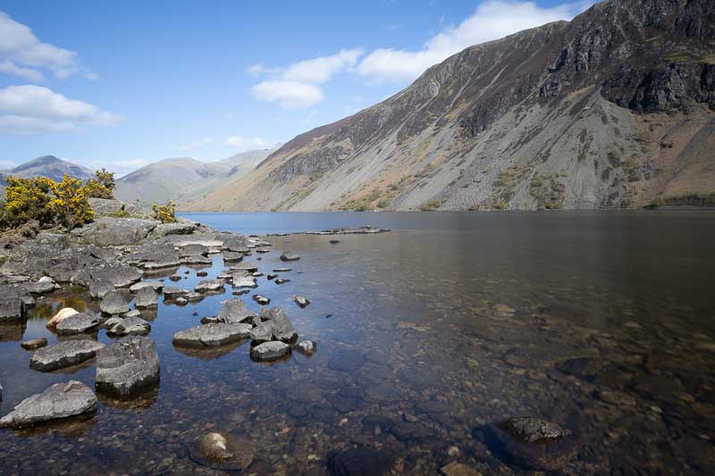
Suitably refreshed, we headed off for Wast Water – which was an incredibly peaceful location at the foot of Scafell Pike (the highest mountain in the Lake District).

These are the last images of our holiday. We packed the cameras away, headed to a small shop nearby for an Ice-cream before heading back to the motorhome – Not via Hardknott Pass this time.
Tomorrow we head south again with one more overnight stop before arriving home. If you’ve been following our journey, then we thank you for the time and interest shown.
